![Prototype LRT Vehicle [10 of 11]](/uploads/r/null/e/b/eb02ece114b18ec7cad121a0ff26ed83df2e1016be16ddc48927bdefd9cf5783/f095353e-9614-48e2-98fd-26fcd5f7bbba-A64318_142.jpg)
Prototype LRT Vehicle [10 of 11]
- COV-S663-: CVA 800-0319
- Item
- Aug. 1976
Part of City of Vancouver fonds
Picture shows bus stopped at bus shelter on Granville Mall.
376 results directly related Exclude narrower terms
Prototype LRT Vehicle [10 of 11]
Part of City of Vancouver fonds
Picture shows bus stopped at bus shelter on Granville Mall.

Provincial Reports - "That's The BC Spirit"
Part of Yaletown Productions Inc. fonds
Item is a sponsored production produced by Yaletown Productions Inc. Item consists of ten, two minute, "Province Reports," with Fred Latrimouille, produced by Yaletown Productions for the government of British Columbia's "B.C. Enterprise" program. In the order that they appear on the tape they are:
-Province Report 2 "People Place/Jobs" (Oct. 5, 1982)
-Province Report 7 "Burden /Restraint" (Oct. 5, 1982)
-Province Report 9 "Teamwork/Employment Initiatives" with Grace McCarthy, Minister of Human Resources (Oct. 5, 1982)
-Province Report 10 "Getting around/Transportation" (Oct. 5, 1982)
-Province Report 11 "Future jobs/Education" (Oct. 5, 1982)| Province Report 1 "Mega projects/Jobs" (Sept. 20, 1982)
-Province Report 3 "Coalscene/Resource Mgmnt [management]" (Sept. 20, 1982)
-Province Report 4 "Transportation/Ports" (Sept. 20, 1982)
-Province Report 6 "Work share/Jobs" (Sept. 20, 1982)
-Province Report 8 "Foundations/Economic strategy" (Sept. 20, 1982)
Recording includes interview clips with various provincial politicians including Stephen Rogers, William Vander Zalm, James Hewitt, Don Phillips, Grace McCarthy and others.
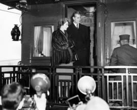
Queen Elizabeth and Prince Philip standing on the back of a railcar
Rail-rapid transit for metropolitan Vancouver
Item is a study prepared for the Department of Highways, Province of British Columbia.
Regional road policy . Provincial highways
Part of City of Vancouver Archives technical and cartographic drawing collection
Regional roads policy. Fast bus network
Part of City of Vancouver Archives technical and cartographic drawing collection
Regional roads policy. Municipal truck routes
Part of City of Vancouver Archives technical and cartographic drawing collection
Report of the Technical Advisory Committee on Urban Transportation : May 31, 1966
Report on British Columbia marine insurance rates
Report on transit fare application : December 1964
Item is a report delivered to a joint committee of mayors and reeves, Greater Vancouver and Victoria transit areas.
Review of transportation plans : Metropolitan Vancouver, B.C. : September 22, 1964
Item is a review prepared for the Department of Highways, Province of British Columbia, cities of Vancouver and North Vancouver, districts of North Vancouver and West Vancouver.
Rider alert : think 50! : for a safe ride, please support your driver in our "think 50" campaign


Sectional map and street directory of Vancouver : Dial map of the city of Vancouver
Part of City of Vancouver Archives technical and cartographic drawing collection
Item is a street map showing Vancouver on one side and Burnaby and New Westminster on the other, as well as information on street car and bus routes, and text advertising the products and services of the Dominion Map and Blueprint Company.
Item is a street map showing Vancouver, Burnaby, New Westminster, West Vancouver, and North Vancouver on one side and Lulu Island and Sea Island, Delta, Surrey, Langley and Maillardville on the other.
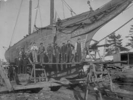
Ship "Oscar Hattie" being caulked
Short term bus improvements for greater Vancouver : report 3
Part of City publications collection
Part of Vancouver Board of Trade fonds
Item is an educational film documenting the history of various modes of transportation (boat, horse and carriage, plane, streetcar, train) in Vancouver from 1887 to 1962.
"Special Feature: MKII vehicles built right here in British Columbia"
SkyTrain : millennium line : spring 2001
"Special Feature: New line brings a host of benefits. . . ."
"Special feature: Support growing for the new SkyTrain line. . . ."
"Special Feature: Construction is underway! . . .
SkyTrain : Surrey report no. 6 : spring 1991
Slack : BC Electric : good for one fare at 4 for 45c
Fare ticket for travel on B.C. Electric streetcars.

South western British Columbia
Item is a map of southwestern British Columbia and northwestern Washington showing cities, municipalities, and settlements, post offices, government agents, railways, roads, ferry and steamship routes, air and seaplane ports, parks, campsites, glaciers, customs ports of entry, and elevations of mountains. Inset maps show the islands north of Cape Scott and the Seattle region. An small key map shows the primary map's location in relation to the rest of British Columbia and other maps published in the same series.
Part of City publications collection
Street and street car directory of Vancouver, B.C.
![[Street cars and taxicabs on Hastings Street]](/uploads/r/null/e/3/e3460b082958ce0fb70de47b3e1459bdb3ce0a26a86c14d8c3200e76490c633e/2bb3fbd4-de88-4667-a78d-09fa1c22a6be-A09848_142.jpg)
[Street cars and taxicabs on Hastings Street]
Part of Major Matthews collection

Street index (Gibson Street to William Street) and tram stations
Part of City of Vancouver Archives technical and cartographic drawing collection
Part is a page from the booklet accompanying a guide map of Greater Vancouver, and contains the last portion of the North Vancouver street index, the West Vancouver street index, and a list of Vancouver tram stations.


Part of Dunbar History Project fonds
Item filed under Transportation.
Part of Dunbar History Project fonds
Item filed under Transportation.

Streetcar travelling North on Dunbar
Part of Dunbar History Project fonds
Item filed under Transportation.
Streetcar travelling North on Dunbar
Part of Dunbar History Project fonds
Item filed under Transportation.
Part of City of Vancouver fonds
This item is a print of one of seven images created by graphic designer and artist David Hornblow for the City of Vancouver street banner series known as "Waterfront Images". This print depicts a tugboat pulling log booms. Two large piles of sulphur are shown in the background.
Hornblow, David
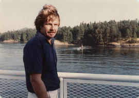
Sydney Hamber on ferry to Victoria
Part of Hamber family fonds

Teddy Lyons conducting the B.C. Electric Railway Co. observation car

Item is a map of the Terrace, British Columbia area showing lands alienated or covered by applications under the Land Act, timber leases, First Nations reserves, land district, provincial forest, and park boundaries, forest management licences, municipalities, post offices, hospitals, sub-mining recording offices, railways, roadways, airports, seaplace anchorages, elevations, telephone and power lines, and glaciers. An index map shows the area covered by the primary map in relation to the rest of British Columbia and other maps published in the series.
Thank you for visiting the GM pavilion
The Alternative Transportation Centre

The Badminton Hotel at 603 Howe Street