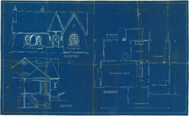

![Parsons [?] house, North Vancouver](/uploads/r/null/4/d/1/4d1a653fefee3c4d6bdc3e7b5e7b6a293edde702a9d6ec8cfa2f60164ee137df/f0773310-1258-409a-85b8-b5f79a6a8dc9-1987-017_142.jpg)
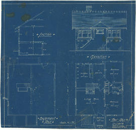

![Bungalow for C. [Cline] Singleton, Vancouver, B.C.](/uploads/r/null/0/e/8/0e8f1fe401cffa704dd33be7ad6a0d055f7ec516ba1d63dd924193e18c708652/396919ff-1214-495c-861e-1b7aa2dada84-1987-017_142.jpg)


![Postal Station [Granville and West Hastings streets]](/uploads/r/null/b/4/1/b4186985e2bb9ebae1b8cd849468ad83513d9584e040aa756a42bfb32e28455b/de507cc1-7f65-44cc-a9ea-a7b46caea5c5-1981-010_142.jpg)


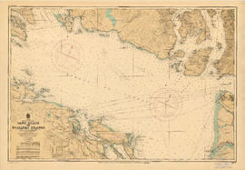
![[Cross sections of ocean floor between Vancouver Island and mainland of British Columbia]](/uploads/r/null/c/a/6/ca687b43e46696a0c1d9223ef1e80ebe50bba0ea48092c458b525fc90f7b517c/7d458083-64ae-4682-be03-8fd1211e38c9-MAP8b_142.jpg)
![Canadian Pacific map of Vancouver [west half]](/uploads/r/null/f/a/fa49266d21715d75ce93883012d471657dd058b90843927ec82b44d2bb42b007/f12ea9a5-4914-4db8-bda9-312aa2e2ccef-MAP10_142.jpg)


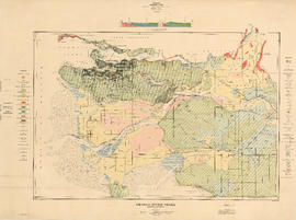


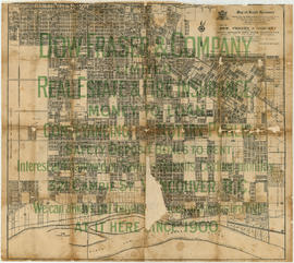
![New Westminster and Yale [districts]](/uploads/r/null/6/a/f/6af222cb96f4a11f05414783d2a53fe8b7ae9bc99fe2919b35111fb34ec8ef04/8a474785-2c59-42e3-9626-48d0f6f45c3a-MAP82_142.jpg)


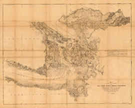
![South Western Districts [of British Columbia]](/uploads/r/null/d/0/c/d0ceafbed0c6a061cca38316066e937eb832289e737bebc70e29bbbd8db278b4/9724c086-f8fa-4751-8cfe-808fa27e04d2-MAP115_142.jpg)
Title and statement of responsibility area
Title proper
City of Vancouver Archives technical and cartographic drawing collection
General material designation
- Cartographic material
- Architectural drawing
- Technical drawing
Parallel title
Other title information
Title statements of responsibility
Title notes
Level of description
Fonds
Reference code
AM1594
Edition area
Edition statement
Edition statement of responsibility
Class of material specific details area
Statement of scale (cartographic)
Scales vary
Statement of projection (cartographic)
Statement of coordinates (cartographic)
Statement of scale (architectural)
Scales vary
Issuing jurisdiction and denomination (philatelic)
Dates of creation area
Date(s)
Physical description area
Physical description
Publisher's series area
Title proper of publisher's series
Parallel titles of publisher's series
Other title information of publisher's series
Statement of responsibility relating to publisher's series
Numbering within publisher's series
Note on publisher's series
Archival description area
Custodial history
Scope and content
The collection includes maps, charts, architectural drawings and technical drawings collected by the Archives.