
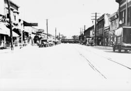
- AM1376-: CVA 553-12
- Item
- [ca. 1939]
376 results directly related Exclude narrower terms
Vancouver International Airport : annual review year ended March 31 1990
Vancouver public transportation : planning for the future
Freeways, rapid transit, transit expressway, compared and projected.
Vancouver public transportation planning for the future
Vancouver-Richmond rapid transit project : summary report
Vancouver's street car and trolley coach fares
Vicinity of the Pacific Great Eastern Railway : Squamish to Clinton

Victor and his mother G.E. Colquhoun in sailboat
Part of Hamber family fonds
Victoria and Vancouver Island 1954 Princess routes for passengers and motor cars
Item is a pamphlet advertising Victoria and Vancouver Island ferry routes. Pamphlet includes map of routes, rates and fares, and trip schedules.

View of Hastings street looking east
Waiting for the trains : a short essay on the politics of skytrains
West 41st Avenue looking east toward West Boulevard
Part of Dunbar History Project fonds
Item filed under Transportation. An interurban streetcar is visible in the background of the image.
West 41st Avenue looking east toward West Boulevard
Part of Dunbar History Project fonds
Item filed under Transportation. An interurban streetcar is visible in the background of the image.

Item is a map of the central British Columbia coast including Haida Gwaii and the mainland from Stewart in the northwest to Kleena Kleene in the southeast. Map shows cities, municipalities, and settlements, post offices, government agents, railways, roads, ferry and steamship routes, air and seaplane ports, parks, campsites, glaciers, customs ports of entry, and elevations of mountains. An small key map shows the primary map's location in relation to the rest of British Columbia and other maps published in the same series.
What every grain grower should know

What the man who comes to Vancouver wants to know
Part of City of Vancouver Archives technical and cartographic drawing collection
Part contains information on lodging, restaurants, transit, social clubs, and other points of interest in Vancouver.

Part of Yaletown Productions Inc. fonds
Film consists of raw footage shot at Expo 86; includes shots of the 'China Gate,' now on Pender St. in Vancouver's Chinatown; it was gifted to the city after Expo 86 by the People's Republic of China. The film also shows various means of transportation: the gondolas, the monorail, and the skytrain; the Expo 86 grounds; including the information centre, and the BC pavilion, several other pavilions, musical performers, and a mime on a unicycle. Silent film.
![World In The City - roll [II]](/uploads/r/null/1/2/1229049/d21c9978-4c2f-436c-bd73-30df2221eb36-V00208_142.jpg)
Part of Yaletown Productions Inc. fonds
Film features the raw footage shot at Expo 86 showing the monorail, the gondolas, ships in harbour, the Expo 86 grounds and pavilions, First nations dancers, aerial views, girl with red spherical travel machine, the USA pavilion with NASA footage, the China pavilion, animals in Canada's North: walruses, polar bears, the arctic fox, a model of a city with moving traffic and working traffic lights. Silent film.

Yaletown Productions Inc. Highland Valley Copper - "A Temporary Use of the Land"
Part of Yaletown Productions Inc. fonds
Itemis a promotional short, titled "A Temporary Use of the Land," produced by Yaletown Productions for Highland Valley Copper (Cominco), Logan Lake, B.C.

Part of Hamber family fonds