
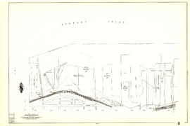
Sheet G : Trafalgar Street to Granville Street and Sixteenth Avenue to Nanton Avenue
- AM1594-MAP 682-: MAP 682.32
- Item
- [ca. 1925], with revisions to Jan. 29, 1952
Part of City of Vancouver Archives technical and cartographic drawing collection
Item is a section showing the area from Trafalgar Street to Granville Street and Sixteenth Avenue to Nanton Avenue. Includes streets and roads; blocks, lots and legal descriptions; and parks, schools, railway lines and golf courses.
Vancouver (B.C.). Office of the City Engineer


![[Aerial view of Burrard Inlet, Hastings-Sunrise, Burnaby and the District of North Vancouver]](/uploads/r/null/d/f/df7e11c97173ce0473c454f0a01569b641972f6efdc12bf192edbc42119542d6/6d72f89b-9b55-48c4-bef6-04eb2137f1d3-A66600_142.jpg)
![[Aerial view of Burrard Inlet, Vancouver waterfront and North Vancouver waterfront]](/uploads/r/null/7/e/7ebb42bad115eb635562fde51fb418b1e63ecf9048f15193681f167f6966c96a/874ecdbf-b7e9-4561-b45f-1003efcc073f-A66601_142.jpg)
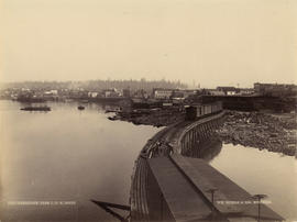
![[Western Canada Shipyards, False Creek]](/uploads/r/null/5/3/53d0a0e17c1710a62fbd39eaed21efd8d1773a33701bcceab1cc3c12366fc39c/020f20b5-8330-4847-81b0-3aac74b51033-A63958_142.jpg)
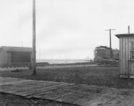

![[Canadian Pacific Railway train crossing Hastings Street]](/uploads/r/null/6/a/6a0c6e8250256deb67ad8d5e3e7be768662201bc5e7af47f5b4c303254594f6d/a6dedf95-3dd0-4d55-94cb-c49f3dc64f47-A09127_142.jpg)
![[Canadian Pacific Railway train crossing at Carrall Street]](/uploads/r/null/c/e/ceb9436e35e7b3b380a69ac2c569efa1afebc415767f71e701fef5ec7e1335e7/fea9b087-56f2-4a1b-804a-610d381ee009-A09126_142.jpg)


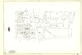
![City of Vancouver [park sites June/80]](/uploads/r/null/9/4/9484add7c4684ea3838e4d00ee8add3ecf85d78d5aa8fe2780cae273e59556a5/bd2464d8-2aa9-4501-aba6-8b3f7d130a42-MAP1032_142.jpg)


