![N.P.A.A.O. [North Pacific Association of Amateur Oarsmen. Four-man sculls at] Esquimalt](/uploads/r/null/3/9/9/39987f37873391a1c3f2c8d1a3117b3b780fd35f99916cea9c357f5094bb1227/15ea02ff-5b9a-4e86-9d07-ac6d7e360763-CVA7-317_142.jpg)
N.P.A.A.O. [North Pacific Association of Amateur Oarsmen. Four-man sculls at] Esquimalt
- AM1584-: CVA 7-317
- Item
- [ca. 1912]
Part of James Luke Quiney fonds
N.P.A.A.O. [North Pacific Association of Amateur Oarsmen. Four-man sculls at] Esquimalt
Part of James Luke Quiney fonds
![N.P.A.A.O. [North Pacific Association of Amateur Oarsmen. One-man scull at] Esquimalt](/uploads/r/null/2/c/7/2c7a041f4573b48dfe710ad66ac640d7e95a4566083535aa2ed127c5268a1b18/931a73ba-3eb4-4564-9a85-04a72e883331-CVA7-318_142.jpg)
N.P.A.A.O. [North Pacific Association of Amateur Oarsmen. One-man scull at] Esquimalt
Part of James Luke Quiney fonds


![Ocean Falls [harbour dredging]](/uploads/r/null/1/e/1e7e09e17dcb3d0b28a30119bceaa2f16244f3ff09e4db0d582bf8f4d720d60c/64cfdccc-461e-4627-b615-908f9ba91921-A31758_142.jpg)
Ocean Falls [harbour dredging]
Part of Major Matthews collection
![Outward bound [Ferncliff leaving the harbour]](/uploads/r/null/0/d/4/0d48abd626ba40c2b0d1fe79807eaa4cf505575e2ddce6ff434ab2a594cfffa7/e4e279ea-7b71-4405-a67c-ed0859a6a8b8-CVA293-128_142.jpg)
Outward bound [Ferncliff leaving the harbour]
![Outward bound [Ferncliff leaving the harbour]](/uploads/r/null/9/4/1/941ada3c187bf82c8b708a7f34b8b35801419807e0815d2ad523a12b9e6570be/b8290159-6586-40fc-a089-d7bdd4808d85-CVA293-128_142.jpg)
Outward bound [Ferncliff leaving the harbour]
This postcard includes personal correspondence addressed to Building Inspectors, Building Dept. of Vancouver.
![[Parliament Buildings, Victoria, B.C.]](/uploads/r/null/d/0/d0f3827fcba74f71918e13419e6a10f2abbb53aad9ccd3b6e764a59a8e42e0d6/58091dda-eca1-43d9-83d4-2ad2d2a77bb5-A04350_142.jpg)
[Parliament Buildings, Victoria, B.C.]
Part of Major Matthews collection
J.S. Matthews' notes with print or negative in Archives.
![Pender Harbour showing [S.S.] "Comox"](/uploads/r/null/a/8/a830ad06450de793e74a3abcd7300572c52301769d6143086b9a050810f238d5/0c246306-10a0-4982-853f-19c126520072-A76290_142.jpg)
Pender Harbour showing [S.S.] "Comox"
Part of James Crookall fonds

Plan of the City of Vancouver, B.C.
Part of City of Vancouver Archives technical and cartographic drawing collection
Item is a map of the old City of Vancouver south to 16th Avenue. The map depicts District Lots and blocks, railway lines, street car lines, industrial areas, parks, postal information, schools, property boundaries.

Part of City of Vancouver Archives technical and cartographic drawing collection
Item is a map showing major landmarks, railway lines, harbour lands reclaimed, proposed wharves and piers, retaining walls and dredging, and soundings in fathoms in Vancouver Harbour (Burrard Inlet) and False Creek.
![Plan showing suggested development fronting D.L. [District Lot] 274, North Vancouver](/uploads/r/null/1/e/4/1e43e8f9bca67073ae3aeaf7041d567d42e6a95a29358355f1cd94909f486f68/d9652aca-fa6d-42c1-880a-e230a325dda4-MAP589_142.jpg)
Plan showing suggested development fronting D.L. [District Lot] 274, North Vancouver
Item is a map showing contours above and soundings below the low water mark along a portion of the North Vancouver shoreline. Map has been annotated with what appears to be the outline of a possible development on the waterfront.

Pleasure craft "Nancy Anne" in Vancouver harbour
Part of Stuart Thomson fonds
![[Pleasure craft "Nancy Anne" in Vancouver harbour]](/uploads/r/null/1/3/13b6ac315dee3da205f9203b95f29302530f9286c51efa1275e89959809d81cd/278bbf2e-36a6-4f3e-894f-2520057d91de-A01228_142.jpg)
[Pleasure craft "Nancy Anne" in Vancouver harbour]
Part of Stuart Thomson fonds

Port Arthur, Ont., from harbor
Part of Major Matthews collection

Port Arthur, Ont., showing Thunder Bay
Part of Major Matthews collection

Port of the City of Vancouver. Isometric view from the south-west
Part of City of Vancouver Archives technical and cartographic drawing collection
Item is a set of maps printed on one sheet. The main map shows an isometric view of the port of Vancouver from Stanley Park through the Second Narrows Bridge (including North Vancouver). The perspective point appears to be located above the Granviile Street and West Georgia Street intersection. Note that the isometric view of locations west of Granville Street is from the south-east, rather than the south-west, as indicated in the title.
The map depicts the port infrastructure, including piers, drydocks and companies located in the port.
The inset maps are a key plan showing the location of the port relative to the Lower Mainland as a whole, and a larger-scale map entitled "Plan of the Port of the City of Vancouver from Coal Harbour to Second Narrows". It contains more detail about the names of the various piers, drydocks and companies and shows the North Vancouver port facilities as well as south shore ones.

Prince Rupert : misc. pix : Jack Long

Prince Rupert buildings and harbour

Part of James Crookall fonds

Princess Elaine enters Vancouver Harbour on maiden voyage to join the C.P.R. Princess fleet
![[Queen Victoria Memorial Fountain]](/uploads/r/null/f/b/c/fbc8607cfbb0c77b361e1848d986e2ef78b715bb554ba8a0769d86d3e082ed38/bebd2627-01c5-42b2-9d75-24f222aaf42d-MonP32_142.jpg)
[Queen Victoria Memorial Fountain]
Part of Major Matthews collection
Panoramic view shows Coal Harbour, Deadman's Island
![[Replica Boeing B&W-1 float plane on Coal Harbour]](/uploads/r/null/3/2/32025b8403038a739a5d027251034c50ae7df3bb3146e0ffddd172cfea4af1b9/cb8061f3-67db-4d22-8d79-2d54221ef558-A23525_142.jpg)
[Replica Boeing B&W-1 float plane on Coal Harbour]
Part of Major Matthews collection
Photograph shows the Royal Vancouver Yacht Club. The event commemorates the 50th anniversary of the first mail flight from Canada to the United States.

R.M.S. "Empress of Asia" leaving harbor. Vancouver, Canada.
Part of Major Matthews collection

R.M.S. "Empress of Russia" in Vancouver Harbour
Part of John William Freeston fonds
Panoramic view showing Burrard Inlet, the Immigration Building, C.P.R. Pier A, C.P.R. Pier D, Pier B-C construction site and Deadmans Island, Coal Harbour, Brockton Point and the Lions in the background
![[Rock formations at Santa Catalina Island]](/uploads/r/null/a/9/a951f29913e1cc4c63593df0a41ebcbd331264fcd732603d85f88abdcbf78cd8/adc699c9-cdaa-4518-8685-553ed2add4de-CVA1477-518_142.jpg)
[Rock formations at Santa Catalina Island]
Part of L.D. Taylor family fonds
![[Rowboats in harbour for regatta]](/uploads/r/null/9/d/9d458757030e0adf87d4850d9f3f4fc08b05bd5f17091a77b867ead298e8110e/dc3b04e5-0d4d-4ef6-b733-b8b52c8fcbef-A07610_142.jpg)
[Rowboats in harbour for regatta]
Part of Major Matthews collection
J.S. Matthews' notes with print or negative in Archives.
![[Rowboats in harbour for regatta]](/uploads/r/null/c/c/cc6de5eac46bac119c80428ac7b02ed401de255fc62ef6a89d136494921240de/fc5264d2-3ab8-4a84-9dcd-bdeb27fc0afd-A07608_142.jpg)
[Rowboats in harbour for regatta]
Part of Major Matthews collection
J.S. Matthews' notes with print or negative in Archives.
Photo shows Deadman's Island in background.
![[Rowboats in harbour for regatta]](/uploads/r/null/0/d/0debb603b15a961c88309aaea8f43a2a6071bc64a914c4d177f25725d819bf71/f245e588-08f5-44ff-866e-2aa5791bb9c5-A07612_142.jpg)
[Rowboats in harbour for regatta]
Part of Major Matthews collection
J.S. Matthews' notes with print or negative in Archives.

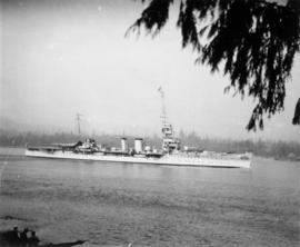
Royal Navy "D" class light cruiser entering Burrard Inlet
Part of Stuart Thomson fonds

Royal Navy vessel entering Burrard Inlet
Part of Stuart Thomson fonds
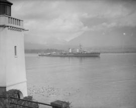
![[Royal Navy warships in Vancouver harbour]](/uploads/r/null/6/8/6869e5d3cafae8929f1c1b05844cb5b3b0d0a335fd4e59e5c3b57c496f00f768/6bade282-e634-4fa4-a613-fc8278a3d45d-A00143_142.jpg)
[Royal Navy warships in Vancouver harbour]
Part of Stuart Thomson fonds

Royal Vancouver Yacht Club "Kittens" racing at Burrard Inlet
Part of Stuart Thomson fonds
![[Sailors rowing to shore from the H.M.S. "Amphion" in Vancouver harbour]](/uploads/r/null/9/b/9bfc3c89bfb227c2ed0b8630533f99722a1277d24cb1e70d34c7740bb5438220/9d00534a-5cfe-42bf-819c-c9fceb9dbf60-A07602_142.jpg)
[Sailors rowing to shore from the H.M.S. "Amphion" in Vancouver harbour]
Part of Major Matthews collection
J.S. Matthews' notes with print or negative in Archives.

Scenes : Vancouver Harbour and skyline etc.

Scenes : Vancouver Harbour and skyline etc.
Scenes : Vancouver Harbour and skyline etc.

Scenes : Vancouver Harbour and skyline etc.

Scenes of ships in harbour, English Bay, tennis courts and mountain views
Part of Olga Jenkinson Bell fonds
Item is a page from an album with photographs showing scenes of ships in harbour, English Bay, tennis courts and mountain views.
![Second Narrows [on] harbour tour](/uploads/r/null/b/2/e/b2ea67536bdb443ce9ad21b9ce328068de0d7aa9252a7ea17ab7aeb9cec67c8f/78042a33-bebb-41f2-ac8e-edfa5de1b752-CVA289-266_142.jpg)
Second Narrows [on] harbour tour
Part of William Orson Banfield fonds

Part of Major Matthews collection
Photograph shows water, tugs, log booms and an industrial section of shoreline.
![Selma Park & Pender Harbour [view from ship] Union Steamship Co.](/uploads/r/null/b/9/b9d40aa8469fc3a5ae14b34b0fdf85b5f9ec7cd8f40da6b11fce28104c4472f4/6fb1525d-e302-4ee4-805a-e2bf36aebc66-A01740_142.jpg)
Selma Park & Pender Harbour [view from ship] Union Steamship Co.
Part of Stuart Thomson fonds
Ship - possibly H.M.S. Despatch
Part of Stuart Thomson fonds
![[Ship docking at wharf - Pender Harbour - Union Steamship Co.]](/uploads/r/null/4/2/425618008e4efb7299c2870f60339c81c383d1885d9b88eb60ad614fd7065cc3/a9d39b1b-a4e5-41f3-a08b-331797367920-A01746_142.jpg)
[Ship docking at wharf - Pender Harbour - Union Steamship Co.]
Part of Stuart Thomson fonds
Item is a photograph showing the vessel, "Lady Cecilia."
Part of Stuart Thomson fonds
![[Ships in Vancouver Harbour]](/uploads/r/null/d/6/d629566f7cb9f7a78af71c85ba3ea4a2cf7167728b91400cee1d65fd777443b3/fbfab785-d4fa-4637-8632-cf9d4b4bddca-A08055_142.jpg)
Part of Major Matthews collection
J.S. Matthews' notes with print or negative in Archives.
![[Ships in Vancouver Harbour; Johnson Wharf]](/uploads/r/null/d/3/d3d981769b95551634534c3b79335d133d4f5e5d1df87be38fc182f6aad7df2a/0546b510-b33e-42c4-b61c-449552679d73-A02418_142.jpg)
[Ships in Vancouver Harbour; Johnson Wharf]
Photograph consists of two images. The upper image shows various ships in Burrard Inlet, with the Vancouver waterfront in the background. The lower image shows ships docked at Johnson Wharf.

Showing Entrance to Stanley Park looking East
Part of Stuart Thomson fonds
Oblique view showing Lost Lagoon, Coal Harbour, Deadman's Island, Brockton Point, Denman Arena, the Horseshow Building and Downtown in the background