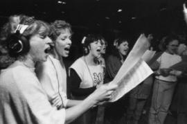
Group in recording studio at Griffiths Gibson Productions
- AM1576-S6-12-F33-: 2011-010.2055-: 2011-010.2055.28
- Part
- 1983
2373 results with digital objects Show results with digital objects
Group in recording studio at Griffiths Gibson Productions

Group in recording studio at Griffiths Gibson Productions

Group in recording studio at Griffiths Gibson Productions

Group in recording studio at Griffiths Gibson Productions
Group in recording studio at Griffiths Gibson Productions

Group in recording studio at Griffiths Gibson Productions
Postal Station C, Mount Pleasant
Part of City of Vancouver Archives technical and cartographic drawing collection
File consists of copies of three architectural drawings of Postal Station 'C' in Mount Pleasant, at Main and 15th Avenue. The building is now referred to as Heritage Hall.
The drawings are two floor plans from the original design of the building and one later drawing of two exterior elevations.

Part of City of Vancouver Archives technical and cartographic drawing collection
Item consists of a planning map depicting the eastern portion of False Creek and surrounding areas.

Part of City of Vancouver Archives technical and cartographic drawing collection
Item consists of a large scale site plan, depicting a proposed development in False Creek [Expo 86?] annotated on top of what appears to be a City planning map. The plan appears to depict part of the Concord Pacific development.
![Vancouver, B.C. Plan showing location of water pipes, hydrants, etc. [Fairview slopes]](/uploads/r/null/6/9/69e0d6904facfa2a814069c15122fba46fc4d8077bff76402e95484a4b13d4d8/313b8940-1e98-45d4-b077-abe0f6bee66a-MAP72_142.jpg)
Vancouver, B.C. Plan showing location of water pipes, hydrants, etc. [Fairview slopes]
Part of City of Vancouver Archives technical and cartographic drawing collection
Item is a map showing the location of water pipes and hydrants for the area bounded by Scotia Street, False Creek, Spruce Street and Tenth Avenue (D.L. 526, D.L. 302 and D.L. 200). Block 6 in D.L. 200 was covered by an overlay depicting a later sub-division. Pipes and hydrants are shown in various coloured inks to indicate installation date. Annotations have been drawn on a base map that was part of a larger map.
Vancouver (B.C.). Water Works Department

Part of City of Vancouver Archives technical and cartographic drawing collection
Item is a map showing the location of water pipes and hydrants for the area from Victoria Drive to False Creek to Prince Edward Street to 16th Avenue (D.L. 264A). Pipes and hydrants are shown in various coloured inks to indicate date of installation.
Vancouver (B.C.). Water Works Department

Part of Pacific Press fonds

Streetcar on Kingsway at Main Street
Part of Pacific Press fonds

Streetcars on Kingsway at Main Street, commencement of longest paved highway in the world
Part of Pacific Press fonds

Two women pushing strollers in Robson Park
Part of Pacific Press fonds

Residential street in Mount Pleasant area
Part of Pacific Press fonds

Homes with stone walls in Mount Pleasant area
Part of Pacific Press fonds
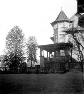
Home with turret and verandah in Mount Pleasant
Part of Pacific Press fonds

Home with stone wall and Evergreen trees in Mount Pleasant
Part of Pacific Press fonds

St. Patrick's School for Girls in Mount Pleasant, with students on steps
Part of Pacific Press fonds

Close-up of students on St. Patrick's School steps in Mount Pleasant
Part of Pacific Press fonds

Florence Nightingale School in Mount Pleasant, showing main entrance with students on steps
Part of Pacific Press fonds
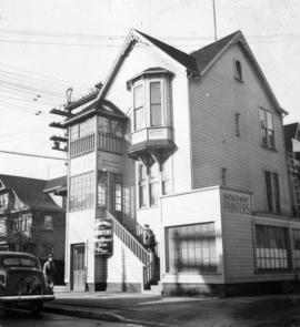
Broadway Printers building exterior
Part of Pacific Press fonds

Mount Pleasant School boy pupils, sitting down outside
Part of Pacific Press fonds

Mount Pleasant School children's outdoor dance class
Part of Pacific Press fonds

Mount Pleasant School children's outdoor dance class
Part of Pacific Press fonds
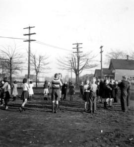
Mount Pleasant School children's outdoor dance class
Part of Pacific Press fonds

Old Beaver dam in Mount Pleasant, with girl by stream
Part of Pacific Press fonds
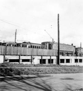
Electric railcars stored in barns above Old Mount Pleasant Beaver dam
Part of Pacific Press fonds

Electric railcars stored in barns above Old Mount Pleasant Beaver dam
Part of Pacific Press fonds

Three children near Old Mount Pleasant Beaver dam
Part of Pacific Press fonds
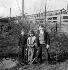
Three children near Old Mount Pleasant Beaver dam
Part of Pacific Press fonds

Man standing beside old granite trough in Mount Pleasant
Part of Pacific Press fonds

Man standing beside old granite trough in Mount Pleasant
Part of Pacific Press fonds
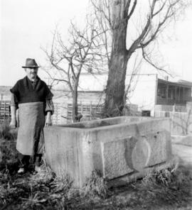
Man standing beside old granite trough in Mount Pleasant
Part of Pacific Press fonds

Part of Pacific Press fonds

Part of Pacific Press fonds
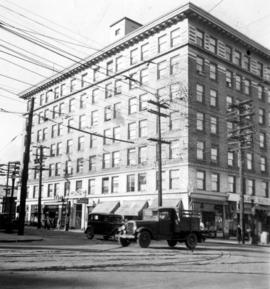
Office building at corner of Broadway and Main Street
Part of Pacific Press fonds
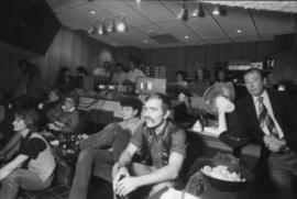
Part of Karl Haspel fonds
Part of Karl Haspel fonds

Mt. Pleasant Queen and attendants before crowning, July 16th
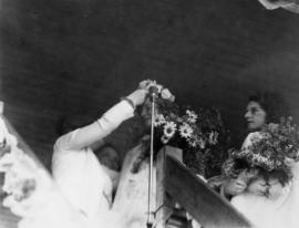
Mt. Pleasant Queen crowned by Mayoress McGeer, July 16th

Mayor McGeer presents oldest lady inhabitant of Mt. Pleasant
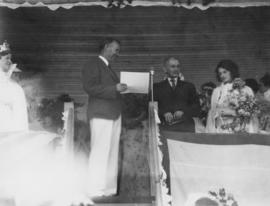
Mayor McGeer presents oldest gentleman inhabitant of Mt. Pleasant
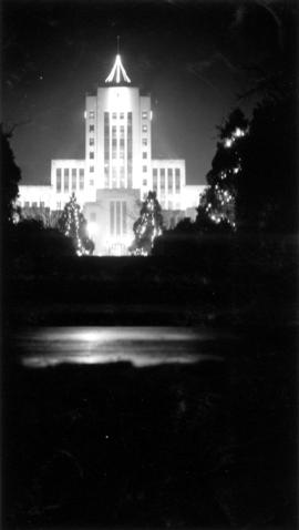
File consists of three photographs showing a view of the seal pond enclosure at Stanley Park, a view of Mount Pleasant neighbourhood looking north, and a portrait of John Irving.
![[Exterior of cottage - 140 8th Avenue]](/uploads/r/null/6/7/67804eaec941806c59b27218de8cfd8799a34bd43daf7ea1a1e40d8a3ead5850/4f7cda55-831a-4a4f-88c3-ebdbf0ae54a3-A24803_142.jpg)
[Exterior of cottage - 140 8th Avenue]
Part of Major Matthews collection
![[Exterior of cottage - 132 East 10th Avenue]](/uploads/r/null/d/a/da363db747ab1aba7b97718adc2c5f6dc97493f7f99bcba4b4bc75e4ccead30d/9cf0232e-6649-47da-bed1-e92c279a5dd8-A25026_142.jpg)
[Exterior of cottage - 132 East 10th Avenue]
Part of Major Matthews collection
![[View of Squad Wagon car wreck at Broadway and Clark Drive]](/uploads/r/null/8/2/a/82ab696fadf8dde30e6d578856f855345436ca7aa6d9c320e1d3220e07da828c/2f3b92ed-11e0-4136-8f8b-72b3a516e0bf-CVA354-136_142.jpg)
[View of Squad Wagon car wreck at Broadway and Clark Drive]
Part of City of Vancouver fonds
Item is a photograph showing the car collision of Firehall No. 3 lnhalator involving firefighters Ken York, Don McLeod, Percy Richards, and Captain Oswald Howell (Howell later died in hospital).
![[View of Squad Wagon car wreck at Broadway and Clark Drive]](/uploads/r/null/5/3/c/53c679bd6f99951d4c75862b663159ab0baba7e015284b470f926373bd735b38/8216b509-f20a-4bec-8dcf-406c5f69ff32-CVA354-137_142.jpg)
[View of Squad Wagon car wreck at Broadway and Clark Drive]
Part of City of Vancouver fonds
Item is a photograph showing the car collision of Firehall No. 3 lnhalator involving firefighters Ken York, Don McLeod, Percy Richards, and Captain Oswald Howell (Howell later died in hospital).
![[View of Squad Wagon car wreck at Broadway and Clark Drive]](/uploads/r/null/a/b/e/abefc9ca8cbf8587fb0caa83d94b0f0b4c64e450ae0ca6207272d36866574fda/3fe5f23d-83c6-4800-bc44-6b43f2633542-CVA354-139_142.jpg)
[View of Squad Wagon car wreck at Broadway and Clark Drive]
Part of City of Vancouver fonds
Item is a photograph showing the car collision of Firehall No. 3 lnhalator involving firefighters Ken York, Don McLeod, Percy Richards, and Captain Oswald Howell (Howell later died in hospital).