Goals for Vancouver : a survey for the Vancouver Planning Commission
- PUB-: PD 398
- Item
- 1979
Part of City publications collection
82 results with digital objects Show results with digital objects
Goals for Vancouver : a survey for the Vancouver Planning Commission
Part of City publications collection
Part of City publications collection
Georgia Viaduct replacement : preliminary engineering study
Georgia Street : the paper for beautiful squares
Flyer concerning a vote for the redevelopment of Georgia and Granville.

False Creek interim harbour headline
Part of City of Vancouver Archives technical and cartographic drawing collection
Map shows interim and ultimate headline, interim headline, ultimate headline, and existing headline, as well as streets, lots, railway yards and waterfront industries in the False Creek area. Map was created for the "False Creek development" study, "Harbour headline" project.

False Creek development survey occupation plan
Item is a copy of a City of Vancouver Engineer's Office map of the False Creek area from Walnut Street to Main Street and downtown to Sixth Avenue. Map shows streets, railway lines, names of businesses occupying sites on the waterfront, and former high tide waterlines.

Part of City publications collection
East Vancouver neighbourhoods study report
Part of City publications collection
Dream city : Vancouver and the global imagination
Downtown Vancouver 1955-1976 : City of Vancouver development plan
Part of City publications collection
Item is a program of events for an exhibition of models and illustrations and a series of guest speakers by the Vancouver Town Planning Commission, October 18 to November 10, 1965.
District lot boundaries within the City of Vancouver
Part of City of Vancouver fonds
Development plans and growth trends : City of Vancouver
Part of City publications collection

Development in the western portion of the Lower Mainland region, 1968
Part of City of Vancouver Archives technical and cartographic drawing collection
Item is a map showing residential, commercial, industrial, civic and institutional, parks and recreational and agricultural zoning in the Lower Mainland area, including West Vancouver, North Vancouver, Vancouver, Burnaby, Coquitlam, New Westminster, Richmond, Maple Ridge, Langley, Surrey, Delta and White Rock. Information has been added to a base map published by the Province of British Columbia.
[Development control brochures]
Part of City publications collection
Departmental Information System Plan (DISP)
Part of City publications collection
Part of Major Matthews collection
CPAC ASPO CIP conference 1975 : a planner's guide
Part of City publications collection
Control of congestion in the city of Vancouver : an investigation of parking charges
Part of City publications collection
Construction, demolition and maintenance activity, City of Vancouver
Part of City publications collection
Community visions : Riley Park/South Cambie
Part of City publications collection
Community visions : Arbutus Ridge/Kerrisdale/Shaughnessy
Part of City publications collection
Community services centre (Britannia) : submission to the Hon. Robert Andras
Part of City publications collection
Community Services : Planning : City Plans : [web site printout]
Part of City publications collection
Web pages contain the following sections: "Insights into Population and Housing"; "Insights into Employment"; "Insights into Transportation"; "Insights in[to] the City and Region".
Community Planning Association of Canada
Item contains comments on a study on highway planning for Metropolitan Vancouver.
Part of City publications collection
Commercial map of Greater Vancouver and district [planning]
Part of City of Vancouver Archives technical and cartographic drawing collection
Item is a printed map of greater Vancouver which has been used as a base map. The base map appears to be the 1929 version of the Commercial Map of Greater Vancouver and District. On this has been added pasted on pictures, arrows and other material that appears to be related to planning activities of some kind.
Commercial Map of Greater Vancouver and District [BC]
Part of City of Vancouver Archives technical and cartographic drawing collection
Commercial map of Greater Vancouver and District depicts railroads, paved streets, streetcar stops, schools, buildings. Uniquely, the map shows the city divided by Postal Block numbers and half mile circles that radiate from City Hall on the corner of Main and Hastings.
The map has large red arrows and clippings of libraries pasted to it that show six proposed library locations and sketch plans. Also included on the map, is an index of all depicted roads in the Hastings, Point Grey, South Vancouver, and Burnaby areas. A legend and compass rose are located in the bottom left hand corner of the map.
The westernmost is road on the map is Marine Drive and the easternmost is North Road while the northernmost is Dempsey Street, and the southernmost is 20th Road.
Commercial Map of Greater Vancouver and District [BC]
Part of City of Vancouver Archives technical and cartographic drawing collection
The map shows the Greater Vancouver Area and its roads, streets, and residential, commercial, and industrial districts in July 1924. In accordance with the legend, the map shows railroads, electric railways, parks, and buildings. The map uniquely depicts the center of Vancouver which is approximately 5400 feet and spans from Water and Railway Street to Prior Street and Abbott Street to Princess Street. The center circle then concentrically expands outwards with other circles marking every mile outward.
Additionally, there are annotations in black, red, yellow, and green. The black annotations mark topography and contour lines with listed elevations. The red annotations mark water gauges. The yellow annotations indicate the best routes through the City and District as suggested by the Automobile Club of BC. The green annotations appear for an unknown reason.
The Westernmost road on the map is Marine Drive and the Easternmost is Columbia Street and North Road while the Northernmost road on the map is Dempsey St. in North Vancouver and the Southernmost point is No. 20 Road.
![Commercial map of Greater Vancouver and district [assessment districts]](/uploads/r/null/0/9/2/0928add1a06ab55bc236f8bebb87712b7e6ad4422db32cc3065efe7c9da96c04/b5b4129d-f9ba-49b9-a863-2ab6e954897e-MAP102_142.jpg)
Commercial map of Greater Vancouver and district [assessment districts]
Part of City of Vancouver Archives technical and cartographic drawing collection
Item is a printed map of greater Vancouver which has been used as a base map. The base map is the 1924 version of the Commercial Map of Greater Vancouver and District. On this copy has been drawn the boundaries of districts, numbered 1-12; inside the drawn boundaries are each district's area in acrea, population and assessed value of property. While the base map is of the pre-amalgamation municipalities, the assessment districts (?) cover the entire post-amalgamation extent of Vancouver.
Part of City publications collection
[Civic planning voting information]
Civic improvements during 1952
Civic arena : report on Downtown Business Association brief
Part of City publications collection
City role in retail development
Part of City publications collection
Part of City publications collection
Part of City publications collection
City Plan : who decides Vancouver's future?
Part of City publications collection
City Plan : a proposal to set "Directions for Vancouver"
Part of City publications collection
City on the move exhibit and symposium : program of events and features
Part of City publications collection
City of Vancouver, east approach route. Alignment alternatives investigated
Part of City of Vancouver fonds
Item is a map which has been created out of a sepia diazotype copy of an aerial photograph of downtown Vancouver. The map has been annotated to show thirteen different schemes for freeway routes to connect the Trans-Canada Highway with downtown Vancouver from the east. The map shows the consultants' preferred route and other alignments investigated.
Phillips, Barratt, Hillier, Jones and Partners, Engineers (Vancouver, B.C.)

City of Vancouver, British Columbia : zoning diagram
Part of City of Vancouver Archives technical and cartographic drawing collection
Part contains a zoning map showing city streets, residential, apartment, commercial and industrial districts, as well as parkways and open spaces. Concentric circles spaced a mile apart on the map emanate from a point in downtown Vancouver.

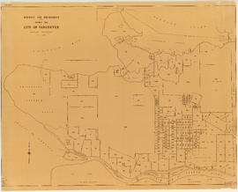
City of Vancouver, British Columbia
Part of City of Vancouver fonds
Item is a map showing city streets and address block numbers.