
Sheet 11 : Wall Street to Rupert Street and McGill Street to Burrard Inlet
- AM1594-MAP 341-: MAP 341.10
- Item
- [1962?], with revisions to Aug. 3, 1963
Part of City of Vancouver Archives technical and cartographic drawing collection
Item is a section showing the area from Wall Street to Rupert Street and McGill Street to Burrard Inlet. Includes streets, blocks, lots and legal descriptions, and the locations of parks, schools, and railways.
Vancouver (B.C.). Engineering Services
![[Sheet 11 : Wall Street to Rupert Street and McGill Street to Burrard Inlet]](/uploads/r/null/e/b/eb84fb8de9ca2e1644a2e39bcbaad5253c563e8716cf25114e675fb7d40365ea/0935fb81-4662-411a-bdfd-c9823c7fb82b-MAP339_142.jpg)


![RLY. [Railway] gates at Hastings Street](/uploads/r/null/0/5/0582c3a6276f544e5a959a78b48163bef47ac0755986c8e828e10931ac926a70/e995a88c-8391-4c01-a498-b44e43e1db6b-A21837_142.jpg)


![[Rail tracks leading Pool No. 1 elevator]](/uploads/r/null/4/5/7/4571a76ba565e9e343e1164e5c3c7c632ee7e63cc6d1f60a0197e0444150f30c/b4803bd2-bd40-4e96-b1e5-7f32711c4c50-CVA260-1341_142.jpg)
![Proposed Raymur Ave. [Avenue] Trunk Sewer diverting sewage from False Creek reclaimed area](/uploads/r/null/c/d/cddf61ac60b97b6fc54309ecbf8d1aea8e9aac3c672576fbd9953a05b82d42fc/14951fa4-0fd0-480c-a1f3-b7c2ef158398-MAP761_142.jpg)
![Proposed Raymur Ave. [Avenue] Trunk Sewer diverting sewage from False Creek reclaimed area](/uploads/r/null/5/2/5260099e92441f23442086ea3a8b5f7512bb5b4b4b5cbf554c9f13450bf4d37f/b5165f5d-bd82-46b5-9beb-0f969f7755ef-MAP761_142.jpg)
![Proposed Raymur Ave. [Avenue] Trunk Sewer diverting sewage from False Creek reclaimed area](/uploads/r/null/a/8/a8edd70876832fb32ffa8add8b5e261fe78b0e6efcb26d07a6fe1c74bf545b57/ac62eada-955d-4eee-8508-6bf4b71a21e5-MAP761_142.jpg)
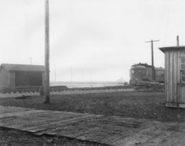
![Plank road [to Canadian Northern Railway] Vancouver freight shed](/uploads/r/null/0/2/02f4c264bbf89ac8d6e2039d74ad3132b07a6a9aecb1a6d67e0d1da0669b3187/a5204c8c-618c-41f8-8fc9-ba1ebfd22686-A09086_142.jpg)
![[Plank road to Canadian Northern Railway freight shed]](/uploads/r/null/f/5/f5f67d6d3ef0fd4d1d1ad4f76f3200eae8708a53d4168e9ae646d94942055668/6fa0e1d6-7b07-4106-9166-296407183c05-A09093_142.jpg)


![[Piers and docks on the Vancouver waterfront]](/uploads/r/null/b/0/b0e2a670e8e0619f9dc496fd5603d78e5e504706970a780e331296067795f410/463bccb4-d8a7-41f5-aeca-b378322a52ab-A63943_142.jpg)
![[Pedestrian overpass over railway tracks near Nanaimo Street]](/uploads/r/null/e/f/ef575796729806ba276deb4e945d9c2b3b95a5a28d2cc85ba6ee2f6313491f53/02e5b57f-8a65-4a7a-8bf9-2fa2b1f2454f-A08789_142.jpg)
![[Pedestrian overpass over railway tracks near Nanaimo Street]](/uploads/r/null/9/8/984a89211484b6149a22b7193bb369507b891c566bf208963284f7dcc9b7e5fc/7c9fe4a1-507f-43d1-8770-c96c94b579aa-A08788_142.jpg)
![Outward freight shed Vancouver [CPR freight shed]](/uploads/r/null/a/a/aaf8d7157ea1a65795e341cb34428f3b0c9134287ab5ac7a61103eb642ab9356/1b8fb1f7-cbe0-4395-9250-9ea7fbcc6f40-A49475_142.jpg)
![Outward freight shed. [CPR warehouse]](/uploads/r/null/9/d/9d2f5b647f34f7f2f2aa102eafe4c3553cd35bc3f98d0edb9af0f157b9935303/df37a889-e7dd-40c9-adfb-0a6f3f0147a8-A49473_142.jpg)
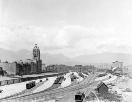
![[Northeast view of False Creek]](/uploads/r/null/c/b/cb30fde9722b8b64fd3b7e25f7487dfe9b743e7495319068d8ee15205635a8d1/982986e0-014c-4224-a34c-78e2d1d69b3f-A59369_142.jpg)
![Miscellaneous [68 of 130]](/uploads/r/null/7/1/71eb447ac97b8dd12a30ce2749b94af2887bb2c044536d599f677a9a487ace45/d11ca122-b806-4991-a03a-73938512db71-A64419_142.jpg)
![Miscellaneous [55 of 130]](/uploads/r/null/6/b/6b76a7bc9c11958ea03236273a346a2fdd7fcba56659419f85403323e3d40a45/4f238cee-3c9d-4aeb-b129-ea759db87fbb-A64386_142.jpg)
![Miscellaneous [54 of 130]](/uploads/r/null/9/0/903f6156f1812c4545deba0949b4c2b9ab99979ad25193013f5f329055368ba0/94bfc5e6-6b69-43d9-95c0-02654abd321e-A64385_142.jpg)
![Miscellaneous [53 of 130]](/uploads/r/null/0/6/06eae5eb055240bc3f25c814df29fc4e98ed13f96a078ed53b3aa631cbbbb5be/01da875c-4a64-476b-b225-1e6b6c125eb5-A64384_142.jpg)
![Miscellaneous [37 of 130]](/uploads/r/null/6/b/6b12f4534c38c24d4567db9adde3a59d2c84bea9a68facada78c66e2cea42bff/41931f04-548e-4b7c-9c69-214709d7a058-A64363_142.jpg)
![Miscellaneous [36 of 130]](/uploads/r/null/b/d/bd9d0b5a56996acdb17c3a4f17f5de6e7a4aaf9673aac419c294f3819d4094c9/8acbf1ad-e3c4-4d5c-b0c7-f4691d422009-A64359_142.jpg)
![Miscellaneous [35 of 130]](/uploads/r/null/7/5/7541e0eef4c4bc4969897b15b2e2cdd88df3138413d4d0176878b20dcec56b3e/db7a9559-37f0-4245-b666-0a0718df1f67-A64358_142.jpg)
![Miscellaneous [34 of 130]](/uploads/r/null/0/4/042ccff47bff4aaa681d0691dc975eef20f315514a52472a82f55384da0e8c9f/2033fddd-6b30-4278-8796-071a072f6dd8-A64357_142.jpg)
![[Men sitting in the stainless steel "dome" during the launch of "The Canadian"]](/uploads/r/null/a/0/a0341e4b33cce42c1ec8a2b7362b17369175b91936ffab1150b19e87d3d04ed6/92960f53-9c08-4a6e-8352-f852b3734835-A70842_142.jpg)
![[Men holding power tools as part of an event associated with a new CNR route]](/uploads/r/null/3/c/3cac5caec81cf6d7819b874f7e4a3810015305fdc506d9f56491363c637284e7/665b7d34-d344-4fae-993f-b21a787b8581-A14001_142.jpg)