- AM1519-: PAM 1971-162
- Item
- 1971
Item is a brochure requesting input on False Creek from the community.
193 results with digital objects Show results with digital objects
Item is a brochure requesting input on False Creek from the community.
![False Creek development : san [sanitary] sewers tentative layout](/uploads/r/null/c/a/ca111eaa497f59a66ecdad4c91bfb2238f21efb21b91a1172f460ef16667055f/4da08847-7457-4d4c-8938-e4c6c1dc50c3-MAP692_142.jpg)
False Creek development : san [sanitary] sewers tentative layout
Part of City of Vancouver fonds
Item is a copy of a sheet from a sectional map of Vancouver which has been annotated to show the proposed locations of sanitary sewers in the area from Keefer Street in the north to 3rd Avenue in the south and from Clark Drive in the east to Ontario Street in the west.
Vancouver (B.C.). Engineer's Office

False Creek development survey occupation plan
Item is a copy of a City of Vancouver Engineer's Office map of the False Creek area from Walnut Street to Main Street and downtown to Sixth Avenue. Map shows streets, railway lines, names of businesses occupying sites on the waterfront, and former high tide waterlines.

False Creek interim harbour headline
Part of City of Vancouver Archives technical and cartographic drawing collection
Map shows interim and ultimate headline, interim headline, ultimate headline, and existing headline, as well as streets, lots, railway yards and waterfront industries in the False Creek area. Map was created for the "False Creek development" study, "Harbour headline" project.
False Creek primary landowners 1973
False Creek water front park : another tour on the house

Part of City of Vancouver Archives technical and cartographic drawing collection
Item is a map showing street names and major landmarks around False Creek during Expo 86. Major pavilions on the fair site are labeled. An index map in the lower right-hand corner of the map shows the location of the primary map in relation to the rest of Greater Vancouver and the United States. The map also includes a short chronology of the history of False Creek and Granville Island. The cover of the envelope depicts a smaller version of the map.

Part of City of Vancouver fonds
Item is a map annotated to show amendments to the layout of False Creek Park. Map shows streets, drainage, elevations of fill, park boundaries, and proposed street extensions in the area bounded by Heatley Avenue, Glen Drive, Prior Street, and the Great Northern Railway lands. Base map extends to Main Street in the west.
Fire at B.C. Forest Products Mill lumber yard
Fire at B.C. Forest Products Mill lumber yard
Fire at B.C. Forest Products Mill lumber yard
Fire at B.C. Forest Products Mill lumber yard
Fire at B.C. Forest Products Mill lumber yard
Fire at B.C. Forest Products Mill lumber yard
Fire at B.C. Forest Products Mill lumber yard
Fire at B.C. Forest Products Mill lumber yard
Fire at B.C. Forest Products Mill lumber yard
Fire at B.C. Forest Products Mill lumber yard
Fire at B.C. Forest Products Mill lumber yard
Fire at B.C. Forest Products Mill lumber yard
Fire at B.C. Forest Products Mill lumber yard
Fire at B.C. Forest Products Mill lumber yard
Fire at B.C. Forest Products Mill lumber yard
Fire at B.C. Forest Products Mill lumber yard
Fire at B.C. Forest Products Mill lumber yard
Fire at B.C. Forest Products Mill lumber yard
Fire at B.C. Forest Products Mill lumber yard

Fire Department Band performing at the Expo Site for Vancouver Day

Part of City of Vancouver fonds

Part of City of Vancouver fonds

Part of City of Vancouver fonds
Part of City of Vancouver fonds

Group on boat cruise in front of Expo Site
Item is a photograph showing Centennial staff. Standing at the bow of the boat, waving are Randie Smith, Tillicum mascot (left), and Sharen Smith, Tillicum Coordinator (right).

Part of City of Vancouver fonds
Item is a map prepared as part of the Harbour Headline project of the False Creek Development Study. Map shows existing, interim and ultimate harbour headlines, existing water areas, ownership boundaries, other property lines and lease boundaries in and around False Creek.
Island Park Walk along False Creek
Part of City of Vancouver fonds

Island Park Walk along False Creek
Part of City of Vancouver fonds

Island Park Walk along False Creek
Part of City of Vancouver fonds

Kathy looking at tour boat on False Creek
Part of Elizabeth Walker fonds
Item is a photograph showing a young girl, Kathy, looking at a tour boat on False Creek with a view of the Granville and Burrard Bridges in the background.
Long and colourful history of False Creek
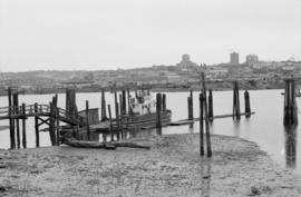
![Low tide, False Creek [view of West End and snow capped mountains]](/uploads/r/null/9/5/3/953572f78d8e5c1ea86509741f557309d36e961c290529493719d150d9033ebf/88a5a318-e26f-45db-bc65-04fd486471c8-CVA293-014_142.jpg)
Low tide, False Creek [view of West End and snow capped mountains]
![Low tide, False Creek [view of West End and snow capped mountains]](/uploads/r/null/e/0/e/e0e5503cf3dbf0703e6c476236df2aa98d0d46e31ab90c7a8b6d2f10c5fce160/fa968d94-288b-48e2-9a11-4dc65f5bc5a0-CVA293-014_142.jpg)
Low tide, False Creek [view of West End and snow capped mountains]

Mah Society of North America building
Part of Paul Yee fonds

Model plane or rocket at Charleson Park
Part of Paul Yee fonds
Mosaic by the sea : a new concept in inner city living
Item describes the history and amenities of the South Shore of False Creek.

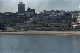
Mount Pleasant and False Creek

Orchestra performance for Yokohama Day at Expo Site
Paddlefest '87 : April 11, 12 : B.C. Complex
Item is a promotional booklet for Paddlefest, including race details, a timetable of events, an exhibition plan, and articles about paddling.
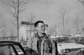
Paul Yee at a parking lot at Granville Island
Part of Paul Yee fonds