Print preview Close
Showing 212 results
Archival description![City of Vancouver [park sites June/80]](/uploads/r/null/9/4/9484add7c4684ea3838e4d00ee8add3ecf85d78d5aa8fe2780cae273e59556a5/bd2464d8-2aa9-4501-aba6-8b3f7d130a42-MAP1032_142.jpg)
City of Vancouver [park sites June/80]

City of Vancouver, British Columbia

Sheet 9 : Clark Drive to Slocan Street and Triumph Street to Charles Street

Sheet 11 : Carrall Street to Clark Drive and waterfront to Keefer Street

Sheet 15 : Oak Street to Main Street and False Creek to Sixteenth Avenue

Sheet 21 : Burrard Street to False Creek and waterfront to Robson Street

Sheet E : University Endowment Lands to Wallace Street and Sixteenth Avenue to Twenty-seventh Avenue

Sheet K : Wallace Street to Trafalgar Street and Twenty-seventh Avenue to Thirty-eighth Avenue

Sheet Q : Churchill Street to Cambie Street and Thirty-eighth Street to Forty-ninth Avenue

Sheet 6 : Craddock Street to Boundary Road and Twenty-ninth Avenue to Fortieth Avenue

Sheet 16 : Maple Street to Oak Street and False Creek to Sixteenth Avenue

Sheet 7 : Clark Drive to Slocan Street and Seventh Avenue to Eighteenth Avenue

Sheet S.V. 14 : Duchess Street to Boundary Road and Twenty-ninth Avenue to Fortieth Avenue

Sheet 13 : Ontario Street to Clark Drive and First Avenue to Sixteenth Avenue

Sheet 15 : Oak Street to Main Street and False Creek to Sixteenth Avenue

Sheet 17 : Trutch Street to Maple Street and Fourth Avenue to Sixteenth Avenue

Sheet 23 : Stanley Park to Granville Street and Robson Street to False Creek

Sheet C : University Endowment Lands to Discovery Street and Fourth Avenue to Sixteenth Avenue

Sheet D : Discovery Street to Trutch Street and Fourth Avenue to Sixteenth Avenue

Sheet G : Trafalgar Street to Granville Street and Sixteenth Avenue to Nanton Avenue

Sheet N : Musqueam Reserve to Wallace Street and Thirty-eighth Avenue to Forty-ninth Avenue

Sheet O : Holland Street to Elm Street and Thirty-eighth Avenue to Forty-ninth Avenue

Sheet Q : Churchill Street to Cambie Street and Thirty-eighth Street to Forty-ninth Avenue

Sheet W : Fraser River to French Street and Fifty-ninth Avenue to Seventy-first Avenue

Sheet S.V. 6 : Prince Edward Street to Bruce Street and King Edward to Thirty-fifth Avenue

Sheet S.V. 7 : Prince Edward Street to Argyle Street and Thirty-fifth Avenue to Forty-seventh Avenue

Sheet S.V. 8 : Prince Edward Street to Argyle Street and Forty-seventh to Fifty-eighth Avenue

Sheet S.V. 11 : Fleming Street to Killarney Street and Thirty-seventh Avenue to Forty-eighth Avenue

Sheet S.V. 12 : Fleming Street to Raleigh Street and Forty-eighth Avenue to Newport Avenue

Sheet 6 : Nicola Street to Beatty Street and English Bay Beach to Georgia Street

Sheet 63 : Carnarvon Street to Cypress Street and Forty-first Avenue to Thirty-third Avenue
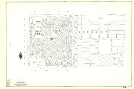
Sheet 27 : University Endowment Lands and Drummond Drive to Camosun Street and Fourteenth Avenue to Fourth Avenue

Sheet 30 : Maple Street to Oak Street and Fourteenth Avenue to Third Avenue and False Creek
Sheet 36 : Rupert Street to Carlton Avenue and Twenty-second Avenue to Grandview Highway

Sheet 43 : East Boulevard to Oak Street and Laurier Avenue to Fourteenth Avenue
Sheet 45 : Discovery Street to Blenheim Street and King Edward Avenue to Fourteenth Avenue

Sheet 52 : Inverness Street to Nanaimo Street and Thirty-second Avenue to Twenty-second Avenue

Sheet 66 : Musqueam Indian Reserve to Balaclava Street and Forty-ninth Avenue to Forty-first Avenue

Sheet 74 : Inverness Street to Nanaimo Street and Sixty-first Avenue to Forty-ninth Avenue

Sheet 75 : Nanaimo Street to Kerr Street and Bobolink Avenue to Forty-ninth Avenue

Sheet 81 : Main Street to Inverness Street and Southeast Marine Drive to Fifty-seventh Avenue

Sheet 87 : Barnard Street to Heather Street and Beckwith Road to Seventy-fifth Avenue
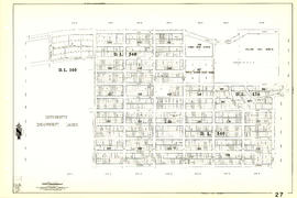
![[Sheet 13 : Rupert Street to Gilmore Avenue and Eton Street to Burrard Inlet]](/uploads/r/null/f/0/f03aaa2671556fb722cf612a9736c0a6b919aff4af5a9dbe048dd93863af5773/30eb2a4c-b404-4552-81da-7461e4aacfaa-MAP339_142.jpg)
[Sheet 13 : Rupert Street to Gilmore Avenue and Eton Street to Burrard Inlet]
![[Sheet 18 : Nanaimo Street to Rupert Street and Fifth Avenue to Charles Street]](/uploads/r/null/d/1/d1f15643f64f1017cebdf5df98ddf5f7c38a6db5ade26e6b203290dc663fd504/8b6604fc-f1c3-4c90-8e0e-7996e05e2419-MAP339_142.jpg)
[Sheet 18 : Nanaimo Street to Rupert Street and Fifth Avenue to Charles Street]
![[Sheet 19 : Clark Drive to Nanaimo Street and Second Avenue to Frances Street]](/uploads/r/null/6/e/6ead2ad53e7927dc776c7c6e209eaf9f3e6dc61a60b191a0180e7c1e60ef8ace/46817199-aca3-4b79-afda-f95b0d9f2f0b-MAP339_142.jpg)
[Sheet 19 : Clark Drive to Nanaimo Street and Second Avenue to Frances Street]
![[Sheet 34 : Nanaimo Street to Rupert Street and Fifth Avenue to Grandview Highway]](/uploads/r/null/4/d/4dec0865cb529d2b3586764b85cb4fe3474714725cb43f9b355eec779ad8162d/6493e9ac-b956-4a83-88fc-b8d6c13efcdf-MAP339_142.jpg)
[Sheet 34 : Nanaimo Street to Rupert Street and Fifth Avenue to Grandview Highway]
![[Sheet 36 : Rupert Street to Carlton Avenue and Twenty-second Avenue to Grandview Highway]](/uploads/r/null/2/a/2a5d48ee373aa9984afbf5119a86658558d79c8c5df27b60fdf83e4bb2673a3d/2b3f592c-cadf-4bac-a188-0a08249104da-MAP339_142.jpg)
[Sheet 36 : Rupert Street to Carlton Avenue and Twenty-second Avenue to Grandview Highway]
![[Sheet 45 : Discovery Street to Blenheim Street and King Edward Avenue to Fourteenth Avenue]](/uploads/r/null/7/b/7b9edfc2a053f0ba6c95af404ad3bf4f22a5e63ff6ddcd9acea2fd6dc469d916/ef5279fc-e406-412e-9886-eddb46d44c27-MAP339_142.jpg)
[Sheet 45 : Discovery Street to Blenheim Street and King Edward Avenue to Fourteenth Avenue]
![[Sheet 51 : Ontario Street to Inverness Street and Thirty-seventh Avenue to Twenty-eighth Avenue]](/uploads/r/null/3/a/3aee300fe6dd39cf02ce71f3cbf8199220cf19dc59148fcf8db71a0bdc7f8239/c1783bd2-c47b-43ed-a71d-29571b121241-MAP339_142.jpg)
[Sheet 51 : Ontario Street to Inverness Street and Thirty-seventh Avenue to Twenty-eighth Avenue]
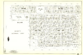
![[Sheet 52 : Inverness Street to Nanaimo Street and Thirty-second Avenue to Twenty-second Avenue]](/uploads/r/null/8/0/80540d4a84d80b164711e9d69d163532d3d064da5a77cf784a15f7025db7ce7a/29b188a1-6a45-4c89-b95b-7238c42064f0-MAP339_142.jpg)
[Sheet 52 : Inverness Street to Nanaimo Street and Thirty-second Avenue to Twenty-second Avenue]
Results 1 to 50 of 212