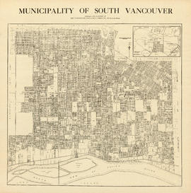
Indexed guide map of the city of Vancouver and suburbs
- AM1594-: MAP 70-: LEG1276.1
- Part
- 1914
Part of City of Vancouver Archives technical and cartographic drawing collection
Part is a map showing district lots, blocks, and boundaries between the City of Vancouver, Point Grey, South Vancouver, Burnaby, New Westminster, and parts of Richmond, North Vancouver and West Vancouver. Concentric circles indicate the distance in miles from the intersection of Main Street and Hastings Street in intervals of 1/2 mile.


![Plan of Point Grey Municipality [ward boundaries]](/uploads/r/null/a/c/a/aca691b3d6e49d092070fc230a88f5ca7bd346fc8c5894892d7cdc5a79b535ee/9a14b192-1858-43aa-ab28-d0b03a2304eb-MAP360_142.jpg)

