
- COV-S510-: CVA 779-W09.21
- Item
- 1981
Part of City of Vancouver fonds
70942 results with digital objects Show results with digital objects
Part of City of Vancouver fonds

Part of City of Vancouver fonds

Part of City of Vancouver fonds
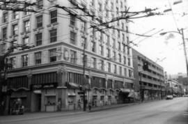
Images show Toronto Dominion Bank, Vincent Delicatessen, the Cheese Shoppe, Welch's Candies, and Robson Florist.

Part of City of Vancouver fonds
Images show Busy Bee Grocery & Flowers and Robson Fabrics.
![700 Jervis Street east side [corner of Robson]](/uploads/r/null/d/e/de0d1b3a4d96ff090fb11d384b6d68029e8623bbb1ed0a3edc5bc2d3b6733fa6/dedddadd-c0e4-4327-aa6d-531ff3e56bbb-A75042_142.jpg)
700 Jervis Street east side [corner of Robson]
Part of City of Vancouver fonds
![1100 Robson Street north side [corner of Bute]](/uploads/r/null/8/8/88c5843035c579e2ff13883db64aac569f8e22f2d41011b6c92d0660d3585260/6489752a-983d-4a5a-b8e1-d16d011a3233-A75054_142.jpg)
1100 Robson Street north side [corner of Bute]
Part of City of Vancouver fonds

Part of City of Vancouver fonds

Part of City of Vancouver fonds
Image shows Black Angus Restaurant.

Part of City of Vancouver fonds
1000 West Hastings Street north side
Part of City of Vancouver fonds
![1000 West Hastings Street north side [corner of Thurlow]](/uploads/r/null/e/0/e0279828d6999f8052faa78e318b56a75eddc869a84c127650101d32cd501b8e/b1dcfabf-4946-4bb9-83fc-3cea77da65d2-A75081_142.jpg)
1000 West Hastings Street north side [corner of Thurlow]
Part of City of Vancouver fonds

1200 West Georgia Street south side
Part of City of Vancouver fonds

1300 Alberni Street north side
Part of City of Vancouver fonds
1400 West Georgia Street south side
Part of City of Vancouver fonds

Part of City of Vancouver fonds

Part of City of Vancouver fonds

1300 West Pender Street south side
Part of City of Vancouver fonds

Part of City of Vancouver fonds

Part of City of Vancouver fonds

Part of City of Vancouver fonds

Part of City of Vancouver fonds
Image shows YMCA.

1400 West Pender Street north side
Part of City of Vancouver fonds
Image shows Canadian Indemnity Building.
Part of City of Vancouver fonds
1100 West Pender Street north side
Part of City of Vancouver fonds

1000 West Pender Street north side
Part of City of Vancouver fonds

1000 West Hastings Street south side
Part of City of Vancouver fonds

Part of City of Vancouver fonds

Part of City of Vancouver fonds

600 West Pender Street south side
Part of City of Vancouver fonds

600 Granville Street east side
Part of City of Vancouver fonds

600 West Georgia Street north side
Part of City of Vancouver fonds

600 West Georgia Street north side
Part of City of Vancouver fonds

Part of City of Vancouver fonds

Part of City of Vancouver fonds
Images show CPR Station.

Part of City of Vancouver fonds
Images show CPR Station.

Part of City of Vancouver fonds

1300 Granville Street east side
Part of City of Vancouver fonds

Part of City of Vancouver fonds
Images show Sears.

500 West Hastings Street north side
Part of City of Vancouver fonds
Images show Sears.

Part of City of Vancouver fonds

Part of City of Vancouver fonds

Part of City of Vancouver fonds
![[View of corner Richards and Dunsmuir]](/uploads/r/null/3/e/3e74c19c3782bbe2e19a232c8d04fe542bc4ccabd53bd162d38d817d61adc61a/0e56b63b-804d-4d3b-b703-28a9c0df898f-A73639_142.jpg)
[View of corner Richards and Dunsmuir]
Part of City of Vancouver fonds
Item shows the Salvation Army Dunsmuir House for Men at 500 Dunsmuir Street.

500 Helmcken Street north side
Part of City of Vancouver fonds
Downtown and West End buildings inventory photographs
Part of City of Vancouver fonds
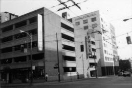
Series consists of images which systematically and comprehensively document the whole of Vancouver's central commercial area, along the waterfront from Cardero to Carrall, narrowing southward to False Creek (Thurlow to Richards at the southernmost point). Photographed in August 1981 (as an internship or work experience project) to provide a reference resource in the preparation for the Vancouver Coreplan. Images are generally 45 degree views of buildings, often from block corners. Arranged in a devised image block numbering scheme (individual image numbers reflect that organization).
Vancouver (B.C.). Planning Department

600 West Hastings Street north side
Part of City of Vancouver fonds

400 Granville Street east side
Part of City of Vancouver fonds

400 Granville Street east side
Part of City of Vancouver fonds
600 West Pender Street north side
Part of City of Vancouver fonds
Part of City of Vancouver fonds