
Hydro electric surveys. Plan showing location of water powers investigated by City of Vancouver
- COV-S346-F01-: MAP 1080.02
- Item
- 1923
Part of City of Vancouver fonds
Item is a map which shows the locations and the dates of use of "gauging stations established" and "city gauging stations still in use" in the area of south-western British Columbia where the City of Vancouver conducted hydro-electric surveys up to 1923.


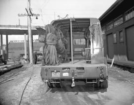
![[Firefighters and motorized equipment in front of Firehall No. 2, 754 Seymour Street]](/uploads/r/null/1/a/2/1a2f1373f1d648856294c4009aca38f93d121927679c379a3ab4dd4db0fd8128/e7169b57-02b8-4cc5-a5d8-122e1c212954-CVA354-043_142.jpg)

![Hastings Street, South Granville, Chinatown [Power lines]](/uploads/r/null/1/9/f/19fb643ced9b72927d05a29a149e92e02b9e267a85eb3fd3a7c67a451631c9d1/34eac91e-9ab5-4cb9-9394-fd71b5dd4834-CVA1095-08723_142.jpg)


![[Electricity conductors at Buntzen Lake Dam]](/uploads/r/null/a/d/ad2ba0642c04626271b9599982126a69a75699440115567584dfe4d320082d31/e6591b79-166e-4c21-9839-0452ffe21218-A23335_142.jpg)
![[Inside the powerhouse at Buntzen Lake Dam]](/uploads/r/null/4/4/441944cbacab6a01cf53da75dcbd78aefda0d7fc4ef30f2b5098f3040ff1d49a/086533ea-4c45-473b-80d3-cba86952170e-A23337_142.jpg)
![[B.C. Electric Railway Co. power house under construction - Westminster Avenue (Main Street)]](/uploads/r/null/5/0/5095d221f9dbd6d4197f7c7da9418c1db5d31366a67107123de691de33fd2eb6/07f67f59-082c-4877-b289-f9638e324012-A24728_142.jpg)
![[B.C. Electric Railway Company's Lake Buntzen power house from the water]](/uploads/r/null/9/e/9eadaddb674739e6795819d633055e321a7de414e505cac37c7449ae8a8af61c/94b4745b-f627-4138-b398-f9e093d7c7ac-A34124_142.jpg)
![[Construction of penstock on hillside behind Buntzen Lake Power Plant number one]](/uploads/r/null/7/7/777f8ad48cdd78d429fbb5895dc18a9596d2b56a649e9f234af154e54f0bed5a/1c36f73b-3d8d-42c7-8eaf-ac40372536ba-A08595_142.jpg)
![[Construction of penstock on hillside behind Buntzen Lake Power Plant number one]](/uploads/r/null/f/0/f0af6cb5f911333031ae5338e5ea5624d1edd90862d069432225bb7a0fb26f81/5d20f315-f33a-4bb4-8fd8-fbaee9d3ab02-A08596_142.jpg)
![[Cross section of headgate structure and New Westminster Water Works intake tower]](/uploads/r/null/e/7/e77f33fbac77e02fe5d428b3cbdfe9839aca02c42ef67efe86d05a8343812c1c/670c4ee9-1c4a-4e8d-9ef2-2d385988ddb0-A08652_142.jpg)
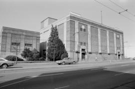
![[Exterior of the second Electric Power House on Pender Street]](/uploads/r/null/3/5/35647710c01dc33bcd80970c56eb3540db6c69c42cc6b6722582ca391eec1fc6/120c48bc-5c9a-486f-86af-da1b21a4da7a-A24624_142.jpg)
![[Exterior view of construction of Buntzen Lake Power Plant number two]](/uploads/r/null/3/2/32d27bbcfeda00a29cb2b624a85857d1fc330815385af092431d9927f8e6e10c/c8b01f55-f245-44ad-ab5a-89a3ace3b2da-A08155_142.jpg)

![[Electric meter installation in hallway of building]](/uploads/r/null/a/4/a4c30389386ab8041000211bdd73c855a602a77776c8f54529e48b3ea6fb8a67/1b97c5d1-84bd-4c83-a380-b6c4031d8f7d-A08522_142.jpg)
![[Electric power lines running above lane west of Granville Street]](/uploads/r/null/3/0/309d219e95d2dc852bfd1efbcce2be57cb6e098a88a684e3141e9c02a123dd6a/52c5f0f8-9b65-47a0-a706-5280635d922e-A08385_142.jpg)
![[Electrical power house near shore area]](/uploads/r/null/1/9/19f0d15bbe7eed02a8137a857e40b42d25ba4abe9362594304d668f18fe5d5c5/51b95d93-47c0-4662-936b-badb39eea969-A04806_142.jpg)
![[Electrical tower and surrounding wires and power poles]](/uploads/r/null/4/2/42ad1347cbf8552b62819e05f822ca83e729c1089ac7971b98bd6779b8ff407b/9d815f63-7735-4cc1-b926-b0661f2c0582-A04752_142.jpg)
![[Electrically operated bus used by the Dunsmuir Hotel to meet boats at the dock]](/uploads/r/null/8/3/83851123b0eb1d28f4db12aa9abec5f9f665bae16b05fcfae32b992a0ec2c8c1/ef009748-8048-4064-ad19-cd1718ff019a-A08608_142.jpg)
![[Exterior of gate house on west shore for Buntzen Lake Power Plant number two]](/uploads/r/null/9/2/92712c79f61c270680bc7a5b394d78b6c69d74174e90686613afb58368b47c90/5b5d1ab9-4c51-456c-9998-ad4f60c409b6-A08138_142.jpg)
![[Exterior of power house for Buntzen Lake Power Plant number one]](/uploads/r/null/d/9/d9337127213eb1f8977db9af4f187c0fdf89a45078c0dbaa27f3d1e5229e1be2/089e672a-5fa3-4f95-a6f3-3e5230b89d19-A04809_142.jpg)
![[Man sitting in back seat of electrically operated passenger coupe style car]](/uploads/r/null/b/1/b136112f38f833ff52bb8d69d820da0fb03afa8699fcaae5ba04e0956be0b612/8f7915d6-73ce-4cb4-8dbe-2a45340127b9-A08609_142.jpg)
![[Men constructing steel frame of Horne Payne substation]](/uploads/r/null/4/0/40bad7cf12a7020df9189ddc79786dac803d15e1e8b7eb96d86947b8b923db8a/d4226b25-972d-4944-a3c3-39b236e3b20b-A08445_142.jpg)
![[Men excavating area underneath scaffolding and pulleys for Buntzen Lake Power Plant number one]](/uploads/r/null/e/c/ec0bf52cdc8fc89f51b2c0254126ad284e9e89a705ab84774971e0c357a47f9e/c52c8bfb-16ee-4da4-9a01-949872cf70e8-A04713_142.jpg)
![[Men installing Babcock and Wilcox boiler drums at Brentwood Bay Steam Plant]](/uploads/r/null/8/3/839e078d7a7a0a28f45ded139ce9592e42f9906ea2b2b64059b66335ad1a85df/8223cfd0-24f8-4149-ba1a-cb657f04e433-A08203_142.jpg)
![[Men laying power cables under Smithe Street]](/uploads/r/null/c/0/c03852cf476e6a6cf7b46111797e0f81244e01b81a4a812e95312f731ee2beaf/f2bcdbd6-1f4b-46d2-8879-ab406984ea2d-A08296_142.jpg)
![[Men standing among rocks in partially excavated area for Buntzen Lake Power Plant number one]](/uploads/r/null/4/5/4518293814d94e7a8c51769fdfbf221356df43dc24cb3af81086f12c0524b006/3db3bc3d-4b57-433b-a946-b8fcd4e3a581-A04836_142.jpg)
![[Men standing outside surge tank of hydraulic tunnel from Buntzen Lake]](/uploads/r/null/5/b/5bb587515f91fd33f616a3f244b7a895c59ae4d9ceb7691326309b836c92d942/0c0b3a92-0b11-4522-a098-8f986f982747-A08139_142.jpg)
![[Men using a storage battery operated truck to haul reels of cable at the south side of False Creek]](/uploads/r/null/1/6/1677233a3baac0884d8ced2c000cd9372f928c50295976f512096fdbfa55660d/f62b7d21-1c6f-423e-ad5a-b1aead4d1bf0-A08603_142.jpg)
![[Men working on foundation of power house extension for Jordan River Power Plant]](/uploads/r/null/1/6/1625c306a3ab2a5f1a42e7c0dbd0b7e3073e1ffe7e66afe9381444f26bb80c18/2891003d-6e19-402f-9dbd-088422f9c160-A08212_142.jpg)
![[Men working on partially cleared site of the Buntzen Lake Power Plant number two]](/uploads/r/null/9/9/99014d457b6e945439f38f1a961f5f8c5bf93d05e24bdc6498e23fc67af788b7/ed8a4803-b958-43d9-ac87-f50096101952-A08600_142.jpg)
![[Partially constructed Buntzen Lake Power Plant number one]](/uploads/r/null/e/e/ee7e08b480b5caa1b0ccb627873fb56227d78dcef82f45fcf36139e96a154736/9dc491fc-df97-48bc-ae04-045bdf2ec8e9-A04735_142.jpg)
![[Partially constructed Buntzen Lake Power Plant number two from Indian Arm]](/uploads/r/null/7/3/736bd89087e3adde8cbd24f7f5dd03f45a0b90a31ac5e35f34c8961d38752117/6bd627a3-5571-47a2-a372-60dbbffa7686-A08429_142.jpg)
![[Partially constructed Buntzen Lake Power Plant number two from Indian Arm]](/uploads/r/null/4/2/4294001fa0049c822f0f6dab290439ca22f8735e04215d4463b7e1a36a294394/837baedd-1459-461a-a4fa-c4777271e92b-A08430_142.jpg)
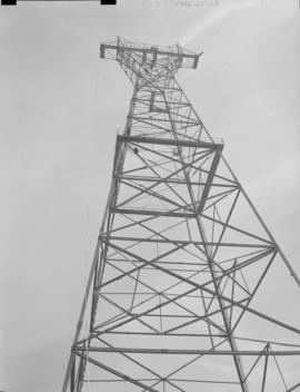
![[Partially constructed electrical tower]](/uploads/r/null/3/a/3a522e82fbafc4d8557c20aa713e492705c611e20c465481fb7b4a75c0baa11c/608441ff-5547-4ac6-91b0-2c67694cf674-A04749_142.jpg)