
Plan of proposed underground convenience for Vancouver
- COV-S365---: LEG288.19
- Item
- [ca. 1910]
Part of City of Vancouver fonds
Item is an architectural drawing depicting the plan for an underground public restroom. The drawing includes cross-sections. The drawing may have been used for reference purposes, or submitted to show supplied equipment associated with a design completed by the Engineering Department.
Walter Macfarlane & Co. Saracen Foundry
![[Coal Harbour view from Denman Street]](/uploads/r/null/f/4/f4ee6b5b8d147b8a774a97a7b59f6f8c29bb8792a52da1695f47dce307742555/f90773a4-4b21-478d-bd42-505e1d441b47-A16624_142.jpg)

![Abbot and Hastings oppo[site Hotel] Lotus](/uploads/r/null/9/1/91eb88a5795d43121cd684a78ce1425823c1e974aafcebadddc0137ff36d1490/af5dca7e-8b6a-4de7-9dfa-b219b0eb63c7-A16591_142.jpg)


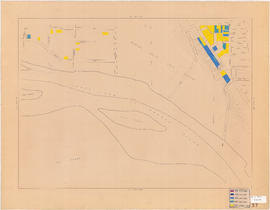

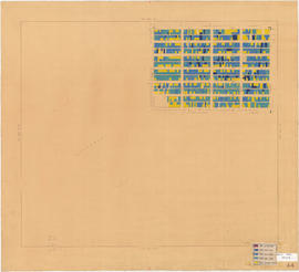
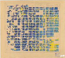


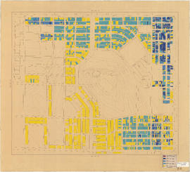
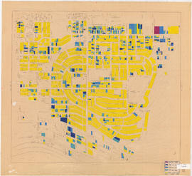
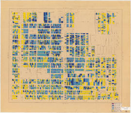
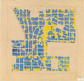
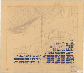
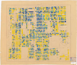
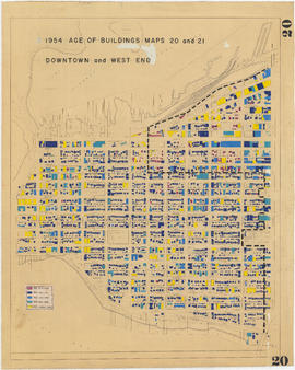
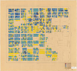
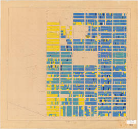
![Age of buildings : Slocan Street to Boundary Road and Wall Street/East Street [Edinburgh Street] ...](/uploads/r/null/e/9/2/e921e2151aed2f9a2fd506bbc7e781632de17633f5f2f1a410764a15e68501b4/01454f17-8dfb-417d-9fd9-0093f19fcd56-LEG1221_142.jpg)


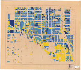


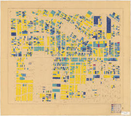


![Block 42, D.L. 541 [Buildings for lease]](/uploads/r/null/6/a/a/6aa3d579c2d82a3f1d8d47ac356411f6cb40bf76e292a7cf233f7d74c72d2d4b/b5fc313d-dd24-4efc-87de-be58860cb553-CVA1095-09177_142.jpg)