
Fred Buchamer, candidate for Alderman, Surrey

A.R.P. parade

Oxen logging
Map of Lulu Island and Sea Island ; Municipality of Surrey ; Map of Maillardville ; University Endowment Lands
Sectional map and street directory of Vancouver : Dial map of the city of Vancouver including adjacent municipalities
Sectional map and street directory of Vancouver : Dial map of the city of Vancouver including adjacent municipalities

Map of Lulu Island and Sea Island ; Municipality of Delta ; Municipality of Surrey ; Municipality of Langley ; Map of Maillardville
[Sectional map of Surrey]
[Sectional map of Surrey]
C. Willingale display booth : R.R. #3, Cloverdale, B.C.
C. Willingale display booth : R.R. #3, Cloverdale, B.C.
Mr. Dunsmuir residence : Crescent Beach, B.C.
Mr. Dunsmuir residence : Crescent Beach, B.C.

Map of Lulu Island and Sea Island ; Municipality of Surrey ; Map of Maillardville ; University Endowment Lands

Hydro technicians working on tower at 104th Ave. and 140th St., Surrey
Road classification (Surrey, B.C.)
Road classification (Surrey, B.C.)
Soil map of Surrey municipality
Soil map of Surrey municipality
New Westminster Land District (Surrey, B.C.)
New Westminster Land District (Surrey, B.C.)
Soil capability map of Surrey (Surrey, B.C.)
Soil capability map of Surrey (Surrey, B.C.)
Soil map of Surrey municipality
Soil map of Surrey municipality
Farm lands (Surrey, B.C.)
Farm lands (Surrey, B.C.)
Map of Surrey municipality
Map of Surrey municipality
Surrey perimeter system
Surrey perimeter system
Surrey perimeter system
Surrey perimeter system
![Pinus Contorta at S[outh] Westminster](/uploads/r/null/f/c/fcda262372c750befdbeccdf0e8b294809b17d5c06ab2a45bb829641c9a7d3d5/923cd107-0892-41f1-bbd2-88caccb6d4dd-A50661_142.jpg)
Pinus Contorta at S[outh] Westminster
Education - school districts - Surrey - 1998
Education - school districts - Surrey - 1998
Education - school districts - Surrey - 2002-03
Education - school districts - Surrey - 2002-03
![[J.A. Cates residence at Crescent Beach]](/uploads/r/null/f/1/f1ff04e3653658a52604ae05451b67134144cf4011f7528e29b026eba02dd870/e28d1dfc-6711-4c20-806c-4dd36d6427c5-A08958_142.jpg)
[J.A. Cates residence at Crescent Beach]
![[J.A. Cates residence at Crescent Beach]](/uploads/r/null/1/1/110bfe89cddd961ed9da5923519385f9a326954bdce47e911f2df0a7aa9abee5/f5201b49-647e-4e1e-b3e5-ded903507aa8-A08959_142.jpg)
[J.A. Cates residence at Crescent Beach]
![[Boundary Treaty Centennial celebration at the Peace Arch border crossing]](/uploads/r/null/8/f/8f6746f809d4748b7e089d0548004e88a3fcd4369bbffc429b6b34c23bc26879/26e4505c-5a55-444e-ac8f-9160213690ed-A12697_142.jpg)
[Boundary Treaty Centennial celebration at the Peace Arch border crossing]

[U.S. veterans marching across the 49th parallel beneath the Peace Arch at the Boundary Treaty Centennial celebration]
New Westminster, British Columbia (Dept. of Mines and Technical Surveys, land
New Westminster, British Columbia (Dept. of Mines and Technical Surveys, land
Zoning map (Surrey, B.C.)
Zoning map (Surrey, B.C.)
Land use (Surrey, B.C.)
Land use (Surrey, B.C.)
District of Surrey
District of Surrey
New Westminster Land District - New Westminster Land Recording District (Surrey, B.C.)
New Westminster Land District - New Westminster Land Recording District (Surrey, B.C.)
Map of Surrey municipality
Map of Surrey municipality
Kelly Lake - Ingledow portion of Peace River #2 transmission line
Kelly Lake - Ingledow portion of Peace River #2 transmission line
Traffic districts (Surrey, B.C.)
Traffic districts (Surrey, B.C.)
Newton Industrial Estate
Newton Industrial Estate
Map of Surrey municipality
Map of Surrey municipality
White Rock
White Rock
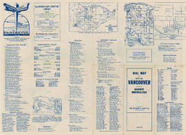
Dial map of the city of Vancouver including the adjacent municipalities
Dial map of the city of Vancouver including the adjacent municipalities
Dial map of the city of Vancouver including the adjacent municipalities
Dial map of the city of Vancouver including the adjacent municipalities

Fraser Valley, Surrey & Richmond

Riot equipped American police and youths from Blaine confront Canadian group at Peace Arch Park

Crowds of demonstrators at Peace Arch Park
Elections - Surrey, B.C.
Elections - Surrey, B.C.
Street index and detail maps
Street index and detail maps
![[Sea cadet band marching past the Peace Arch at the Boundary Treat Centennial celebration]](/uploads/r/null/e/b/eba9156d8f135c55d7b8ece5488b541cbbf9a739eb04f504f76afaf3ef777fb8/20f50f23-eb1b-4241-9918-0ec0c2c727d8-A12700_142.jpg)
[Sea cadet band marching past the Peace Arch at the Boundary Treat Centennial celebration]
Land use (Surrey, B.C.)
Land use (Surrey, B.C.)
Subdivision and land use : residential analysis (Surrey, B.C.)
Subdivision and land use : residential analysis (Surrey, B.C.)
Zoning map (Surrey, B.C.)
Zoning map (Surrey, B.C.)
![[Group of people standing under Peace Arch monument during its construction]](/uploads/r/null/6/4/649adf4615101272bd3ab5a8bb98ec47188da9cb409c5e9435872e89cdbb106a/47395b85-5f5a-4a8a-b729-035757cbd792-A73000_142.jpg)
[Group of people standing under Peace Arch monument during its construction]