
- AM1487-F05-: 2013-004.18
- Item
- 1973-1974
Part of City of Vancouver Archives sound recording and moving image collection
Item is a film showing group golfing, Stanley Park including Siwash Rock and Girl in a Wetsuit statue, a trip to Atlantic City including footage of Shriners band practice at a hotel, a man dressed in a bikini, a parade and men getting shoes shined, views of New York City from inside a vehicle and Expo Spokane grounds.


![View on the Chuckanut Drive, Pacific Hiway [Highway]](/uploads/r/null/0/a/1/0a1f1953636564ca1646814e64cd543aec5e12b70d12d5ead5e12114ec2165d1/feb53896-e5dd-42a0-855f-c0967c781f64-CVA289-003_142.jpg)
![View on the Chuckanut Drive, Pacific Hiway [Highway]](/uploads/r/null/b/6/0/b6025b13309e21bdb54af6e223a16ae7ab6bf53a3d09a2def09a8c93166d0ea5/dd783a7b-beab-4ff7-bad9-301024b32a21-CVA289-003_142.jpg)
![View on the Chuckanut Drive, Pacific Hiway [Highway]](/uploads/r/null/4/d/0/4d058fcb9f0d5b32ed97fd9c5af0e35e8283cc8b152eafdd34d5578209db5363/41e49344-b986-472a-9e9e-408f242cb37d-CVA289-003_142.jpg)
![View on the Chuckanut Drive, Pacific Hiway [Highway]](/uploads/r/null/8/a/1/8a1138124e805230ee4e02a2286badfe44ff977e5a46f86409a07f8161f7aa71/cd291a91-4ce1-4e1f-8aeb-db5917ba39b1-CVA289-003_142.jpg)

![[View of Mount Shuksan from the road to Mount Baker]](/uploads/r/null/d/7/d77b6396eecb2d0f09fe1df0a14704f25d6a92df9eb23bf1fc9adae7a87adaa0/b0cecf3c-95b9-48e0-81cf-a5524cdb66dc-A32833_142.jpg)
![Veratrum [at] Mount Baker, Washington](/uploads/r/null/9/c/9c38d8792e2c86902dfa539e3525cd77be414e011c9d1cb0f371b8c9955f3f75/086b1136-c8a9-4d27-abb1-601c25f41ce1-A58335_142.jpg)
![Veratrum [at] Mount Baker, Washington](/uploads/r/null/8/0/80c95d684d66b84d35f9ff795d098fae90d542e9efd215455c701df685169c6d/051712fc-6b92-478a-a2e6-ece0f2ecf2ba-A58334_142.jpg)
![Vaccinium [at] Mount Baker, Washington](/uploads/r/null/3/3/338e12c80bcf0050cb72f9fee4dcc07a6d63e1e11fe4ae1e46a591e9f9700888/539c7e4f-1a83-4682-930e-c61019972a0b-A58319_142.jpg)


![The road at summit [of] Blewet Pass](/uploads/r/null/8/7/a/87af9a01f91e6a639af597d399c2e04b941e6bb36f49e35531f96a2c196a342f/6eb5986e-f3e3-4be3-8663-3b8cfd485586-CVA289-004_142.jpg)
![[The entrance to Fairhaven Park]](/uploads/r/null/d/1/d1bce377719fe72a83156fee9aea583aace0164cc961d110e6a8551a35571d1a/9c2c756b-94f8-4b17-9397-2c86e0a87287-A26812_142.jpg)


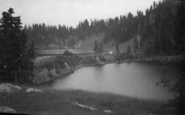
![Table M[oun]t[ain]](/uploads/r/null/9/3/f/93f45b7e77f91c47f5825d46db7a4f7a92ca8db083def523a6c7b348e94d30c5/1125e985-3495-40fc-81b4-81f89ec4fe25-CVA289-004_142.jpg)


![Phyllodoce empetriformis, Hurricane Ridge - Olympic Pen[insula]](/uploads/r/null/e/2/e2214854c50ece5526d274af6b748ec02f81df8f96d535fc5831ecd0e298f7ce/c231e151-61e8-4dfb-b2e4-4f15c426fce0-A57201_142.jpg)


![Paeonia suffruticosa [at] US Nat[ional] Arboretum](/uploads/r/null/3/6/3606ad94689fed4f1740c5d2c87ba8439a9e306af33a0c6504995c8199f0bcb9/fc80ad8b-5e31-4462-b96b-2eafc2bc0f2f-A57154_142.jpg)
![Our motor trip to Portland : Looking over [the edge of Inspiration Point]](/uploads/r/null/4/7/2/472bc3865ffb1ee0dd0d5f275b7b8c7196c2155c462f8b518d16213413d5034b/d10ad6d6-c193-41fc-b33b-ee77c0818e95-CVA289-002_142.jpg)
![Our motor trip to Portland : Inspiration Point, Chuckanut Hiway [Highway]](/uploads/r/null/4/e/9/4e99d9d9911ebc87de52381367854969f5d2e67c165a868611d27b0f05f6207d/ab1335f7-2108-4eec-882d-485cd4059503-CVA289-002_142.jpg)
![Our motor trip to Portland : Gwyn [Lewis] going-?](/uploads/r/null/8/3/b/83b79ca98cce8ab981f140f211393d57c9cd253d7d73733be3851a3532f3812b/67dc7352-e7d3-4333-a203-7e21500c0903-CVA289-002_142.jpg)
![Orthocarpus imbricatus : owl's clover [at] Hurricane Ridge](/uploads/r/null/2/3/23d6ad2373cdf9b28420acef1c262e781de9e62098aa8ac5edc6160421f07ce5/21890175-83db-46ce-83f3-bdc27c9a7246-A56773_142.jpg)
![Oroville, Wash[ington] from Anarchist M[oun]t[ain]](/uploads/r/null/c/6/c/c6cbb9de05dfd059413bfe53f740e3b92cbd2c230b73741ec481cea5e1e9694e/8de554c5-6470-4bc5-bb0a-675aef0b0760-CVA289-005_142.jpg)


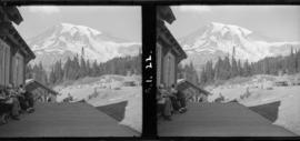
![Narada Falls [Mt. Rainier]](/uploads/r/null/b/7/a/b7a75a964b21a52015369b4b03528d136a704030a66c9ea4259be97bfcd557be/64fdb4a2-9802-4cdb-b36d-8b2c4febcea2-CVA260-2087_142.jpg)