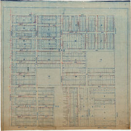
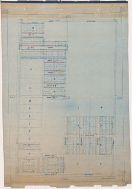
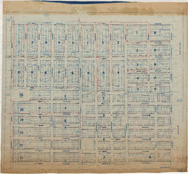
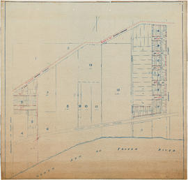
Water service map of South Vancouver
- COV-S371-: MAP 367
- Item
- 1912-[ca.1933]
Part of City of Vancouver fonds
Item is a sectional map showing water services, streets, district lots, house numbers, and size of lots in South Vancouver. Map was used by the Water Works Department and the Engineering Department until about 1945, and has been annotated to show changes in street names and address block numbers.











![Streets [23 of 139]](/uploads/r/null/3/6/36e1e0e1e630053e92b8b28eab950a7490978a0651816c5057792a769d083474/d3ac16e6-ca36-4f36-8462-bc28ad54e293-A64211_142.jpg)
![Streets [24 of 139]](/uploads/r/null/a/2/a20e8603a05b4c60f0a8ded650eaadd63457041b6e4732ebffce6b362e4db913/e2dea87c-5e13-4e43-8b3f-8d256f554cd4-A64212_142.jpg)
![Streets [25 of 139]](/uploads/r/null/6/2/628ad76bb0e9a48752a29dc0cf40be570b965017d3cea3fcaf6fad60361e5a20/848c840c-e0bd-4a15-beca-72392fc313b5-A64213_142.jpg)
![Streets [27 of 139]](/uploads/r/null/0/1/01be2ecc09f4e85b432d4870e5540be839b9abb3319eefcd8488e7d8462914bf/50f6dbcb-471b-4255-9657-0432f88dff1f-A64215_142.jpg)
![Streets [40 of 139]](/uploads/r/null/5/5/5576574ffb39ca1d5abdb64e8bfd7ade1ce649387c37131b6222f3d482c09fd5/725d2710-6ccb-4f7d-b44d-7732150f1fe9-A64228_142.jpg)
![Streets [87 of 139]](/uploads/r/null/2/e/2e9ee76e6daacd6d0b026366c7efcbaa0e4692e09a783a74df21b3d79a05de6e/aa226fb2-e574-4dfb-9f55-bd058120be65-A64276_142.jpg)
![Streets [98 of 139]](/uploads/r/null/7/b/7bab62a4962f2f060b1c937baa39e12d82288ba4eedea72276eb302e5b9cb33c/866279da-f815-402f-b17b-79497b0898af-A64329_142.jpg)
![Streets [99 of 139]](/uploads/r/null/2/e/2e709f5b8ec571dc922158d61c583609df11d655ead3de68378084389d0ee4f8/db495f74-f0e7-455b-9291-ff6e712c74c6-A64330_142.jpg)
![Streets [34 of 139]](/uploads/r/null/9/7/9706fc2b24a8486559211a059a9685c27e6e2417a6118d19bb2f1b9b4e100508/3c00c869-6cf2-45a5-88a1-714dfbfefac3-A64222_142.jpg)
![Streets [36 of 139]](/uploads/r/null/9/5/95112a41844b9f74a8b34c68cc0fe9ce6ec5541f97204e197cd9720cc5e47045/9d0aa579-2b86-45e2-8705-8c4814ab8b0b-A64224_142.jpg)
![Streets [75 of 139]](/uploads/r/null/6/3/639f10b22123d86274ec47d707c64acb8efb3e487379e8735419fa31b081a852/ea328414-4e69-4d62-9693-848a939e85c5-A64264_142.jpg)
![Streets [79 of 139]](/uploads/r/null/a/4/a4d4d55b4ed654a3227ee5c6b9444184de82d44bf9f16bef93c51dd282aa9b38/d9ff5d21-d256-40e3-97f7-b9bf1aa83c9f-A64268_142.jpg)
![Miscellaneous [2 of 130]](/uploads/r/null/a/e/ae37c9a0617fd33a21bc565ace186f35b93cc4afb9bd5a034cddcbad84f96de1/c28caa78-85cd-4d91-b085-f03c08c8c4bb-A64290_142.jpg)
![Miscellaneous [3 of 130]](/uploads/r/null/1/0/10cfe2996be605ef099c8b79297779128bb35a24ebd000177e44fc30ac5f88f1/0e983f50-5c26-4186-9ed9-c8758acb497b-A64291_142.jpg)
![Streets [96 of 139]](/uploads/r/null/e/9/e996879785819fff9eca1f553fe3c39124ac2cf05fa4901d3860620a20e797af/13a74699-ea2d-478f-b9ae-a194bdd78aa4-A64327_142.jpg)
![Miscellaneous [25 of 130]](/uploads/r/null/9/2/920494723cf29bad0c207f1bac5a68ad6bf7b962ec60e9a9eaa30bbb40976552/eda8bff7-d66d-4795-87bd-c33def564bfd-A64336_142.jpg)
![Miscellaneous [26 of 130]](/uploads/r/null/6/8/68e90e3463072c72e51f2015081f8e3d991e1ba72ec02dd5a58fe8085c74348f/fd2bfb14-612f-4bff-a548-22f90666cc38-A64337_142.jpg)
![Miscellaneous [30 of 130]](/uploads/r/null/7/a/7a38a2507ca731ea93c70c819ca9ff3b6635d0f8b3756aea3940526f59b56806/d7919d7d-6f5a-4b40-9c92-d99ea47a61b1-A64342_142.jpg)
![Miscellaneous [40 of 130]](/uploads/r/null/4/3/438493704a352a44cef81dc662db72b9477ac890e8779f3e876218103398b5ec/fb8900d7-a919-4c3b-8b2c-53f9831ecde9-A64366_142.jpg)
![Miscellaneous [45 of 130]](/uploads/r/null/6/c/6ce43982e239c2d85f5e2e391a936696b52df8f1aa4881ac67cd9c5646180a9f/795752a3-dfd7-490a-b933-9f465edf1efd-A64371_142.jpg)
![Miscellaneous [66 of 130]](/uploads/r/null/f/3/f3e5c735d932ae4b6cf5264ac1126704a320ba278c9197a1e374be368226338b/a99fc078-5f61-4e29-b051-d858f0963d35-A64400_142.jpg)
![Streets [111 of 139]](/uploads/r/null/7/f/7f3e94968ec381dac6958fbb9649eeda7f53f4ec23e06ba32e5df522b46e6b44/46714aec-e27e-4131-bf22-5e414eefbfef-A64402_142.jpg)
![Streets [115 of 139]](/uploads/r/null/0/5/05ad6fe1eb7e6bed52357bfd702be8866a3f02398891018bf5962c8b62f182e5/3e31ee39-9368-446a-9812-29096f77a28a-A64408_142.jpg)
![Streets [118 of 139]](/uploads/r/null/e/1/e17fe306535ef51abd9e9dadb827b2091cdb5b0db67b6d7194ec46ae7439eba4/4e95f1d6-aa99-42dd-a01b-c01d8a69d216-A64411_142.jpg)