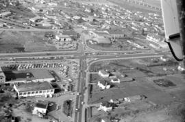
![[Aerial view of shopping centres]](/uploads/r/null/d/2/d21dcc14ced0356484b5666789f851fac68a175214b4718fae1444fec7417944/1f264270-6b68-43e6-be2e-f5b59df5d035-A71605_142.jpg)
[Aerial view of shopping centres]
![[Aerial view of Richmond Centre mall]](/uploads/r/null/2/e/2ee69f17353dd5eafd9d3c5d8d0ae7f95f74b5669c564c68a4c72ffafb9cda20/e0752fe7-4588-4c42-a25c-ef561bf4ed68-A71603_142.jpg)
[Aerial view of Richmond Centre mall]
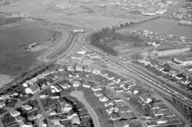
![[Aerial view of a shopping centre]](/uploads/r/null/1/5/156ef6b6f2bbd9391835c1b458d9e5fa7ba0e39f8fd2abeb2812e6ee46100008/a8e98ea8-442f-4d1a-acbf-ff2cc8319fa1-A71606_142.jpg)
[Aerial view of a shopping centre]
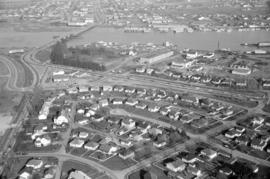
![[Aerial view of industrial area]](/uploads/r/null/5/d/5dd69372e15c5f349b4b4b8cdb7a12063cbbf02d158ab97d57ba863214b5c209/5f3baa69-a2f9-4adb-a590-4b420086d51d-A71604_142.jpg)
[Aerial view of industrial area]
![[Aerial view of shopping centres]](/uploads/r/null/1/0/10ff59da2ba368988732f96fd1cd6e8fa091b0be501fa556439f7a93e5f7da6e/ac882c6d-a7cb-45e1-94f7-e89b0f645a16-A71607_142.jpg)
[Aerial view of shopping centres]
![[Aerial view of Downtown Vancouver looking south from Burrard Inlet]](/uploads/r/null/3/2/32bc12be65a895f144d669768ee019e6abc83bc4018b11b3ecf96930fbd98786/024e645a-ce5d-4e73-a4e1-efb2ad9b7995-A71518_142.jpg)
[Aerial view of Downtown Vancouver looking south from Burrard Inlet]
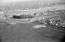
![[Aerial view of rail yard and industrial area]](/uploads/r/null/9/f/9f92989deb2b54597c6743bd67717653fc644c23b6fc48e55d2e1b9dbf6e8489/763b5a38-9eae-4b16-bedc-45ca5c32d888-A71602_142.jpg)
[Aerial view of rail yard and industrial area]
![[Aerial view of Vancouver]](/uploads/r/null/9/b/9b3acec26123edc53f11bf2f41f3286d09254ffea9918cd31b6715395ebe18d0/26473909-fe49-4474-8c3f-05eb1e8ab059-CVA1376-252_142.jpg)
[Aerial view of Vancouver]
Summer 1982 - Aerial shot from the south side of False Creek before Expo
Summer 1982 - Aerial shot from the south side of False Creek before Expo
Aerial shot from over Stanley Park
Aerial shot from over Stanley Park
Aerial shot of the West End from over English Bay with Denman Street meeting Beach Avenue near the Old Boat House
Aerial shot of the West End from over English Bay with Denman Street meeting Beach Avenue near the Old Boat House
![[Aerial view looking northwest towards the Downtown waterfront]](/uploads/r/null/c/c/cc62f979c7614b3405e2bfbfcd8cf6172232e958fc2dcd17a970dbbf3d28b4d8/4699d55d-d238-4161-854b-fa983bd7d738-A71613_142.jpg)
[Aerial view looking northwest towards the Downtown waterfront]
![[Aerial view looking west over Burnaby towards Vancouver]](/uploads/r/null/3/e/3ee0bad707202c9fbcaad91d585345ec93cbe9ec0be93643a8c82dd4f323bdde/1d10f88f-abea-4b79-b07a-e27dfe5d6cd0-A71608_142.jpg)
[Aerial view looking west over Burnaby towards Vancouver]
![[Aerial view over Burnaby]](/uploads/r/null/3/3/331b6e68239af4202f445b5284f51f9a4cb22c20b12ed83ca8ea7f7333df1d07/025da952-0a47-40b0-8988-6a3f80af1576-A71612_142.jpg)
[Aerial view over Burnaby]
![[Aerial view looking west over Burnaby towards Vancouver]](/uploads/r/null/a/1/a1972aaa0fedf64a8da64c0a3f99647764ec26034813d610dc060d54afdfe1bf/0b1d7503-6b52-44de-a829-67274f54d77c-A71609_142.jpg)
[Aerial view looking west over Burnaby towards Vancouver]
![[Aerial view over Burnaby]](/uploads/r/null/0/0/000c0196f6c810d76eb723bd8a3264ee3e43b53d6e32e7ad08a8e01e6712e7d7/75a245f8-8a3d-404d-bc50-219fadd7d908-A71611_142.jpg)
[Aerial view over Burnaby]
![[Aerial view looking over the Downtown waterfront]](/uploads/r/null/1/6/1644eebceda09466c9aac6a8534ea82b04164ab39d5d756ec4cc902d5ba16e30/d4c9f855-498d-4971-a368-0f672d3a89a4-A71614_142.jpg)
[Aerial view looking over the Downtown waterfront]
![[Aerial view over Burnaby]](/uploads/r/null/0/3/037ecb1cc7577fad52b33cbaec0eaf096ffaba433660c44f741e17d03dfdfabd/2b0ca722-06fa-4545-9dc1-41843e30b8ec-A71610_142.jpg)
[Aerial view over Burnaby]

Aerial view of Vancouver and environs showing North Shore, Burrard Inlet, Vancouver and the Fraser River estuary and east.
Aerial view of Pacific Terminal showing grain elevators and shipping containers in Vancouver Harbour
Aerial view of Pacific Terminal showing grain elevators and shipping containers in Vancouver Harbour
Aerial view of Pacific Terminal showing grain elevators and shipping containers in Vancouver Harbour
Aerial view of Pacific Terminal showing grain elevators and shipping containers in Vancouver Harbour
Aerial of Vancouver, B.C.
Aerial of Vancouver, B.C.
Aerial of Vancouver, B.C. [over False Creek]
Aerial of Vancouver, B.C. [over False Creek]
Tom Wong Collection
Tom Wong Collection

Air Canada Viscount airplane and Y5 ramp on tarmac
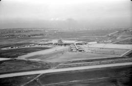
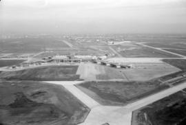
Aerial view of airport terminal, runways and approaches to Sea Island
Aerial view of Fraser River
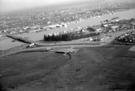
Aerial view of Fraser River
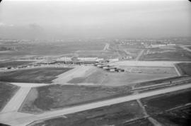
Aerial view of airport terminal, runways and approaches to Sea Island

Aerial view of airport terminal, runways and approaches to Sea Island

Aerial view of airport terminal, runways and approaches to Sea Island
Aerial view of airport terminal, runways and approaches to Sea Island

Aerial view of Fraser River
Aerial view of Fraser River
![[R.C.A.F. Maritime Air Command plane No. 102 flying over English Bay]](/uploads/r/null/1/3/13b6c7a118ed10801cfbe633df28806771f06f62a484edbf5de83c5acd20e0a4/ff8af309-b1af-4c30-9216-ba8a2859660d-A71302_142.jpg)
[R.C.A.F. Maritime Air Command plane No. 102 flying over English Bay]

Aerial view of Vancouver airport, aircrafts at terminal

Aerial view of airport terminal, runways and approaches to Sea Island

Aerial view of airport terminal, runways and approaches to Sea Island
Aerial view of Fraser River

Aerial view of Fraser River
Aerial view of airport terminal, runways and approaches to Sea Island

Aerial view of airport terminal, runways and approaches to Sea Island
Aerial view of airport terminal, runways and approaches to Sea Island

Aerial view of Fraser River

Aerial view of Vancouver airport, Sea Island
![[Aerial view of fire at Vancouver sawmill]](/uploads/r/null/2/6/261c182ef20aa4aa00d0b46917096bf17c339730ec5975e81a6c1fbc2b63158f/05be5137-bdbf-42ad-a142-3e73d5538015-A71287_142.jpg)
[Aerial view of fire at Vancouver sawmill]

Aerial photo, vertical, Deadman's Island, Coal Harbour and surrounding area

Aerial photo, oblique, 41st Ave. and Oak St., Vancouver

North Arm of Fraser River

University of British Columbia and Norman Mackenzie House