Add to clipboard
City of Vancouver, British Columbia
Add to clipboard
City of Vancouver, British Columbia
Add to clipboard
City of Vancouver, British Columbia : co-ordinate street index map 12
Add to clipboard
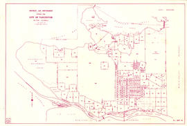
City of Vancouver, British Columbia : zoning diagram
Add to clipboard
City of Vancouver, British Columbia [index map]
City of Vancouver, British Columbia [sectional map]
Add to clipboard
City of Vancouver, British Columbia [sectional map]
Add to clipboard
City of Vancouver, Canadian Pacific Town Site
City of Vancouver, Vancouver, British Columbia : sectional maps
Add to clipboard
City of Vancouver, Vancouver, British Columbia : sectional maps
City of Vancouver, Vancouver, British Columbia : sectional maps
Add to clipboard
City of Vancouver, Vancouver, British Columbia : sectional maps
City of Vancouver, Vancouver, British Columbia : sectional maps (printed 1970)
Add to clipboard
City of Vancouver, Vancouver, British Columbia : sectional maps (printed 1970)
Cityscape: A map of downtown Vancouver
Add to clipboard
Cityscape: A map of downtown Vancouver
Commercial Map of Greater Vancouver and District [BC]
Add to clipboard
Commercial Map of Greater Vancouver and District [BC]
Add to clipboard
Composite aerial mosaic of metropolitan Vancouver
Composite industrial map of the metropolitan area, Lower Mainland, British Columbia
Add to clipboard
Composite industrial map of the metropolitan area, Lower Mainland, British Columbia
Corporation of Point Grey : topographical plan of ABCDE D.L. 317 and HIJK D.L. 318 : Marine Drive & Vancouver & Lulu Railway to Fraser River between Angus St. [Drive] & Milton St
Add to clipboard
Corporation of Point Grey : topographical plan of ABCDE D.L. 317 and HIJK D.L. 318 : Marine Drive & Vancouver & Lulu Railway to Fraser River between Angus St. [Drive] & Milton St
Devonshire Block 41
Add to clipboard
Devonshire Block 41
Add to clipboard
Dial map of Greater Vancouver
Add to clipboard
Dial map of Greater Vancouver and suburbs
Add to clipboard
Dial map of Greater Vancouver and suburbs
Add to clipboard
Dial map of Greater Vancouver and suburbs
Dial map of the city of Vancouver including the adjacent municipalities
Add to clipboard
Dial map of the city of Vancouver including the adjacent municipalities
Add to clipboard
District lot boundaries with the City of Vancouver, British Columbia
Add to clipboard
District lot boundaries with the City of Vancouver, British Columbia, D.L. map 40
Add to clipboard
District lot index and street index (1st Avenue to Campbell Avenue)
Add to clipboard
D.L. 301 - Ward 8 [location of water pipes and hydrants]
D.L. 301 - Ward 8 [water pipes and hydrants]
Add to clipboard
D.L. 301 - Ward 8 [water pipes and hydrants]
Downtown Peninsula; Vancouver, B.C. Canada; Lines at 100 Foot Intervals; Datum Line 100
Add to clipboard
Downtown Peninsula; Vancouver, B.C. Canada; Lines at 100 Foot Intervals; Datum Line 100
Add to clipboard
East Vancouver Heights
Existing service stations, retail shopping centres and commercial zoning
Add to clipboard
Existing service stations, retail shopping centres and commercial zoning
Fairview
Add to clipboard
Fairview
Add to clipboard
False Creek Basin
Free map of Vancouver, New Westminster and surroundings
Add to clipboard
Free map of Vancouver, New Westminster and surroundings
Add to clipboard
Free map of Vancouver, New Westminster and surroundings
Add to clipboard
General development plan, Exhibition Park, Vancouver, B.C.
Goad's Atlas of Vancouver Vol. 1
Add to clipboard
Goad's Atlas of Vancouver Vol. 1
Granville Street
Add to clipboard
Granville Street
Greater Vancouver road map
Add to clipboard
Greater Vancouver road map
Greater Vancouver target area. Civil defence survival instructions
Add to clipboard
Greater Vancouver target area. Civil defence survival instructions
Add to clipboard
Greater Vancouver votes October 17th : know your ward - know your poll
Greater Vancouver votes October 17th : know your ward - know your poll
Add to clipboard
Greater Vancouver votes October 17th : know your ward - know your poll
Greater Vancouver votes October 17th : know your ward - know your poll
Add to clipboard
Greater Vancouver votes October 17th : know your ward - know your poll
Add to clipboard
Greater Vancouver votes October 17th : know your ward - know your poll
Ground Services Plan. Kitsilano Site
Add to clipboard
Ground Services Plan. Kitsilano Site
Guide map. Vancouver-New Westminster. Burnaby and North Shore municipalities
Add to clipboard
Guide map. Vancouver-New Westminster. Burnaby and North Shore municipalities
Guide to Vancouver
Add to clipboard
Guide to Vancouver
Harbour Green Neighborhood; Hastings Street Elevation North
Add to clipboard
Harbour Green Neighborhood; Hastings Street Elevation North
Add to clipboard
Hotels
Add to clipboard
Index plan of provincial government lands to be sold at auction at Vancouver B.C. November 20, 1906
Add to clipboard
Index to 400 ft. scale section maps, City of Vancouver, British Columbia
Add to clipboard
Index to 400 ft. scale section maps, City of Vancouver, British Columbia, index map 40


![City of Vancouver, British Columbia [index map]](/uploads/r/null/d/4/d4fc7ef393680c6515927aa960de863e6fd9e846c3fac12499691549673dc4b7/eed36b0b-2e63-48f2-a7ee-02ed3de937b9-MAP682_142.jpg)


![D.L. 301 - Ward 8 [location of water pipes and hydrants]](/uploads/r/null/7/b/7b8914ef9132a2e20fa03008daf1a70f3de861b767043aaf338abaeeb42423d7/ce1965c6-6a58-454c-9630-0fcba30688bf-MAP72_142.jpg)


