
- AM427-S4-F4-: CVA 289-004.103
- Item
- 1927
Part of William Orson Banfield fonds
Part of William Orson Banfield fonds
Rough grading of driveway through Stanley Park finished. Pathway banks have been seeded with grass
Part of Major Matthews collection

Roof top view of Vancouver from Georgia and Burrard Street
Photograph is a reproduction of a black and white print that has been hand coloured and shows the Georgia Hotel and Christ Church Cathedral.
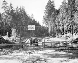
![Rogers Pass [Highway]](/uploads/r/null/7/a/7a8bab558d799cc829194f8468b37b41b1561d92c702daf18635f2c151b1a09e/cd827869-375f-4da9-8848-f70fb9435790-A25532_142.jpg)
Part of Major Matthews collection

Part of Major Matthews collection
![[Road to steamship dock]](/uploads/r/null/0/4/04632f42956eea4cfaa0e3149d4d7457504e7b31d58eeb2919b8a1700478f11a/0a690293-0899-4550-bbc4-20ef5121ea5e-A76278_142.jpg)
Part of James Crookall fonds

Part of James Crookall fonds
![[Road to Prospect Point]](/uploads/r/null/d/a/a/daa0831efd4a4753b9f3608038f2ab4dc73bce7b0618fa9795893157ef6d3587/e63a9e74-d52e-4788-87fa-473f69f68b26-CVA260-144_142.jpg)
Part of James Crookall fonds
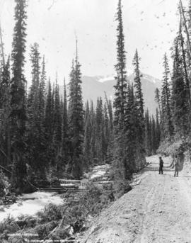
Part of Major Matthews collection
Photograph shows two men on a dirt road beside a roiling stream
![[Road through Stanley Park]](/uploads/r/null/4/e/4ed20a4b9aa83332c66373b7b26e260f348323996cc651a552e8a75612d67c6b/3d6cc97a-f594-4d67-b48f-12c4fc3cfbf3-A09653_142.jpg)
Part of Major Matthews collection
![[Road through Stanley Park]](/uploads/r/null/c/5/c5cc5cce0beff22843029245c3bbb357474727607f60a34536ee878388b6b578/109ab64c-8b9b-4218-8ff9-d08ec6f7feb8-A09675_142.jpg)
Part of Major Matthews collection
Photograph shows a split in the road around a large tree. A sign on the tree directs traffic to "Keep to the left".
![[Road through Stanley Park]](/uploads/r/null/2/b/2bf63f78ee7e8f65d5fd6d82cf3e6f597034a44a831f7a708d4c1cea55004b09/9b88704b-7c71-4e4d-bfcb-dbce0b164ca2-A01900_142.jpg)
Photograph shows a dirt road, diverging at two large trees. Photograph also shows individuals on a walking path next to the road.
![[Road through Stanley Park]](/uploads/r/null/8/3/832c013d4d0e3fb97a0bf5f8a3a311f1651b3f2dec207708cbf9ad5c16276581/c5e4f758-c04e-43ac-b7fd-b266e2b4e017-A02573_142.jpg)
![[Road through Stanley Park]](/uploads/r/null/b/6/b6d78b72fb5195f26e1f9ffaf3b56d5127bd82fc20d81395d29499f8a117f02e/1e726f00-aaa5-437f-b8c4-c17c76df821f-A02571_142.jpg)
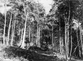
![[Road through forest on Bowen Island]](/uploads/r/null/4/4/446ddb4687d3b2ee1aa96f8eb795ca22c3c8a8c828d3749240ee0801c4e27474/09b4dc2c-1c2e-4900-a4a2-2c9befcd36e0-A04618_142.jpg)
[Road through forest on Bowen Island]
Part of Major Matthews collection
J.S. Matthews' notes with print or negative in Archives.
![[Road through forest on Bowen Island]](/uploads/r/null/b/6/b6b5c5af20de889886d3d0db0e835de8ba345a4b2511318377d82742026fe3ec/ee6094be-bb1b-4319-aaf1-45a65f41d7f8-A04617_142.jpg)
[Road through forest on Bowen Island]
Part of Major Matthews collection
J.S. Matthews' notes with print or negative in Archives.
![[Road through forest on Bowen Island]](/uploads/r/null/7/0/70def0c98cc2e1d1ab537b1410505e807b5318ad0679a79b85842b2ca5eebbfe/4a43a587-8575-4ada-9fbf-e4f6749e6696-A04620_142.jpg)
[Road through forest on Bowen Island]
Part of Major Matthews collection
J.S. Matthews' notes with print or negative in Archives.


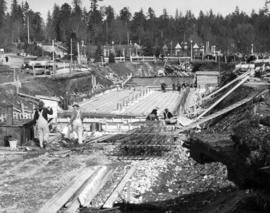
Part of City of Vancouver Archives technical and cartographic drawing collection
![[Road leading to steam ship dock]](/uploads/r/null/c/8/9/c8951ec1931420889cd9073726783c1966939a255fcfe8cfc73c1d83bdb9eed6/f1a0b6f9-53b6-4f99-8e9c-9d21e11bfb80-CVA260-1105_142.jpg)
[Road leading to steam ship dock]
Part of James Crookall fonds
Road Leading to Dockyard - Esquimalt
Part of Major Matthews collection
Photograph shows the telegraph office, church and other buildings.
![[Road into Stanley Park, covered in snow]](/uploads/r/null/1/0/10cad8d9ec5eeece7b42b9d0b61296a35a18b91781fd9b796627b129d772d0d6/a55591bc-0658-4a75-93db-8828a0c53f71-A02310_142.jpg)
[Road into Stanley Park, covered in snow]
Photograph shows road, trees, and Vancouver Yacht Club building.
![[Road in Stanley Park near Brockton Point]](/uploads/r/null/b/8/b8aa1a0c165756c09f317fff3916a8de1c5a7036f11387056b17247f83a4983b/d7d67379-3251-4974-9daa-e9ffde35d2b7-A04022_142.jpg)
[Road in Stanley Park near Brockton Point]
Part of Major Matthews collection
Road between Mud Lake and P'tlasko (Nach-nach-out)
Part of John Davidson fonds
![[Road around tree in Stanley Park]](/uploads/r/null/e/9/e911742df94cea352931ab210f9140a4c286aa8243edd44307207e41b9d86cc5/73898296-4d34-4f7b-b8e3-1608a8cb832b-A04420_142.jpg)
[Road around tree in Stanley Park]
Part of Major Matthews collection
J.S. Matthews' notes with print or negative in Archives.
![[Road around mountain to Coquitlam Dam]](/uploads/r/null/0/9/09fe6eac46ebe49a22a0117d512c5bed232d0b2365dbbbc0dcf45759713f7413/2683899b-906e-41ae-acaa-9b2ad2e45ad5-A08413_142.jpg)
[Road around mountain to Coquitlam Dam]
Part of Major Matthews collection
![[Road and buildings beside] waterfront at Pacific Mills [on the] Queen Charlotte Islands](/uploads/r/null/b/9/b991cfa0013c25630230f938b9a1bf0922b20fa9d8ee1b7c38058d9622d13966/aba7dd2c-ff59-4945-acc6-f878b63fdf12-A14919_142.jpg)
[Road and buildings beside] waterfront at Pacific Mills [on the] Queen Charlotte Islands
![[Road above Thomson River in dry belt]](/uploads/r/null/9/1/91d51e585cd7835e4b3165376229d3edd371dd76a867e1a2181b6e5c5c6dabff/539accef-a385-4571-8d57-2ddb1f6361c6-A50143_142.jpg)
[Road above Thomson River in dry belt]
Part of John Davidson fonds
Photograph shows a horse-drawn wagon
![[Road above Thomson River in dry belt]](/uploads/r/null/1/4/14e74af5f571cee82c4f6998290fa380303cededd926220b50a1f77b0505b352/9a9054fc-15c2-4266-a5e8-d646fd2735f2-A50797_142.jpg)
[Road above Thomson River in dry belt]
Part of John Davidson fonds

Part of James Crookall fonds
![[River Road (Marine Drive) near McCleery's farm]](/uploads/r/null/8/b/8b3a8aaf0ff18b9da5738fbf3fe10b9c3577cc80079f52d76d583fde6a574200/934e6cc5-a29b-48bb-ab45-36c88e40e9ec-A37101_142.jpg)
[River Road (Marine Drive) near McCleery's farm]
Part of Major Matthews collection
![[River Road (Marine Drive) near McCleery's farm]](/uploads/r/null/f/e/fe71cd33c573d0d5c54086ee4dea5f848be7817ef7759410586d7afcc76838c9/fd07b1a3-6056-4a32-9039-1e71b1e1dbd0-A37100_142.jpg)
[River Road (Marine Drive) near McCleery's farm]
Part of Major Matthews collection
![[River Road (Marine Drive) looking east from Shaughnessy Street]](/uploads/r/null/1/2/122fc6e851d1ffed042982cc7e853a2265c7d1ccf0e4697faf06f4322ce3a02e/6a26912b-93d5-46ac-aade-1f39f3700a60-A37141_142.jpg)
[River Road (Marine Drive) looking east from Shaughnessy Street]
Part of Major Matthews collection
![[Repairing the road after the Seymour Creek washout]](/uploads/r/null/8/2/8233c5b9dc175116957eb424fa00a10f30aaf44bc9042bb1c636671f77e279fd/e9498fdf-4d04-45cc-b311-334d84b07a57-A33584_142.jpg)
[Repairing the road after the Seymour Creek washout]
Part of Major Matthews collection

Part of William Orson Banfield fonds
![[Railroad tracks crossing main street in Slocan]](/uploads/r/null/f/f/a/ffa8f852553be9fc315e093d97258be52132cbab780dd062acd9e751d2c0ddcf/14e1d14c-c1d7-425d-a157-b522233a170d-CVA260-1394_142.jpg)
[Railroad tracks crossing main street in Slocan]
Part of James Crookall fonds
Photograph shows part of the Arlington Hotel

Quercus specimen, avenue of live oaks, South Carolina landscape historical
![Prototype LRT Vehicle [6 of 11]](/uploads/r/null/e/5/e5da0ddae1fad1caadf18330ac19f7478940a7c9e8f89c4fdbea28a1a56b897b/5b0d7e41-1854-4c35-b08b-861e70c7f5cf-A64314_142.jpg)
Prototype LRT Vehicle [6 of 11]
Part of City of Vancouver fonds

Prospect Point, Stanley Park, Vancouver, B.C.
Part of Major Matthews collection
Photograph shows a woman standing near a flagpole next to a dirt road, looking out towards Burrard Inlet. J.S. Matthews' notes with print or negative in Archives.

Proposed route of Grouse Mountain Highway
Part of City of Vancouver Archives technical and cartographic drawing collection
Item is a map which shows a proposed route of Grouse Mountain Highway, including parcels of land through which it would pass. Shading indicates land owned by Hawkins & Horie. Burrard Inlet, Capilano Creek, Mosquito Creek, Lynn Creek, and Seymour Creek are also depicted.
Hawkins & Horie, Engineers & Surveyors
Part of Major Matthews collection
Photograph shows the Royal Vancouver Yacht Club in the background

Preliminary plan of road and bulkhead for proposed diversion of airport road
Part of City of Vancouver Archives technical and cartographic drawing collection
Item is an architectural site plan of a proposed road design. The plan includes a cross-section of the proposed roadway and partial plan, as well as an elevation and end view of a fence.
Underhill and Underhill Engineers and Surveyors (Vancouver, B.C.)
![[Power poles along dirt road]](/uploads/r/null/3/f/3f4448f4f1664c7a45a9f772a26e8dd98c31a7deb74b6d0baf2e4d6b5b74efce/0fd5cf5d-f7dd-4097-a8cf-e3e025a10241-A04748_142.jpg)
Part of Major Matthews collection
![[Power poles along dirt road]](/uploads/r/null/5/e/5e668bbe5e21a9965ca8dae0484194cae7548e6a284e14ca8a28ac29d8f6155c/88dff179-da71-4b23-9862-2d5cd9495a40-A04751_142.jpg)
Part of Major Matthews collection

Part of Major Matthews collection
Photograph shows a gravel road and a bridge over Bon Accord Creek

Part of Major Matthews collection
![Plank road [to Canadian Northern Railway] Vancouver freight shed](/uploads/r/null/0/2/02f4c264bbf89ac8d6e2039d74ad3132b07a6a9aecb1a6d67e0d1da0669b3187/a5204c8c-618c-41f8-8fc9-ba1ebfd22686-A09086_142.jpg)
Plank road [to Canadian Northern Railway] Vancouver freight shed
Part of Major Matthews collection
Photograph shows two men walking on plank road by freight shed.
![[Plank road to Canadian Northern Railway freight shed]](/uploads/r/null/f/5/f5f67d6d3ef0fd4d1d1ad4f76f3200eae8708a53d4168e9ae646d94942055668/6fa0e1d6-7b07-4106-9166-296407183c05-A09093_142.jpg)
[Plank road to Canadian Northern Railway freight shed]
Part of Major Matthews collection
![[Plank road and flume] between Sugdens and George Streets, Lynn Valley](/uploads/r/null/d/f/df03f489a5119820bf2f7e50e409932a1c4ac87aa7207a37ea12f291989561eb/698eb6d2-5a3b-4449-bdd9-6dda4b06b81a-A02705_142.jpg)
[Plank road and flume] between Sugdens and George Streets, Lynn Valley
Photograph shows road, flume, and tree stumps.
![Plan to accompany by-law no. [Blank] being a by-law to amend by-law no. 4054 being the street nam...](/uploads/r/null/3/a/d/3ad2e1a740be487ac9cdd1a7e10ac6cbe15cda433b0937bde9a0837696e4148a/802101ef-808b-4353-a5fe-3100da56eeb7-MAP71c_142.jpg)
Part of City of Vancouver Archives technical and cartographic drawing collection
Item is a copy of map which depicts the area bounded by East Boulevard, Nanton Avenue, Arbutus Street and 33rd Avenue.