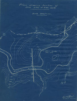
Plan showing locations of dam sites at Green Lake
- COV-S346-F01-: MAP 1143
- Item
- [1923?]
Part of City of Vancouver fonds
Plan showing locations of dam sites at Green Lake
Part of City of Vancouver fonds
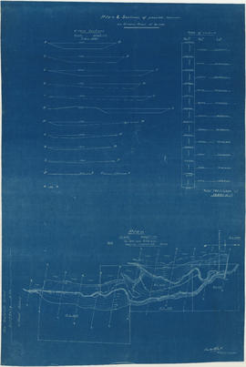
Plan & sections of possible reservoir on Green River
Part of City of Vancouver fonds
Item is a map sheet that depicts a portion of the Green River with a proposed dam site. Twelve cross-sections of the resultant reservoir are depicted, with estimated total cubit feet of water for each in an accompanying table.
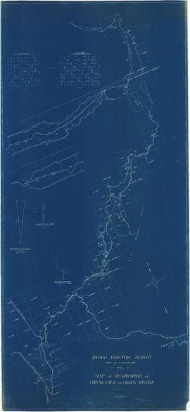
Map of headwaters of Cheakamus and Green rivers
Part of City of Vancouver fonds
Item is a map sheet showing the results of the hydroelectric surveys of the upper Cheakamus River, Green Lake and Green River. The sheet includes 3 cross sections of the Cheakamus River.
![Longitudinal section along [centre line] of dam sites at north end of Green Lake](/uploads/r/null/7/4/a/74af74789da62d7da66c012dd18dd964e4e83151ac5f0b139a53843bce6ccfe6/974ff05f-0f29-4e65-b818-c663b1a236e1-MAP1142_142.jpg)
Longitudinal section along [centre line] of dam sites at north end of Green Lake
Part of City of Vancouver fonds
Item is a sheet depicting 2 profiles: one of dam no. 1 at railway crossing at 2247+763 and one of dam no. 2 at the head of the Green River (Green Lake).