
North America. West Coast. Fraser River and Burrard Inlet
- AM1594-: MAP 49
- Item
- 1860-1923
Part of City of Vancouver Archives technical and cartographic drawing collection
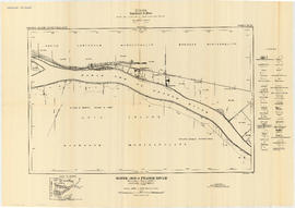
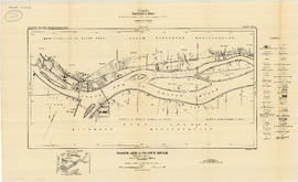
Item is a nautical chart which show details of area surveyed from Pitt Lake in the north to Roberts Bank in the south and from (what is now) Harrison Hot Springs in the east to Bowen Island in the west. The chart shows soundings in Burrard Inlet, and along the Fraser River.


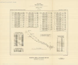


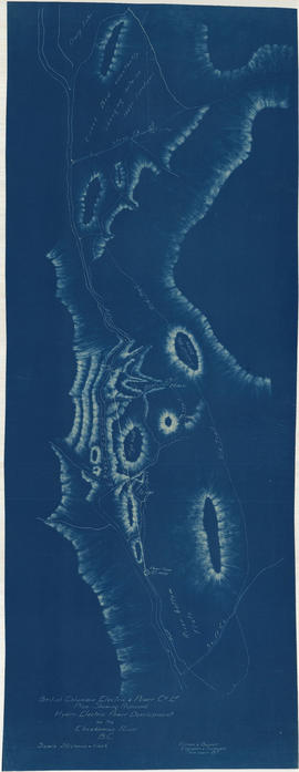


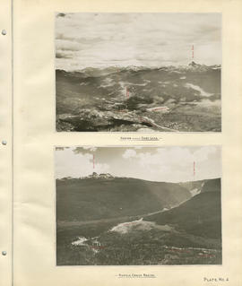
![Profile of Lillooet River between Lillooet & Tenasse [Tenas] Lake](/uploads/r/null/7/b/8/7b86c7530348c631fba136d04e4b31b414065b7e3f90c8000f45b0b3cc1242c8/bfb1c164-5e71-45ae-add4-e17ffd8c8272-MAP1140_142.jpg)


![Sheet 10A [Sydney Street to 22nd Avenue to Knight Street to 28th Avenue]](/uploads/r/null/6/8/a/68a5ee3c33e4a16ab15608383f6f4c59030ccb98434d74a4b9841d8baeb01a4f/797e1ea9-b769-4c53-a498-ddc837d8d6b0-LEG1153_142.jpg)
![Sheet 10B [Slocan Street to 23rd Avenue to Sidney Street to 29th Avenue]](/uploads/r/null/7/a/6/7a643182fb12f452f594aa241aacdb21982fb1e70249d145f3f8edff509857db/bec9da93-10c1-43a2-98ad-4a46771fceb9-LEG1153_142.jpg)
![Sheet 10C [Gladstone Srteet to 29th Avenue to Knight Street to 37th Avenue]](/uploads/r/null/e/e/6/ee677093b334dfa6504db28523f8861a78222a2259d95572fe2ef5131318e857/8a482765-fdbe-4162-9d22-e5bd1c6e3ff2-LEG1153_142.jpg)
![Sheet 10D [Chambers Street to 29th Avenue to Gladstone Street to 37th Avenue]](/uploads/r/null/d/d/7/dd7db9c8c09a85f2d91d18832f6ed2cfe09f88d6850111e170876ccfaec70043/9668563c-4058-4346-ae11-a99c8a48a605-LEG1153_142.jpg)
![Sheet 11A [Victoria Drive to 37th Avenue to Knight Street to 45th Avenue]](/uploads/r/null/6/e/a/6ead9db0025ca23bfc2bcb8dcd095d7cd06a2e60497eb4f6de3c4729d163bf79/b80628c0-b5ff-4789-80b8-4077ef9b593b-LEG1153_142.jpg)
![Sheet 11B [Wales Street to 37th Avenue to Victoria Drive to 45th Street]](/uploads/r/null/1/0/e/10e216d966349146e6c8bcd323ab9c23bd8d76a41fb67e813dc85c3b45d02a85/67f3269b-d839-420f-a865-7504f4573fae-LEG1153_142.jpg)