
Northerly portion Vancouver Island
- AM75-F26-: LEG1374.08
- Item
- 1948
Item is a map of northern Vancouver Island and the adjacent British Columbia coast showing Crown and reserve lands, timber leases, district, park, and provincial forest boundaries, cities, municipalities, villages, post offices, hospitals, roads, railways, seaplane ports and anchorages, airports, elevations of some geographical features, and marine distances in nautical miles.
![Olive arguing with Myrtle [Kilpatrick]](/uploads/r/null/f/b/5/fb5e43c6c9885b6013666776c041dbf07f6ecc2cc842ad061a6171a76617d2e2/242a8de0-b973-450f-b843-3390a5d5d031-CVA289-003_142.jpg)
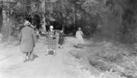
![[Olive Kilpatrick, Myrtle Kilpatrick and Olive Sadler] ready to start for Parksville](/uploads/r/null/8/4/e/84e5b76d02e75b8bf5aeb46b564dd3787ba2e3514d77cc54d275b5cba4575b50/bf7277c0-163e-486f-9ab0-524d2d6f6f1f-CVA289-003_142.jpg)
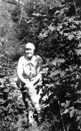

![Olive [Sadler] triumphant, Myrtle [Kilpatrick] recumbent](/uploads/r/null/3/c/d/3cdd092c58003b9f1564602cb27b75a6b6d9d5329ce8d2579ba5ae570dbfbbef/0ca04af8-9f49-47bf-b9ec-aafb07d8ec09-CVA289-003_142.jpg)


![Scenics Victoria : C.M.A. trip to Island [Goodyear blimp]](/uploads/r/null/5/3/b/53bf1eb9786f4b64e5d25fc25a00f2d76307fddb8f4d187058f2e5d680a3cb9c/aa877184-9cf1-4379-946b-4408afe10f0b-CVA586-15148_142.jpg)
![Scenics Victoria : C.M.A. trip to Island [Hotel Strathcona]](/uploads/r/null/6/9/c/69ca0ac57104efeb7d5d5afce6373c4f6c41f362f2708df9d7eba84bfdfc7a71/c090cee7-e8b5-42bb-b7b7-d51433723d26-CVA586-15144_142.jpg)
![Scenics Victoria : C.M.A. trip to Island [The Chalet]](/uploads/r/null/3/f/2/3f22f4a0f67d77255b07cb4606e58424c8ab739bfa5041b2f13491f3bc3cddd1/1f95d7fd-d78f-4bb3-8f6c-14e88917fd9c-CVA586-15147_142.jpg)


![[View of] Little Qualicum Falls](/uploads/r/null/8/9/8923e2a2e8b20b1d3f1ee14f346adef7beac44890a81e0397e832b764c0d85ee/b668948b-23f2-4c30-bb79-b13735ec9955-A72040_142.jpg)
![[View of] Little Qualicum Falls](/uploads/r/null/4/4/444ce78ed582a5760d5e6672b65530e5e3b12f77ceabe62c2c58b992d206088c/f5dbd7cb-1ace-4bcf-ae6a-3812087bb189-A72038_142.jpg)
![[View of] Little Qualicum Falls](/uploads/r/null/4/0/4063dff1ad52452b8c6450e735ed8a45e6dc84f3e366ea55b5d6e5d54e9e973a/c4b3a4b5-7cfc-43d1-a4ef-fa382dad3929-A72039_142.jpg)

![West Coast trip [with Sherwood Lett, Arthur Lord, W.O. Banfield] : Art [Lord] fishing in Trout River](/uploads/r/null/c/c/a/ccab4317f563529cebd8372c99467266b9bf5a80a0101d414ced94d21c286ae4/0798ff25-1601-4f04-8cf7-0fe8a7108d64-CVA289-003_142.jpg)
![West Coast trip [with Sherwood Lett, Arthur Lord, W.O. Banfield] : Brailing fish](/uploads/r/null/c/8/a/c8a0408a587b5f8aba7c66deeb0c6812ed37a0e32832894c9d8ecdb0ce7c31b0/00539abd-8467-4d4d-ab2f-37d8ec0cfc74-CVA289-003_142.jpg)
![West Coast trip [with Sherwood Lett, Arthur Lord, W.O. Banfield] : Dumping the silver horde](/uploads/r/null/0/f/3/0f3e3d90e7bf32b7472b25ce46f3c6c63f78c68e71905c29a86a31077f37a9e4/d90c43e7-7e1e-4992-950b-3aead4760594-CVA289-003_142.jpg)