
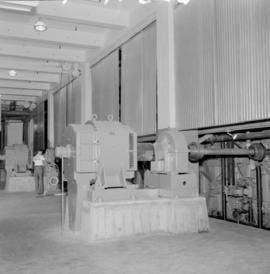
Elk Falls plant : ground wood motors
- AM1545-S3-: CVA 586-15362
- Item
- 1952
220 results directly related Exclude narrower terms
Elk Falls plant : ground wood motors


Elk Falls plant interiors : roll grinder

Elk Falls plant interiors : roll grinder
Elk Falls plant interiors : roll grinder

Elk Falls plant interiors : roll grinder


English Church, Courtenay, B.C.

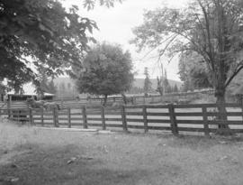
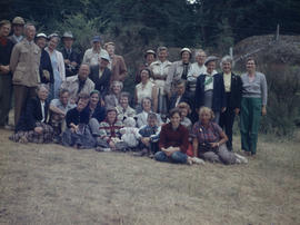
Fairbridge Farm, Vancouver Island : farm scenes
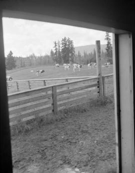
Fairbridge Farm, Vancouver Island : farm scenes

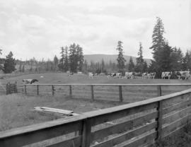
Fairbridge Farm, Vancouver Island : farm scenes

Fairbridge Farm, Vancouver Island : farm scenes
Fairbridge Farm, Vancouver Island : farm scenes
Fairbridge Farm, Vancouver Island : farm scenes


![Going to [Mitlenatch Island]](/uploads/r/null/f/e/d/fed3a763e66009cfb8891b4f95035241216736342d267a32fea3f87c7f72d946/5f3248d6-b738-4c1d-b7f9-51b3a58bd94e-2005-040_142.jpg)


Group on rocky point at Grouse Nest
![Group on V. Is. [Vancouver Island] at Nanoose](/uploads/r/null/8/d/6/8d62aa8abb26e5649d3ff49903d0fda750ad864238bf0e4dc1d28ee24dd0b29c/c2584b8a-4cd9-4593-b9e3-8adaa0eeaafe-2005-040_142.jpg)
Group on V. Is. [Vancouver Island] at Nanoose
LaBelle family album, 1940-1948
File is a photograph album showing images of the Labelle family and friends, interior and exterior views of the their home at 2677 West 43rd in Vancouver, students at Little Flower Academy, vacationing, golfing at the Marine Drive Golf Club and the Beach Grove Gold Course, the 1939 royal tour of King George VI and Queen Elizabeth, workplace scenes at a B.C. Telephone Company office, trips to other parts of British Columbia, various military and air force personnel, as well as scrapbook materials from a trip to California including commercial and personal photographs, postcards and other ephemera. Names and places are further identified for most images in the album. Some images are duplicates to images found in the other LaBelle family albums of this accession.
LaBelle family

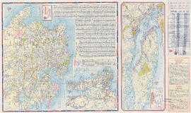
Map no. 1 shewing Union Steamship Company route and ports of call : lower run
Item is a map showing ports of call along Vancouver Island and the southern coast of British Columbia from Smith Sound to Vancouver.
Map of portion of New Westminster District with adjacent islands and part of Vancouver Island
Part of City of Vancouver Archives technical and cartographic drawing collection
Item is a property map which shows timber leasesholds, Indian reserves, districts, and parcels of land.
Map of portion of New Westminster District with adjacent islands and part of Vancouver Island, B.C.
Part of City of Vancouver Archives technical and cartographic drawing collection
Item is a map which shows parts of the east coast of Vancouver Island of southern Vancouver Island, the Strait of Georgia, the Gulf Islands, the Sechelt Peninsula, and Greater Vancouver. The map shows the numbers of the district lots for all of the New Westminster Land District.

Map of south western British Columbia showing coastal lumber producers
Primary map shows lumber shippers and producers in the Lower Mainland and Vancouver Island. Inset maps show lumber shippers and producers in Greater Vancouver and the location of the primary map in relation to the rest of Canada.
Maps of Victoria and Vancouver Island, mileage chart and traffic routes
Part of City of Vancouver Archives technical and cartographic drawing collection
Part contains a street map of Victoria with street index, a map of Victoria and vicinity showing major roads, a map of Vancouver Island showing highways, a mileage chart, and traffic rules for Vancouver and Victoria.

Mrs. Stevenson & sea urchin, Victoria outer harbour
![Myrtle [Kilpatrick]](/uploads/r/null/0/0/e/00eb0b77a13bfa824ec6d3f8ef73553f073ef19c95c4de4431d7880bb4fe78c0/0f25f379-7ce2-45a3-9701-e92d8743e8b1-CVA289-003_142.jpg)
Part of William Orson Banfield fonds
![Myrtle [Kilpatrick] and Olive [Sadler]](/uploads/r/null/2/2/a/22ae0074631268708a81b2647fa6c6d3a6d893c4b3007dcb789a11087d7dae2b/da34a586-a84c-4bbb-8416-fde3ccbf6515-CVA289-003_142.jpg)
Myrtle [Kilpatrick] and Olive [Sadler]
Part of William Orson Banfield fonds
Nanoose & Long Beach, 1955 and 1960

Nanoose Bay, May 1955 - Digging up gooey-ducks, Marine Biology trip, V. I.

Nanoose Bay, May 1955 - Group on hill at Powder Point


