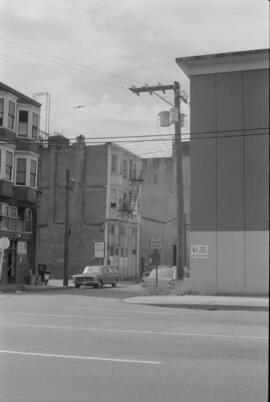
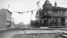
![RLS [Intersection]](/uploads/r/null/6/d/f/6dfe88a0d740cf69f057aa49afaac2c09edd88135ab5d099050e2a9fd0d6d68a/f6cf2dc2-f41c-4d10-89a8-5511543dfd33-2019-103.0066_142.jpg)
- COV-S505-1-: 2019-103.0066
- Item
- [198-?]
Part of City of Vancouver fonds
3878 results directly related Exclude narrower terms
Part of City of Vancouver fonds
![RLS [Intersection]](/uploads/r/null/9/a/5/9a50e1cf72cf7dcd74c15366f787afd9cacdc69be54a99ddbf30e5f032c21f2e/799b6320-49e5-4eb4-83b6-ed260800df48-2019-103.0065_142.jpg)
Part of City of Vancouver fonds
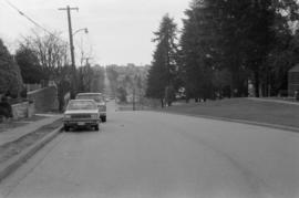
![Roll "A" [Street]](/uploads/r/null/5/4/c/54cda0d7cce111a5729c470dab0760e3a0d109590d13b8c2a971d60960a2957c/24eb74d1-8207-4db7-87a6-06829e00c181-2019-103.0011_142.jpg)
Part of City of Vancouver fonds
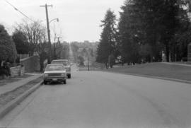
![Roll "A" [Street]](/uploads/r/null/b/d/8/bd890a86646f73bbc060f725b075ed611d4c5bf90cf76ecb95754297ccafda75/fd573cec-9dbc-4f48-8626-7c0cd5e996ad-2019-103.0010_142.jpg)
Part of City of Vancouver fonds
![Roll "A" [Street]](/uploads/r/null/b/0/8/b08b68606ef56262103e922a0f1e121df41aed2484a1a3967ee1c0a1c41bb0a0/30d5e6d3-3ee0-49bb-add5-1a55fe05ca03-2019-103.0009_142.jpg)
Part of City of Vancouver fonds
![Roll "A" [Street]](/uploads/r/null/8/3/8/838e87b85669fad04ddcf36d205b58a49efb24cded140ad35643831f2621eb32/70f81c32-89a1-4d56-8c9a-20e472e0daa6-2019-103.0008_142.jpg)
Part of City of Vancouver fonds
![Roll "A" [Street]](/uploads/r/null/b/a/6/ba670f47f0786d036ca0e7a8ac3198fe1c4fcddc1a339c17ca81e175410e20b6/2768ac76-b4f2-4da2-a8a8-6e4e675e48f2-2019-103.0005_142.jpg)
Part of City of Vancouver fonds
![Roll "A" [Parked cars on street]](/uploads/r/null/1/8/a/18a4c53216377962506c12c71f0ee9702f13cc1f46fc9f5b6fa0d62ba127d532/b1136924-de0d-4160-9606-a081bbe84b33-2019-103.0004_142.jpg)
Roll "A" [Parked cars on street]
Part of City of Vancouver fonds
![Roll "A" [Sidewalk]](/uploads/r/null/e/c/4/ec45e8175582399f7b97ad230a4f32e5e7263a72efd9ed9b9b6a28bc16ecc7e2/cad72f96-ecd5-48a6-bd55-19c0e1622ce5-2019-103.0003_142.jpg)
Part of City of Vancouver fonds
![Roll "A" [Tree lined street, 2 of 2]](/uploads/r/null/5/3/3/5333ab20a22079269440fab6b6fbc8d1c3446ace9624f87c338825f39d793362/0722c324-2094-4071-ad02-782fbfa4d708-2019-103.0002_142.jpg)
Roll "A" [Tree lined street, 2 of 2]
Part of City of Vancouver fonds
![Roll "A" [Tree lined street, 1 of 2]](/uploads/r/null/3/9/6/39692c4eff909a6949713f77238b05f2825dfcb53e196521367170bef9dfd1ee/1f73541f-e180-4c14-95b2-8ed21f5d3b95-2019-103.0001_142.jpg)
Roll "A" [Tree lined street, 1 of 2]
Part of City of Vancouver fonds
![[Cars on downtown street]](/uploads/r/null/3/7/0/370161e5c83baa350fb19962992c2cef314e83e1c8892e90f21fc1a516302003/6132a451-7e8c-4d90-b4a0-3e38d9d28a0a-CVA1095-15067_142.jpg)
Part of City of Vancouver fonds
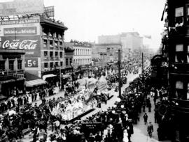
![[Celebration at West Hastings and Carrall Streets looking west]](/uploads/r/null/a/e/aed53fbaee4a486c48ee8542c2ad278eb674183067a4a2f474b780ad55baf1bf/80b73d52-91d1-46da-81d0-3c8f31ead92c-A01814_142.jpg)
[Celebration at West Hastings and Carrall Streets looking west]
Photograph shows a band, horse drawn carriages, spectators, and a large horse-drawn structure decorated with Union Jack flags. Also shown are the Palace Hotel at 349 - 359 Carrall Street and the English Chop House at 377 Carrall Street.
![[Cement truck and buildings]](/uploads/r/null/b/0/2/b0276df1352734ab21424f4d2a3dc49856f2f9ef352b9271d842f816bb3e7ab1/9c7ddf9c-7408-4140-bb1b-656ffda9322f-CVA1095-14390_142.jpg)
Part of City of Vancouver fonds
![[West 13th Avenue and Spruce Avenue intersection]](/uploads/r/null/8/8/a/88ae11c41de429c1baddd060cec00115208eecc9f90990d579e57e1e62b79258/ac78c751-ed15-4834-b82e-71a35509a36e-CVA1095-12850_142.jpg)
[West 13th Avenue and Spruce Avenue intersection]
Part of City of Vancouver fonds

Sheet G : Trafalgar Street to Granville Street and Sixteenth Avenue to Nanton Avenue
Part of City of Vancouver Archives technical and cartographic drawing collection
Item is a section showing the area from Trafalgar Street to Granville Street and Sixteenth Avenue to Nanton Avenue. Includes streets and roads; blocks, lots and legal descriptions; and parks, schools, railway lines and golf courses.
Vancouver (B.C.). Office of the City Engineer
Miscellaneous Historical Area - 439
Part of City of Vancouver fonds
Visible is a sign for 22 West Pender Street.
![Historical Area - 443 [Intersection]](/uploads/r/null/8/4/1/841a6ccb61fdb89b8aeec0037649cbd2b29f6f7011b4122a76aa858c1e93279d/743c7c53-8842-4cd5-b900-46b41849bb4d-CVA1095-08925_142.jpg)
Historical Area - 443 [Intersection]
Part of City of Vancouver fonds
![Historical Area - 443A [1 of 2]](/uploads/r/null/a/d/b/adb0501965fd81e60dbe21d2588f6e4284600055d7da6abf19e056deee002c4f/a9fa9394-c4fe-434a-809b-207f4479fa58-CVA1095-08891_142.jpg)
Historical Area - 443A [1 of 2]
Part of City of Vancouver fonds

Part of City of Vancouver fonds
![[View of 900 block Seymour Street]](/uploads/r/null/8/a/8a5b02b2c474bf4b469da2d909bb54224b911318574331cce7bc62d4574553c8/7f06889b-efed-40ae-b34c-c6615fa12dd1-CVA810-93_142.jpg)
[View of 900 block Seymour Street]
Sign for Dominion Motors can be seen.
![Miscellaneous [41 of 130]](/uploads/r/null/5/e/5e42ab92f4cae68f59e04f28d6c5796d7a4a008adc11be6e92a097993d27c4cf/850f5829-2350-4212-bfdb-20c86d11b5a2-A64367_142.jpg)
Part of City of Vancouver fonds
Item is a photograph showing Robson Street between Burrard and Bute.
![Miscellaneous [66 of 130]](/uploads/r/null/f/3/f3e5c735d932ae4b6cf5264ac1126704a320ba278c9197a1e374be368226338b/a99fc078-5f61-4e29-b051-d858f0963d35-A64400_142.jpg)
Part of City of Vancouver fonds
Item is a photograph showing a woman walking along the street end at Robson and Chilco with a partial view of Stanley Park in the background.
![[Pender Street at Cambie Street, looking west]](/uploads/r/null/3/d/3d91c3d4cd2181022a308d60e8fad6da587efcfa17cc0a68527eb95c215bc009/5a8ff240-1741-4881-b137-7b3a66b98a1d-A43705_142.jpg)
[Pender Street at Cambie Street, looking west]
Part of City of Vancouver fonds
Photograph shows the Vancouver Sun sign, City Health Department building and Central Public School
![Naval parade and review [Cambie and West Hastings]](/uploads/r/null/6/e/6eb34cc2d7a336262d8897a793cc11faface3f399fd4d32b966507b117f84be3/6bd11750-ca63-4a9a-8a15-997e4ab35d60-A00552_142.jpg)
Naval parade and review [Cambie and West Hastings]
Part of Stuart Thomson fonds
![[One way traffic Seymour St. at Georgia Street, looking south]](/uploads/r/null/6/a/6ab5722dd80ce8659c50534737b97713ef7378106e8777583f6504275d6eb353/28fb7cc1-f428-4efb-9354-3631dfad7020-A43714_142.jpg)
[One way traffic Seymour St. at Georgia Street, looking south]
Part of City of Vancouver fonds

East 15th Ave., facing west towards Knight St.
Photograph taken from corner of East 15th Avenue and Fleming Street, showing dip in land where China Creek once flowed. To the right is Clark Park.

East 15th Ave., facing west towards Knight St.
Photograph taken from corner of East 15th Avenue and Fleming Street, showing dip in land where China Creek once flowed. To the right is Clark Park.
Looking west on East 15th Ave. toward Knight St.
Photograph shows depression in 15th Avenue where China Creek once flowed. To the right is Clark Park. Additional descriptive information on back of print.
Looking west on East 15th Ave. toward Knight St.
Photograph shows depression in 15th Avenue where China Creek once flowed. To the right is Clark Park.
![Streets [89 of 139]](/uploads/r/null/b/b/bb43c82b67a4a7e975d3adb95128b71f6d01bd4575324c28f8395ea9f9fddec9/8897b8b8-c3c0-4a7e-a898-91c092f3a1ab-A64278_142.jpg)
Part of City of Vancouver fonds
Item is a photograph showing the 6400 block of Columbia Street at West 48th.
![Commercial [Drive],18th [Avenue] and Findlay [Streets looking] west](/uploads/r/null/f/f/ff9064f1dffd7a5a8017faaf6ab700e91a15775e8d9375c588f3fc67e9617104/a27b4a41-48b6-46f0-ab9d-962e394b34ce-A43187_142.jpg)
Commercial [Drive],18th [Avenue] and Findlay [Streets looking] west
Part of City of Vancouver fonds
Item is a photograph showing the view taken from the east side of Findlay Street looking west where the road becomes Commercial Street. Selkirk Elementary School is visible in the background.
![[View of the 600 block West Hastings]](/uploads/r/null/9/7/9794e66aa3ed705d8e31ec2ade4b14ca796155c9205fc6a66301c5c6611f8478/15a56ed3-121e-4b13-a226-92b98aa27e1f-A13748_142.jpg)
[View of the 600 block West Hastings]
![Bldgs. [Buildings on the north side of the 600 block of Hastings St.]](/uploads/r/null/6/4/64b973f3b3c9cb2b4aacf7687a576bcdb575fe8a8d0778960483abc44eac347c/96dcae5c-a1ef-4954-9ed8-36549a7fa8f8-A21867_142.jpg)
Bldgs. [Buildings on the north side of the 600 block of Hastings St.]
Part of Walter E. Frost fonds
Photograph shows the Empire building, the British Boot Shop, 41 Grill, Vogue Ladies Apparel, Green Parrot Coffee Shop, the Royal Bank Building and a part of the Post Office.
Part of Major Matthews collection
Photograph shows a parade on Hastings Street from Carrall Street
![[Apartment buildings on Granville Street and 16th Avenue]](/uploads/r/null/f/a/fa784ffaa10d1453214e5173ea06e22c00f7a6530a93138d7a34e442453bd490/c98ab7d0-2707-401e-b79e-7ccb519e48d9-A09703_142.jpg)
[Apartment buildings on Granville Street and 16th Avenue]
Part of Major Matthews collection
Map of Vancouver and Lower Mainland : avenue guide
Part of City of Vancouver Archives technical and cartographic drawing collection
Map includes Lower Mainland, B.C. and shows streets, railways, street cars, bus lines, schools, parks and industry.

The official street name map of the City of Vancouver
Part of City of Vancouver fonds
Item is a map created to accompany a street naming by-law.
Vancouver (B.C.). Engineer's Office
![[Aerial view of Mount Pleasant, South Strathcona and Kensington-Cedar Cottage]](/uploads/r/null/7/5/75ea991fe8319eaffda79b314cbf20e281e35eb2cd8a89eaa898b492242d6282/05f856f3-0a45-41eb-94dc-46cb9d2f7ecf-A63348_142.jpg)
[Aerial view of Mount Pleasant, South Strathcona and Kensington-Cedar Cottage]
Part of Major Matthews collection
Photograph shows aerial view of the east end of False Creek, Thornton Park, Great Northern Railway and Canadian National Railway yards, Mount Pleasant, Strathcona, Grandview-Woodland, Trout Lake, Kingsway, Vancouver Technical School grounds, Renfrew playing fields, John Hendry Park, British Columbia Electric Railway Right of Way, Clark Park, Grandview Highway South, Great Northern Railway.
Part of Hastings Street, Vancouver
Part of Major Matthews collection
Photograph shows Hastings Street looking east from Granville Street and the Alfred Bunker and Customs House building (formerly L.A. Hamilton's house)

Part of City of Vancouver Archives technical and cartographic drawing collection
Item is a street map of the City of Vancouver showing streets, schools, hospitals, parks and golf courses. A street index is included. A dial would have been attached at the centre of the map, but the dial has since been removed.
![[Inspection of 6th Regiment D.C.O.R. on Cambie Street grounds]](/uploads/r/null/2/e/2ef9009e1370d881168d5b9564a0b91823a5cd05e51b96a18f4d25d756105e43/8584938e-bbc7-4c8e-a54e-d62d04d8f8bc-A26733_142.jpg)
[Inspection of 6th Regiment D.C.O.R. on Cambie Street grounds]
Part of Major Matthews collection
Photograph shows the houses in the 600 block on the west side of Cambie Street and the spires of the St. Andrews Presbyterian Church and Holy Rosary Cathedral
Map shows the pre-emptors of land, land use, and the location of sawmills in Vancouver during the period of the 1880s. The map is associated with textual information documenting the history and development of Vancouver in the same period of time. The map also shows the early streets and roads of Vancouver.
Procession July 1st, 1890 Cordova Street
Part of Major Matthews collection
Photograph shows a view looking west from Carrall Street of street decoratations for Dominion Day and the Dunn-Miller Block
![Hastings Street [00 block]](/uploads/r/null/7/8/78eeee5ffd1656608ca5c5d8e0316c16d6729e5071f2cdaae2dd224d9eb34f4c/4b394c4c-143d-48cd-aafc-1bad91736c71-A70084_142.jpg)
Part of William Eadington Graham fonds
Item is a photograph showing Pay-less Shoes, Save On Meats, the Palace Hotel and the Army & Navy Department Store.
![Miscellaneous [38 of 130]](/uploads/r/null/3/7/370c8962c5022681b9caa655aa413f9ae4a96a1b5857d9f9963f661bee67422e/2a98c6b9-de39-4e35-b795-772b5f9b517a-A64364_142.jpg)
Part of City of Vancouver fonds
Showing Broadway and Heather

Granville Street at night looking north between Nelson and Smithe Streets
Part of City of Vancouver fonds

West side of Granville Street between Smithe and Nelson Streets
Part of City of Vancouver fonds
West side of Granville Street between Robson and Smithe Streets
Part of City of Vancouver fonds
![[C.P.R. right of way between Cordova and Carrall Streets]](/uploads/r/null/c/0/c0eddc6c76c3133f7aa1feaa564938fbeae4de6371f4369968d4436a3da40345/40b2d0ae-d4eb-4b89-835a-a5d5332ce91f-A09979_142.jpg)
[C.P.R. right of way between Cordova and Carrall Streets]
Part of Major Matthews collection
Photograph shows man sitting on tree stump across from the Oyster Bay Cafe, which was the site of City Hall after the fire in 1886. J.S. Matthews' notes with print or negative in Archives.