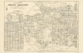
B.C. Electric Rly. Co. Ltd. plan showing transit services in Vancouver city as at end of 1951
- AM1594-: MAP 803
- Item
- 1948
Part of City of Vancouver Archives technical and cartographic drawing collection
Item is a transit map of Vancouver showing existing and proposed service routes under the three year transit modernization plan for years 1948-1951.
![Big Outfit Starting for Klondike [in front of] Johnston, Kerfoot and Company - 104 and 106 Cordov...](/uploads/r/null/b/b/bb3cd07a1ba100cc07995e16864284758450d3649cc9b80550e9281be6b626bb/f179280f-7f6a-4dfd-8bd8-ab4ea97bda41-A37249_142.jpg)
![Bus shelter [1 of 20]](/uploads/r/null/9/8/98c2987a60ec52eff5abd0e752bda92842f3549a27658c42ba1fda3e3ab8c10e/e49ee64b-0f79-4c3b-82d4-8787db1faa6a-A64105_142.jpg)
![Bus shelter [14 of 20]](/uploads/r/null/6/8/683ce00c2ef6ee8144768c14a4f6203ddfae9067da6358f94a1d41ed95d231f4/f49add76-4721-45bc-9a3b-eb2d17e56274-A64283_142.jpg)
![Bus shelter [15 of 20]](/uploads/r/null/4/0/40b36833d723bfd8a96c8a3e8e6150ad07b35e81538d12d94e21e5dd318dacd4/0c2ae8d7-4872-4f4f-a0cf-25a16ff44dbe-A64284_142.jpg)
![Bus shelter [17 of 20]](/uploads/r/null/3/d/3debe17e6e2056dc834e8a7fdf4da31a9d65b761386c6e35d539a424ed2c08b9/4167f175-9f4d-4d55-a53e-6bedb917e389-A66179_142.jpg)
![Bus shelter [19 of 20]](/uploads/r/null/c/9/c9e9e07b74ebd5769e5e9332cc0d7e70eb56778f7378192c7a836de1aa6a0ea0/ffbae9d2-2bf8-401e-964b-851e748dcbab-A66181_142.jpg)
![Bus shelter [2 of 20]](/uploads/r/null/2/d/2da9c1bb89fc16effcbafa80f5351abc77f0e9d390067569732231c79cda23af/d003491b-89ab-4064-b5bb-511acac88583-A64106_142.jpg)
![Bus shelter [5 of 20]](/uploads/r/null/2/8/28cf6b3769210eee50b93ad4f8a454ae756a789919897bcc9ce0722994ee37b6/b65ad54e-417d-4110-8880-eda554da0f0b-A64127_142.jpg)
![Bus shelter [6 of 20]](/uploads/r/null/9/a/9a0f169f0fa99661c133a79055b71340b248e47024cb0ed9b1078c8566f2bd70/e58dd43c-028c-41fa-81d0-6a21b1374ea3-A64128_142.jpg)
![Bus shelter [8 of 20]](/uploads/r/null/7/3/73d223174f172b87d2f5a6227908b464886406a386a87947482df2495187d516/0164005e-2d3a-44ab-80b9-7d5db0c886fe-A64142_142.jpg)
![Bus shelter [9 of 20]](/uploads/r/null/b/f/bfb0381a2d79232f7c45923c5b5593fe7c8d3ea734efcab681fbec5b9dce5527/433a367e-3049-4d79-acc1-4b5920fe32e7-A64163_142.jpg)


![[Man helping a woman into a truck labeled as "McDonald Bus Line"]](/uploads/r/null/0/d/0d4d7b38fb2f34640f256a619f456109b10d1500b41beb1beac51f103e4654ee/69b12d98-2f28-4f40-a461-9615bcafc7df-A12989_142.jpg)

![Miscellaneous [10 of 130]](/uploads/r/null/8/0/8049d8ca8c93c4eac9849fa9f93abca07db6cb5b431f47f3e223583d00ffec81/c29c2d1f-d482-4963-aa07-1e9767ed4301-A64298_142.jpg)
![Miscellaneous [9 of 130]](/uploads/r/null/2/4/245ca570cd689526ccf317f8f6b17198ebfc9f868fd095112ea2e964448f5b4c/e1ed6930-376c-40fd-9ae5-5dbe0a94a42a-A64297_142.jpg)

![Prototype LRT Vehicle [10 of 11]](/uploads/r/null/e/b/eb02ece114b18ec7cad121a0ff26ed83df2e1016be16ddc48927bdefd9cf5783/f095353e-9614-48e2-98fd-26fcd5f7bbba-A64318_142.jpg)
![[Street cars and taxicabs on Hastings Street]](/uploads/r/null/e/3/e3460b082958ce0fb70de47b3e1459bdb3ce0a26a86c14d8c3200e76490c633e/2bb3fbd4-de88-4667-a78d-09fa1c22a6be-A09848_142.jpg)
