Title and statement of responsibility area
Title proper
Tongass National Forest, Alaska : Copper River Meridian
General material designation
- Cartographic material
Parallel title
Other title information
Title statements of responsibility
Title notes
Level of description
Item
Reference code
AM75-F26-: LEG1374.07
Edition area
Edition statement
Edition statement of responsibility
Class of material specific details area
Statement of scale (cartographic)
Multiple scales
Statement of projection (cartographic)
Statement of coordinates (cartographic)
Statement of scale (architectural)
Issuing jurisdiction and denomination (philatelic)
Dates of creation area
Date(s)
-
1951 (Creation)
Physical description area
Physical description
3 maps on 1 sheet : lithographic print, col. ; 99 x 74 cm
Publisher's series area
Title proper of publisher's series
Parallel titles of publisher's series
Other title information of publisher's series
Statement of responsibility relating to publisher's series
Numbering within publisher's series
Note on publisher's series
Archival description area
Name of creator
Name of creator
Custodial history
Scope and content
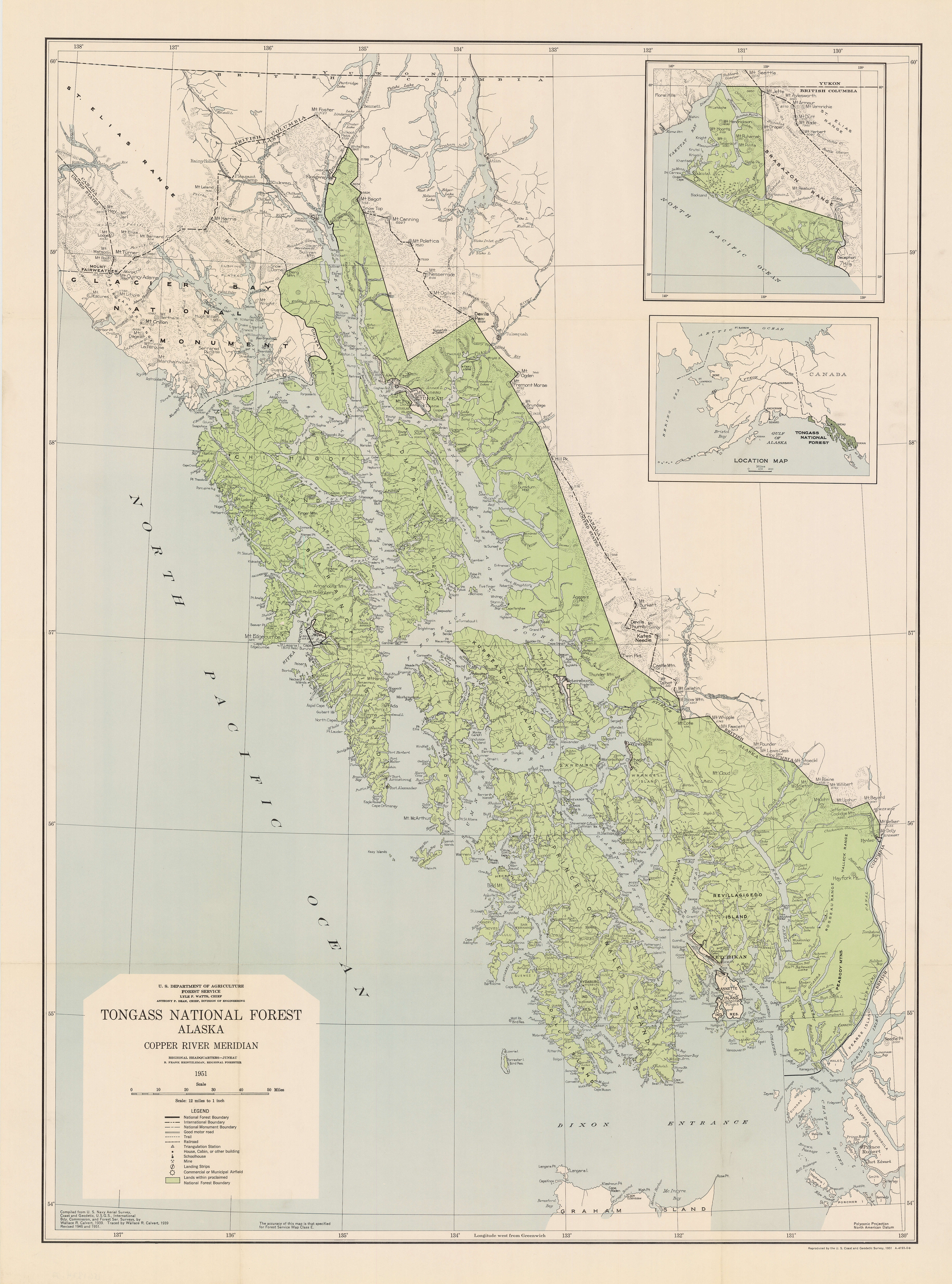
Item is a map of the Tongass National Forest showing roads, trails, railways, triangulation stations, dwellings, schoolhouses, mines, landing strips, airfields, and international, national forest, and national monument boundaries. Two smaller maps show the location of the Tongass National Forest in relation to the rest of Alaska and the far northwest portion of the forest not shown on the primary map.
Notes area
Physical condition
Immediate source of acquisition
Arrangement
Language of material
Script of material
Location of originals
Availability of other formats
A digital copy is available.
Restrictions on access
Access to original material is restricted for preservation reasons.
Terms governing use, reproduction, and publication
Finding aids
Associated materials
Accruals
Alpha-numeric designations
A-4193-0
Rights
Public domain
External Link
ftp://webftp.vancouver.ca/archives/MAPS-TIFF/LEG1374.07.tif
- Format: TIFF (LZW compressed)
- MD5: 496B29A914A512DAE7B845B8956E8949
- Size: 115684956 bytes
Alternative identifier(s)
Standard number area
Standard number
Access points
Subject access points
Place access points
Name access points
- U.S. Coast and Geodetic Survey (Publisher)