![Rupert [Street] and Kingsway [traffic controller]](/uploads/r/null/3/3/7/337eea3b1322870b674567e971f7598acc65a1069f3a13a4fac372a819b2ed85/961594e7-4657-4e15-b7ae-4169d227f52e-2019-103.0498_142.jpg)
Rupert [Street] and Kingsway [traffic controller]
- COV-S505-1-: 2019-103.0498
- Item
- [198-?]
Part of City of Vancouver fonds
6150 results directly related Exclude narrower terms
Rupert [Street] and Kingsway [traffic controller]
Part of City of Vancouver fonds
![Safeway Free Cooking School [at Vancouver Theatre, 765 Granville]](/uploads/r/null/9/d/9da32e7dd26cd60112985112388a252b57fac8e30f98794d6737ac4ac76fe3c3/22181493-4f99-4e7a-85ff-a0045188e09a-A01405_142.jpg)
Safeway Free Cooking School [at Vancouver Theatre, 765 Granville]
Part of Stuart Thomson fonds
![Sales Comparison # 1 58 to 62 Powell [Street]](/uploads/r/null/7/8/789929b66c285013d48ccf10bf2c0ad918953fb1739f985b8bec2b8a08dbbc1a/dfa8c94f-fcb6-4c09-9961-13fe1f7c1b70-CVA810-65_142.jpg)
Sales Comparison # 1 58 to 62 Powell [Street]
Photograph shows the 58 to 62 Powell Street from across Powell Street. The alley behind the building and parked cars are visible in the photograph. Businesses shown Raymond Chow Art Gallery.
![Sales Comparison # 1 610 W. Cordova [Almer Hotel]](/uploads/r/null/7/9/79f34b62ccc99b7193ec72bff2412b031e501e6fac031a772efcfa0e74c63c84/5fc265d4-7ea9-4d3c-8eef-cc34800df36a-CVA810-43_142.jpg)
Sales Comparison # 1 610 W. Cordova [Almer Hotel]
Photograph shows the Almer Hotel on West Cordova Street and the St. Francis Hotel to its left. Cars are parked on the street in front of the hotels. The photograph is taken from across Cordova Street. Hotel is visible in the background.
![Sales Comparison # 2 2 to 14 W. Pender [Street]](/uploads/r/null/f/e/feba970c3074cedec8ee36b0b2ff329a63d96f2432883c172993e141a0821be9/8dfd6268-386d-47a4-b2c7-63ad8b932f1d-CVA810-66_142.jpg)
Sales Comparison # 2 2 to 14 W. Pender [Street]
Photograph shows 2 to 14 West Pender Street from across Pender Street. Street lights and wires are visible in the photograph. Businesses shown ? Kong Silk.
![Sales Comparison # 2 553 to 555 Hamilton Street [Del Mar Hotel]](/uploads/r/null/3/6/36c4169759a030741cbced2c75a2479ba1a81a075b71697e494ecc949f96d3fc/e9d899b9-24f1-490c-b5e6-26c2a0349d1b-CVA810-44_142.jpg)
Sales Comparison # 2 553 to 555 Hamilton Street [Del Mar Hotel]
Photograph shows the Del Mar Hotel on Hamilton Street in Gastown with a parking lot on the right. Cars are parked in the parking lot and in front of the hotel. The photograph is taken from across Hamilton Street.


Item is a slide used to accompany the presentation "The Townsite Story".
![Sanitation [3 of 12]](/uploads/r/null/8/5/85629ab6750b6e26418478b394c9ca78aaaadb64e02750f4915b82adca9df37b/6d8caf8b-c024-40ac-989c-0ef9019fc018-A64441_142.jpg)
Part of City of Vancouver fonds
![Sasamat [Street] and 10th [Avenue intersection, 1 of 4]](/uploads/r/null/1/0/b/10b89791738c1c62341023c2e6192c10d0ce336de91f15795f580cd3503962bb/d9d3943d-5eba-4e90-9af0-419bda5dfe92-2019-103.0301_142.jpg)
Sasamat [Street] and 10th [Avenue intersection, 1 of 4]
Part of City of Vancouver fonds
![Sasamat [Street] and 10th [Avenue intersection, 2 of 4]](/uploads/r/null/f/4/9/f491239e9d71b5d05193fffe0474eb9333647109d915d37e3ad1b4aea9bf28b1/ad83ecbc-b145-465f-b5eb-c953899a9da7-2019-103.0302_142.jpg)
Sasamat [Street] and 10th [Avenue intersection, 2 of 4]
Part of City of Vancouver fonds
![Sasamat [Street] and 10th [Avenue intersection, 3 of 4]](/uploads/r/null/6/f/f/6ff3e887b3dbe6875023a6c16a67e2e857781718e063c6b05ff315d2430adf96/aeaeabc8-30e0-48d1-a107-574a5db2420f-2019-103.0303_142.jpg)
Sasamat [Street] and 10th [Avenue intersection, 3 of 4]
Part of City of Vancouver fonds
![Sasamat [Street] and 10th [Avenue intersection, 4 of 4]](/uploads/r/null/6/f/5/6f5547fe20532a23ba3cd1865c55555d55735217258c6196fb3b7e37e67646dc/e1800e49-19d4-46a6-ad84-0cb9d8b99297-2019-103.0304_142.jpg)
Sasamat [Street] and 10th [Avenue intersection, 4 of 4]
Part of City of Vancouver fonds
![Sasamat [Street] and 10th [Avenue traffic controller]](/uploads/r/null/e/a/d/ead35ff064be8d64b22ce16957d98c98882d6c8a49b008ff8502ca17583d87f0/22e73f54-693a-4cc3-8492-aee4a581788d-2019-103.0305_142.jpg)
Sasamat [Street] and 10th [Avenue traffic controller]
Part of City of Vancouver fonds
![Schou [Street] and Canada Way [looking] west](/uploads/r/null/8/0/8005aaa4caa8d824bd5cd65ea4fa590aafbb9cdfcfe71df5bacf3ff6d279d6c4/73562fd4-d35a-46f8-8bb5-373e167c3a2d-A42833_142.jpg)
Schou [Street] and Canada Way [looking] west
Part of City of Vancouver fonds
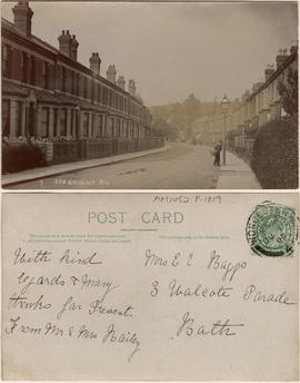
This postcard includes personal correspondence addressed to Mrs. E. C. Baggs of Bath.

Item is a photograph on an album page, annotated with "An example of conditions often met with. On the left (North side of street) the sidewalk is on the inside, with outer boulevard; on the right the sidewalk is constructed to the kerb, with inner boulevard. Proper boulevarding under such conditions is impossible. Note the forest maples planted closely together on the left and the occasional tree on the opposite side. An application is on file requesting the City to remove these trees entirely, so as to permit light and air to the houses and to make more effective street lighting at night."

Second slide in set to accompany The Townsite Story
Sectional map and street directory of Vancouver : Dial map of the city of Vancouver
Item is a street map of Vancouver with map on one side and information on street car and bus routes, schools, businesses, and other notable locations on the other.
Sectional map and street directory of Vancouver : Dial map of the city of Vancouver
Item is a street map showing Vancouver on one side and Burnaby, New Westminster, Coquitlam, and parts of Port Moody and Port Coquitlam on the other, as well as text advertising the products and services of the Dominion Map and Blueprint Company.
Sectional map and street directory of Vancouver : Dial map of the city of Vancouver
Item is a street map showing Vancouver on one side and Burnaby and New Westminster on the other, as well as information on street car and bus routes, and text advertising the products and services of the Dominion Map and Blueprint Company.
Sectional map and street directory of Vancouver : Dial map of the city of Vancouver
Part of City of Vancouver Archives technical and cartographic drawing collection
Item is a street map showing Vancouver on one side and Burnaby and New Westminster on the other, as well as information on street car and bus routes, and text advertising the products and services of the Dominion Map and Blueprint Company.
Sectional map and street directory of Vancouver : Dial map of the city of Vancouver
Item is a street map showing Vancouver on one side and Burnaby, New Westminster, Coquitlam, and parts of Port Moody and Port Coquitlam on the other, as well as text advertising the products and services of the Dominion Map and Blueprint Company.
Sectional map and street directory of Vancouver : Dial map of the city of Vancouver
Item is a street map showing Vancouver on one side and Burnaby, New Westminster, Coquitlam, and parts of Port Moody and Port Coquitlam on the other, as well as text advertising the products and services of the Dominion Map and Blueprint Company.
Item is a street map showing Vancouver, Burnaby, New Westminster, West Vancouver, and North Vancouver on one side and Lulu Island and Sea Island, Delta, Surrey, Langley and Maillardville on the other.
Part of City of Vancouver Archives technical and cartographic drawing collection
Item is a street map showing Vancouver, Burnaby, New Westminster, West Vancouver, and North Vancouver on one side and the Lower Mainland from Vancouver to Chilliwack on the other. Item includes lists of businesses, schools, public buildings, hospitals, bathing beaches, fire halls, and golf and country clubs, as well as text advertising the products and services of the Dominion Map and Blueprint Company.
Item is a street map showing Vancouver, West Vancouver, North Vancouver and Burnaby on one side and the Lower Mainland from Vancouver to Chilliwack on the other. Item also includes information about bus services in Greater Vancouver and text advertising the products and services of the Dominion Map and Blueprint Company.
Item is a street map showing Vancouver, West Vancouver, North Vancouver, and Burnaby on one side and the Fraser Valley, New Westminster, and Greater Vancouver transit lines on the other. Item also includes text advertising the products and services of the Dominion Map and Blueprint Company.
Item is a street map showing Vancouver, West Vancouver, North Vancouver, and Burnaby on one side and the Lower Mainland from Vancouver to Chilliwack, Richmond, and New Westminster on the other. Item also includes text advertising the products and services of Dominion Map and Blueprint Ltd.
Item is a street map showing Vancouver, Burnaby, New Westminster, West Vancouver, and North Vancouver on one side and the Lower Mainland from Vancouver to Chilliwack on the other. Item includes lists of businesses, schools, public buildings, hospitals, bathing beaches, fire halls, and golf and country clubs, as well as text advertising the products and services of the Dominion Map and Blueprint Company.
Part of City of Vancouver Archives technical and cartographic drawing collection
Item is a street map showing Vancouver, Burnaby, New Westminster, West Vancouver and North Vancouver on one side and Delta, Surrey, Langley, Maillardville, Lulu Island and Sea Island on the other.
Item is a street map showing Vancouver, West Vancouver, North Vancouver and Burnaby on one side and the Fraser Valley and New Westminster on the other.
Item is a street map showing Vancouver, West Vancouver, North Vancouver and Burnaby on one side and the Fraser Valley, New Westminster, Richmond, Delta, and Surrey on the other. Item also includes text advertising the products and services of the Dominion Map and Blueprint Company.
Item is a street map showing Vancouver, West Vancouver, North Vancouver and Burnaby on one side and the Lower Mainland from Vancouver to Chilliwack on the other. Item also includes information about bus services in Greater Vancouver and text advertising the products and services of the Dominion Map and Blueprint Company.
Part of BC Gay and Lesbian Archives
Part of BC Gay and Lesbian Archives

Part of BC Gay and Lesbian Archives
Part of BC Gay and Lesbian Archives

Service Entrance - 342/4 Water Street

Severn Avenue, Weston-Super-Mare
This postcard includes personal correspondence addressed to Mr. A. E. Baggs of Worcester.

Sewerage system : plan of Point Grey Municipality
Part of City of Vancouver fonds
Item is a map annotated to show the sewer system in Point Grey. Base map was created by the Vancouver Map and Blue Print Co. and shows streets, railways, and district lot and block numbers.
![Seymour and Cordova [Streets looking] east](/uploads/r/null/4/9/49dedd82f39fdbc5d463bb8e9abb5b7244dca422235a7a79dfcb7f50e9c14ff7/92b0263a-877c-4588-96db-4485a258d696-A44325_142.jpg)
Seymour and Cordova [Streets looking] east
Part of City of Vancouver fonds
Photograph shows the Kelly Building
![Seymour and Cordova [Streets looking] north](/uploads/r/null/c/1/c1eb3c7d6341ef26ddedaf8e5f163eda0a7fb9a9687a322ee6cb7ce847cb80b7/9b81f97a-4f20-4723-a16c-93aa21af37c1-A44324_142.jpg)
Seymour and Cordova [Streets looking] north
Part of City of Vancouver fonds
Photograph shows the former C.P.R. Station now the Seabus and Skytrain Station
![Seymour and Cordova [Streets looking] south](/uploads/r/null/5/4/54673c3161bfbd1ee65852cb68144297d3cdff1047110b28e71b08788977e91c/2079d7fb-94a1-4dd7-b1b2-358e05a252d6-A44327_142.jpg)
Seymour and Cordova [Streets looking] south
Part of City of Vancouver fonds
![Seymour and Cordova [Streets looking] west](/uploads/r/null/c/7/c78c47efd66c5bb23c54ca9f2c1ae588f05b37b577224493f59fe36a4f5c1b7f/43ffc884-38b6-48a3-b76d-4705c9313d3e-A44326_142.jpg)
Seymour and Cordova [Streets looking] west
Part of City of Vancouver fonds
![Seymour and Davie [Streets looking] east](/uploads/r/null/2/9/29d2f0aee5a7a978bbe358ab9a5f640ed2738305af03e8fc24adffdc9fe210ed/3e65d2ef-4c1d-4e6c-a64b-49bb9b701e49-A44352_142.jpg)
Seymour and Davie [Streets looking] east
Part of City of Vancouver fonds
![Seymour and Davie [Streets looking] north](/uploads/r/null/2/7/27cc93ba07e19d6503495d49f7563f61b3ff2c1e7fa2a84fc179d68a16074b04/525f0a0f-8a9a-47e8-bc37-5f1eb16fc482-A44351_142.jpg)
Seymour and Davie [Streets looking] north
Part of City of Vancouver fonds
![Seymour and Davie [Streets looking] south](/uploads/r/null/3/d/3d905af7de8b4deeb3fc914f506d65f1d2b4bc5314845605ad7357b3b04ee0de/b932dfff-3fdd-41b7-95d2-fe30307c67ec-A44350_142.jpg)
Seymour and Davie [Streets looking] south
Part of City of Vancouver fonds
![Seymour and Davie [Streets looking] west](/uploads/r/null/8/3/838fdd8aca07fb323f2dec0f9b9f7f5d76b1a913a8e9fa85cf6054754dda001d/0bd6252e-70ee-49d5-89c6-4bc7ecfaca22-A44353_142.jpg)
Seymour and Davie [Streets looking] west
Part of City of Vancouver fonds
![Seymour and Drake [Streets looking] east](/uploads/r/null/c/a/cae33c8c1a9b4ea7f3d229dedc27c166506537d248cc7ae68bcef8643bccf47a/b99bc230-3e5f-4892-ad76-c315c90dfd4d-A44333_142.jpg)
Seymour and Drake [Streets looking] east
Part of City of Vancouver fonds