

Title and statement of responsibility area
Title proper
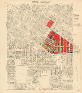
Sewage, water services and actual occupancy - area bounded by Joyce Street, Boundary Road, Wellington Avenue and Kingsway
General material designation
- Cartographic material
Parallel title
Other title information
Title statements of responsibility
Title notes
Level of description
File
Reference code
COV-S302--
Edition area
Edition statement
Edition statement of responsibility
Class of material specific details area
Statement of scale (cartographic)
Scale not defined
Statement of projection (cartographic)
Statement of coordinates (cartographic)
Statement of scale (architectural)
Issuing jurisdiction and denomination (philatelic)
Dates of creation area
Date(s)
-
[ca. 1950] (Creation)
Physical description area
Physical description
3 maps : lithographic prints, annotations ; 41 x 37 cm
Publisher's series area
Title proper of publisher's series
Parallel titles of publisher's series
Other title information of publisher's series
Statement of responsibility relating to publisher's series
Numbering within publisher's series
Note on publisher's series
Archival description area
Name of creator
Custodial history
Scope and content
File consists of three identical base maps of the area from Earles Street to Boundary Road and 29th Avenue to 49th Avenue, which have been annotated to show the sewage system, water services system, and types of occupancy in the area bounded by Joyce Street, Boundary Road, Wellington Avenue and Kingsway.