
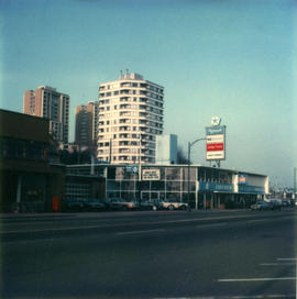
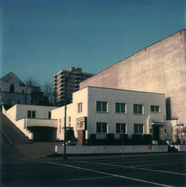
- AM123-S4---: CVA 810-80
- Item
- Feb. - Mar., 1980
85 results directly related Exclude narrower terms


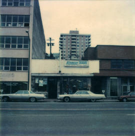
Kennedy Travel can be seen.
Sign for Columbia Funeral Chapel can be seen.


Radio Shack and Tandy Leathercraft businesses can be seen.


The Mercantile Building, 332 Columbia, can be seen.

Sign for Wharfside Craft Centre can be seen.

King Edward Hotel

Building has sign for "Wright's". Window has sign saying "Mr. Mattress opening soon".
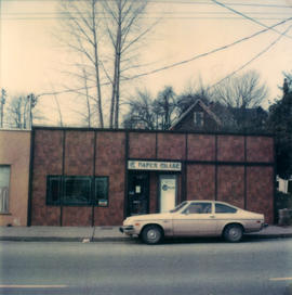
Paper Chase business can be seen.
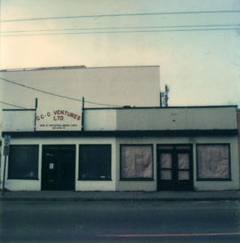
CCC Ventures sign can be seen.
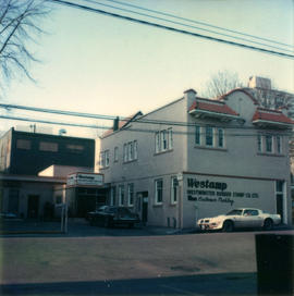
Sign for Westamp rubber stamp company can be seen.


![Building [Guichon Block] at 401-407 Columbia St. and Burr Block at 413-419 Columbia St., New West...](/uploads/r/null/7/f/7f39dbe26da177522375483a1a4a924622161f244e705d7884770f46dafa4b38/8a1a3876-8d57-466e-92fd-397404b27cb4-CVA810-29_142.jpg)
Photograph shows the Burr and Guichon blocks on Columbia Street in New Westminster from the intersection of Columbia St. and 4th Street. Street, sidewalk, cars and pedestrians also shown.
![[Burr and Guichon Block, 401-419 Columbia Street, New Westminster]](/uploads/r/null/0/f/0f44359f777e6fd8febc52123b251740579adb530f9037b9105098f13cf2d1bc/113130b6-081b-48ae-a300-ad1fb173770b-CVA810-67_142.jpg)
[Burr and Guichon Block, 401-419 Columbia Street, New Westminster]
Photograph shows the Burr and Guichon blocks on Columbia Street from across Columbia Street. Street lights and wires and a car are visible in the photograph. Businesses shown include Butterfield Florists.
![[Burr Block, 409-417 Columbia Street, New Westminster]](/uploads/r/null/8/0/804c631ca409628c8e21c63accd455ca3803b1e942f6fb5a1cf38139eb650bb1/66a490cb-c3e7-436b-bd81-03996298f0a3-CVA810-5_142.jpg)
[Burr Block, 409-417 Columbia Street, New Westminster]
Photograph shows the Burr Block from Columbia Street with part of the Queen's Hotel and the Guichon Block on its left and right sides respectively.

Burr Block, 411 Columbia St., New Westminster
Photograph shows the Burr Block on Columbia Street in New Westminster.
![[Celebrating "The Relief of Ladysmith, South Africa" on Columbia Street]](/uploads/r/null/2/4/2477fd876c37d6c77a8bcd3c5ab53754f444a4a9d270d53215637770fb1265e4/0a558fc1-e73a-4e26-9908-3c02ada67341-A32316_142.jpg)
[Celebrating "The Relief of Ladysmith, South Africa" on Columbia Street]
Part of Major Matthews collection

Columbia Street - Great Westmister Fire, Sept 11th, 1898
Part of Major Matthews collection
Photograph shows the ruins of buildings

Columbia Street After the Fire, New Westminster
Part of Major Matthews collection
![[Columbia Street after the Great Fire]](/uploads/r/null/1/7/179957aacee335eed6e87456516082aa6e89bb97db37504c8f033e94eb0c05a6/d1cd8754-0693-48bd-9f28-8c8a5a8092aa-A33103_142.jpg)
[Columbia Street after the Great Fire]
Part of Major Matthews collection
![Columbia Street [after the] Great Westminster Fire](/uploads/r/null/2/7/2708f676460b5fef7fc386e1f670494fbe18b76b0a790f9d1e65df4270b3c076/9c58892d-6ab7-4049-9c42-2e6308ce6682-A33937_142.jpg)
Columbia Street [after the] Great Westminster Fire
Part of Major Matthews collection
![Columbia [Street] and 4th [Street] east side incoming](/uploads/r/null/0/8/0877a01fcd6e325812d187db25cd79278a2a59680799f44283247f8bd6a0a033/2f7f3ff3-9772-4a56-96cd-8ec58ea50716-A20213_142.jpg)
Columbia [Street] and 4th [Street] east side incoming
Part of Major Matthews collection
Photograph shows a billboard advertising Swift's Premium Hams and Bacon

Columbia Street Great Westminster Fire
Part of Major Matthews collection

Columbia Street Great Westminster Fire
Part of Major Matthews collection

Columbia Street in 1888 New Westminster
Part of Major Matthews collection

Part of Major Matthews collection
J.S. Matthews' notes with print or negative in Archives.
[Commercial real estate survey New Westminster]
File includes images of commercial real estate properties in New Westminster, B.C. It also includes 2 textual records on self-adhesive labels that contain codes for each building type.
The reverse of some photographs contain information relating to the type of commercial property, rental and lease figures and recent sales information for each property.
CVA 810-69: 219 Carnarvon
CVA 810-70: 202 Carnarvon
CVA 810-71: 620 Carnarvon
CVA 810-72: 337 Columbia
CVA 810-73: 233 Columbia
CVA 810-74: 416 Columbia
CVA 810-75: 317-319 Columbia
CVA 810-76: 305 Columbia
CVA 810-77: 318-332 Columbia
CVA 810-78: 625 Columbia
CVA 810-79: 425 Columbia
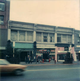
CVA 810-80: 102/120 Agnes
CVA 810-81: 533-537 Clarkson
CVA 810-82: 330 Columbia
CVA 810-83: 223 Columbia
CVA 810-84: 3 Carnarvon
CVA 810-85: 3 Columbia
CVA 810-86: 805 Agnes
CVA 810-87: 611-627 Agnes
CVA 810-88: 523-525 Agnes
CVA 810-89: 513-515 Agnes
CVA 810-90: 338 Agnes
CVA 810-91: 210 Agnes
CVA 810-92: 612-618 Columbia
CVA 810-166: 207 Columbia
CVA 810-167: 430 Columbia
CVA 810-168: 210 Carnarvon

Dial map of Greater Vancouver and suburbs
Part of City of Vancouver Archives technical and cartographic drawing collection
Part contains a street map of Vancouver, Burnaby, New Westminster, West Vancouver and North Vancouver showing block numbers, street car, bus, and railway lines, parks and hospitals. Map includes two dials (a numbered circle, a paper indicator, a grid of block numbers and a street index used to find locations). A small inset map shows the Capitol Hill/Scenic Park area of Burnaby in greater detail.

Dial map of Greater Vancouver and suburbs
Part of City of Vancouver Archives technical and cartographic drawing collection
Part contains a street map of Vancouver, Burnaby, New Westminster, West Vancouver and North Vancouver showing block numbers, street car, bus, and railway lines, parks and hospitals. Map includes two dials (a numbered circle, a paper indicator, a grid of block numbers and a street index used to find locations). A small inset map shows the Capitol Hill/Scenic Park area of Burnaby in greater detail.

Dial map of Greater Vancouver and suburbs
Part of City of Vancouver Archives technical and cartographic drawing collection
Part contains a street map of Vancouver, Burnaby, New Westminster, West Vancouver, and North Vancouver showing railways, hospitals, parks and block numbers. The map includes two dials (numbered circles, paper indicators, a grid of block numbers and a street index used to find locations).

Dial map of New Westminster and Burnaby
Part contains a street map of New Westminster and Burnaby. Two small inset maps show the Capitol Hill/Scenic Park area and the area bounded by Canberra Avenue, Holdom Avenue, Dundas Street, and Hastings Street in greater detail.
Dial map of the city of Vancouver including the adjacent municipalities
Part of City of Vancouver Archives technical and cartographic drawing collection
Item is a street map showing Vancouver, Burnaby, New Westminster, West Vancouver and North Vancouver on one side and the University Endowment Lands, Surrey, Maillardville, Lulu Island and Sea Island on the other.
Dial map of the city of Vancouver including the adjacent municipalities
Item is a street map showing Vancouver, Burnaby, New Westminster, West Vancouver and North Vancouver on one side and the University Endowment Lands, Surrey, Maillardville, Lulu Island and Sea Island on the other.