Tales from the back bumper : a century of BC licence plates
- HE 5620 .L5 .G37 2013
- 2013
3217 results with digital objects Show results with digital objects
Tales from the back bumper : a century of BC licence plates
Sports car road racing in Western Canada.

New construction on Carrall Street
Part of Paul Yee fonds

Part of Paul Yee fonds
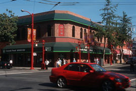
Toronto Dominion Bank building at northeast corner of Main and Pender Streets
Part of Paul Yee fonds
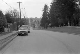
![Granville [Street] and 71st [Avenue] looking north](/uploads/r/null/6/e/6e07d771a2239df9ca6430b1246a1594e68c70c95203e20bab3c36b5900ddf55/6263fe8d-9097-42a9-9c60-3e8794bf740e-A43756_142.jpg)
Granville [Street] and 71st [Avenue] looking north
Part of City of Vancouver fonds
![Cambie and 19th. [Avenue looking] north](/uploads/r/null/a/b/abd4277415b29ead9be2b7cf305a2e37e4018476c8d3013e2aef50537c8aee77/bccd9c16-2fe6-47ab-a699-bad88cfeca2b-A43043_142.jpg)
Cambie and 19th. [Avenue looking] north
Part of City of Vancouver fonds
![[Glen Drive and 12th Avenue looking south]](/uploads/r/null/9/b/9b6494015ee60f546f66548ba74d99351e914510ce8148e2f8865eeae15e8ea2/135ee982-7c9f-45f5-927f-35e4159d0d3d-A44552_142.jpg)
[Glen Drive and 12th Avenue looking south]
Part of City of Vancouver fonds
![Begg [Street] at Terminal [Avenue looking] east](/uploads/r/null/a/f/af0ec1f52dc1a3650d0d86dae593103224a89f3d313d1b555932427d9e05d9e0/92862dc1-0c3d-4eae-92f6-5e939059ee3b-A42789_142.jpg)
Begg [Street] at Terminal [Avenue looking] east
Part of City of Vancouver fonds
Photograph taken underneath the Grandview Viaduct
![Boundary [Road] and 45th [Avenue looking] east](/uploads/r/null/d/8/d85545357d9ce98a48c9f7f97290cbf51f330c66dbbd1f29ca9d95a70977a2f9/515e769d-ad2f-4c29-85b1-18b35ac96fa3-A42893_142.jpg)
Boundary [Road] and 45th [Avenue looking] east
Part of City of Vancouver fonds
![Boundary [Road] and 45th [Avenue looking] north](/uploads/r/null/f/f/ffbc7b6265da109c4888db8527a75abb71a4b262e71aea9fd3570380687a8d21/ffa1006b-0809-4769-82e6-c2c753efa76a-A42890_142.jpg)
Boundary [Road] and 45th [Avenue looking] north
Part of City of Vancouver fonds
![Boundary [Road] and 45th [Avenue looking] south](/uploads/r/null/e/d/ed8bca323b04c26466ed649a5ae031156cdc8fb07a14956206ffe18153f73e2d/2d3eb11d-ed80-4c33-b7ba-cfa351a53bc1-A42891_142.jpg)
Boundary [Road] and 45th [Avenue looking] south
Part of City of Vancouver fonds
![Boundary [Road] and 45th [Avenue looking] west](/uploads/r/null/b/d/bdd08ee937e119a718844a9f50e15d600454f3afd2183feb482f5a93a4641a1b/f75df89b-d28e-4f89-a42b-943c05db13e4-A42892_142.jpg)
Boundary [Road] and 45th [Avenue looking] west
Part of City of Vancouver fonds
![Beach [Avenue] and Thurlow [Street looking] west](/uploads/r/null/2/3/23c699fc5040859c8da92714096b3ea3af61c33e29c1ae655d96ab19b0b4eb89/82cd55d9-0956-49f0-acbf-8170963e11f6-A42770_142.jpg)
Beach [Avenue] and Thurlow [Street looking] west
Part of City of Vancouver fonds
![Beach [Avenue] and Thurlow [Street looking] north](/uploads/r/null/c/4/c4ad54a5b1008db5b8f49947db08d3ed99da796a97f6ee690edaded85cb72df5/70fa2f82-7a1b-4822-898f-7dc3ca465434-A42771_142.jpg)
Beach [Avenue] and Thurlow [Street looking] north
Part of City of Vancouver fonds
![West Boulevard and 45th [Avenue looking] north](/uploads/r/null/c/9/c9ac65d4b4530a8a2f43365fb93aa77ddfc576078bf29acaa0d1139829eacb92/ff913e12-5453-47a3-b340-52637d2e0ae0-A42819_142.jpg)
West Boulevard and 45th [Avenue looking] north
Part of City of Vancouver fonds
![Ash [Street] and Broadway [looking] east](/uploads/r/null/8/3/83c227b223500f5814846e8a3704a1c180610f620d57ec1ce1716fd1f64ee693/e8b9d360-bf17-470d-b41b-9dbc278006b5-A42762_142.jpg)
Ash [Street] and Broadway [looking] east
Part of City of Vancouver fonds
![Ash [Street] and Broadway [looking] north](/uploads/r/null/9/4/94350f66137c908523de406afda47bafbc5932a30ece1189af4e9b33e7900dbd/23953fc3-d2ce-44b3-aba7-15abea0bd7e8-A42763_142.jpg)
Ash [Street] and Broadway [looking] north
Part of City of Vancouver fonds
![Marine and Angus[Drives] looking west](/uploads/r/null/a/c/ac60f269a4347eebf325e81d575fc365b50ce06f2c00315936965cb72257639a/0d30b890-81a0-4270-bd38-680443197527-A44093_142.jpg)
Marine and Angus[Drives] looking west
Part of City of Vancouver fonds
![Beach [Avenue] and Thurlow [Street looking] east](/uploads/r/null/e/5/e5b61776b0dd209e0887c02fcdeeb1c32e0ebac285911f6d3242d0c27c88493c/2d3c6834-2720-4958-8010-c2abde712334-A42769_142.jpg)
Beach [Avenue] and Thurlow [Street looking] east
Part of City of Vancouver fonds
Photograph shows the north end of the Burrard Bridge over Beach Avenue
![West Boulevard and 45th [Avenue looking] south](/uploads/r/null/c/5/c5d6bd0529b7bd91919fd2eba5ffd835473f6d76ebcd49041bac8071be049efd/65989e2d-8a5b-4f42-89b0-e118df669a11-A42820_142.jpg)
West Boulevard and 45th [Avenue looking] south
Part of City of Vancouver fonds
![2409 Main Street [F.W. Woolworth Co.]](/uploads/r/null/5/c/1/5c182ddd1b224ad36b6d4f9a7583c1e06c1d4e9285d4a9894429c399380c5bfe/1998be35-c0d5-44ef-9e62-48d7f21e39b1-CVA332-25_142.jpg)
2409 Main Street [F.W. Woolworth Co.]
Part of City of Vancouver fonds
Photograph shows street banners.
![2409 Main Street [F.W. Woolworth Co.]](/uploads/r/null/f/d/f/fdfdaab03f8fc2d005116b0dd3377d6a2c57a4c3edd0de77d2ca93074889c65a/df886338-9dc6-4d85-997e-68d6b0aed5c9-CVA332-26_142.jpg)
2409 Main Street [F.W. Woolworth Co.]
Part of City of Vancouver fonds
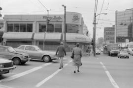
![Broadway and Stephens [Street looking] north](/uploads/r/null/d/4/d46142a02179e38605f87a167da07f99d0df8dd532bbf8256b7bd125e0edaa78/8ae2d194-935a-40b8-bfe1-10cee6628b94-A42902_142.jpg)
Broadway and Stephens [Street looking] north
Part of City of Vancouver fonds
![Broadway and Stephens [Street looking] east](/uploads/r/null/6/6/66f2fe9300f0151a31d835f1655054e900f11b910c1a9137c52cb546a2806227/9499abbc-eeb3-44ab-96b7-70fdcda4dbd8-A42904_142.jpg)
Broadway and Stephens [Street looking] east
Part of City of Vancouver fonds
![Broadway and Stephens [Street looking] west](/uploads/r/null/7/a/7a821381f67fc35c5fcff7717196ce068b06bea761526ead6fdbc89b3c4ff5b6/7b591056-0d17-4374-a3f7-20a62a88279a-A42905_142.jpg)
Broadway and Stephens [Street looking] west
Part of City of Vancouver fonds

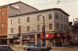
Part of City of Vancouver fonds
Photograph shows Royal Furniture and Mt. Pleasant Credit Union.
![Rockies by Rail ; music and FX [effects] only offline](/uploads/r/null/1/2/1226802/a07ef359-4895-4843-9887-e5530191d8f3-MI-509_142.jpg)
Rockies by Rail ; music and FX [effects] only offline
Part of Yaletown Productions Inc. fonds
Item is a version of "Rockies by rail" which has no narration, only music and effects. There is a time code reading at the bottom of the screen throughout. Footage includes some nice panning shots of the city of Vancouver. Michael Collier is sometimes one of the train passengers. Some footage was shot in Alaska as well as British Columbia.
![Cambie [Street] and 59th [Avenue looking] east](/uploads/r/null/a/c/ac8e28e6034d133bc4a84588a39dfa83ebcfd0ad8db7fd5994f4e20b10d416fa/b63f838a-6273-46fa-b2ab-6e27bce481fb-A43067_142.jpg)
Cambie [Street] and 59th [Avenue looking] east
Part of City of Vancouver fonds
![Burrard [Street] and Helmcken [Street looking] north](/uploads/r/null/5/c/5cfa1a41bcc74afb6df8f3919cf0d4533d47c32ec08966325a1e91fe184cba44/1b8f0c46-914a-4d7a-acde-1b2134f79514-A42932_142.jpg)
Burrard [Street] and Helmcken [Street looking] north
Part of City of Vancouver fonds
Photograph shows part of St. Paul's Hospital
![Burrard [Street] and Helmcken [Street looking] south](/uploads/r/null/e/2/e2c9bc63927c2c6881d91b3b266171a6ccf0ad093770d55cdb596c80e8df8b60/0e79b69d-6bbf-49a0-98ad-dc845002d75c-A42933_142.jpg)
Burrard [Street] and Helmcken [Street looking] south
Part of City of Vancouver fonds
Photograph shows the Burrard Motor Inn
![Burrard [Street] and Hastings [Street looking] north](/uploads/r/null/0/5/057c4906499227d7427f6b49eca0118e0f7a4e55b1a079da5a24333f79d02455/a23eca92-ad71-43c9-a803-ba566536c01d-A42931_142.jpg)
Burrard [Street] and Hastings [Street looking] north
Part of City of Vancouver fonds
![Burrard [Street] and Nelson [Street looking] south](/uploads/r/null/a/e/aed0d6f7d8e56a92a859556f5b17d1f9496d8191504fb027b5c5282a00c26a16/fedb0652-60ca-4caa-962a-96d52272d74a-A42937_142.jpg)
Burrard [Street] and Nelson [Street looking] south
Part of City of Vancouver fonds
![For VMC [Vancouver Men's Chorus]](/uploads/r/null/0/7/3/0735659574f060c5f1f4f01d636b1514d5a3f3c5779e1239b2bac212ec36543b/0a5eb6e7-1df1-4a37-980d-43543ebe4c92-2018-020_142.jpg)
For VMC [Vancouver Men's Chorus]
Part of BC Gay and Lesbian Archives
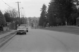
Looking west on East 15th Ave. toward Knight St.
Photograph shows depression in 15th Avenue where China Creek once flowed. To the right is Clark Park. Additional descriptive information on back of print.
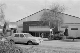
Photograph shows automobile parked in front of Kerrisdale Arena, 5670 East Boulevard

Safeway grocery store at Kingsway and Knight St.
Photograph shows store and parking lot. Part of a Domo gas station visible in foreground

Safeway grocery store at Kingsway and Knight St.
Photograph shows store and parking lot.
![Boundary [Road] and 49th [Avenue looking] west](/uploads/r/null/9/c/9cc0a485786529b7ea995102ef13d2652a30d9bb89c6b4daf2889a322b7380b4/b297ebec-79c3-4ff2-bc75-6b0b900e0bcb-A42900_142.jpg)
Boundary [Road] and 49th [Avenue looking] west
Part of City of Vancouver fonds

Intersection at Cambie St. and Broadway
Photograph taken facing west down Broadway. Visible in photograph are signs for Fogg n' Sudds restaurant, Orchid Garden restaurant, and London Drugs

Safeway grocery store at Kingsway and Knight St.
Photograph shows store and parking lot.
![Boundary [Road] and 49th [Avenue looking] east](/uploads/r/null/5/1/51fd0d3aba484586c608e65201084d88cd7aa72720a8c48eacd723f460fa7ef0/8e0dd36a-93a8-4e84-b643-33bab58b89a2-A42901_142.jpg)
Boundary [Road] and 49th [Avenue looking] east
Part of City of Vancouver fonds
Looking west on East 15th Ave. toward Knight St.
Photograph shows depression in 15th Avenue where China Creek once flowed. To the right is Clark Park.

Intersection at Broadway and Cambie St.
Photograph taken from south-west corner, facing south. Trolley bus visible in foreground, Royal Bank building visible in background
Intersection at Cambie St. and Broadway
Photograph taken facing west down Broadway. Visible in photograph are signs for Fogg n' Sudds restaurant and Orchid Garden restaurant

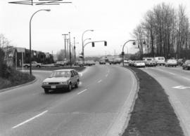
View looking north on Boundary Road from Marine Way
Part of City of Vancouver fonds
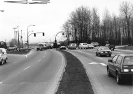
View looking east on Marine Way at Boundary Road
Part of City of Vancouver fonds
View looking east on Marine Way at Boundary Road
Part of City of Vancouver fonds
Item contains a commercial exhibitor floor plan, tech sheets, and collectors' highlights for the motorsport show, March 4-6, 1988, and the PNE.