- COV-S397---: LEG1362.01
- Item
- Jan. 19, 1926
Part of City of Vancouver fonds
Part of City of Vancouver fonds
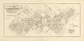
Land use : Semlin Drive to Nanaimo Street and Burrard Inlet to Triumph Street
Part of City of Vancouver fonds
Item is a map annotated to show residential, commercial and industrial land use. Base map shows streets, legal addresses, and waterfront businesses in the area from Clark Drive to Slocan Street and Burrard Inlet to Powell Street/Triumph Street.

Lot numbers, boundaries, railway lines and street names in the municipality of Point Grey
Part of City of Vancouver Archives technical and cartographic drawing collection
Primary map shows lot numbers, boundaries, railway lines and street names in the municipality of Point Grey from 16th Avenue in the north to the Fraser River in the south and from Ontario Street in the east to Blanca Drive in the west. A smaller map in the bottom left-hand corner of the item shows the north west portion of Point Grey.

Champlain Heights : D.L. 334, group one, N.W.D.
Part of City of Vancouver Archives technical and cartographic drawing collection
Part is a map showing lot numbers, lot sizes, lot values and sidewalk crossings in the area from Rosemont Drive in the north to 63rd Avenue in the south and from Butler Street in the east to Kerr Street in the west.

Part of City of Vancouver Archives technical and cartographic drawing collection
Item is a map of the municipality of Richmond, showing streets, dykes, railways, swing bridges, churches, schools, post offices, proposed roads, lot numbers and geographical features.
Buckle, C. W.

Second section : Shaughnessy Heights
Part of City of Vancouver Archives technical and cartographic drawing collection
Item is a map showing lot subdivision of the southern portion of Shaughnessy Heights (commonly referred to as "Second Shaughnessy") at January 1st, 1932. Annotations appear to refer to zoning restrictions.
Canadian Pacific Railway Company

Part of City of Vancouver Archives technical and cartographic drawing collection
Map shows a survey conducted by the Canadian Pacific Railway of English Bay, Burrard Inlet and Coal Harbour, including a rough outline of area and lots. Note on map reads "Certified as a correct plan showing the land required for right of way Burrard Inlet B.C., February 22, 1886. H.J. Cambie, Engineer in Charge." Map is certified as correct and signed by various C.P.R. officials, including W.C. Van Horne.

University Endowment Lands : plan of units nos. 1 and 2
Part of City of Vancouver Archives technical and cartographic drawing collection
Item is a map showing streets, land subdivision, properties disposed of, and buildings in the University Endowment Lands north of University Boulevard. Telephone numbers have been changed, issuing date added, and additional blocks filled in by hand, likely by J.S. Matthews.

Hastings Townsite : Renfrew Street to Rupert Street and 5th Avenue to 13th Avenue
Part of City of Vancouver Archives technical and cartographic drawing collection
Part is a sheet of a sectional map of Hastings Townsite showing streets, railways, legal addresses, some lot sizes, and municipal boundaries. Item has been annotated with information regarding property ownership, including identification of properties included in a 1919 tax sale, and various symbols of unspecified meaning.

Hastings Townsite : Rupert Street to Boundary Road and 5th Avenue to 13th Avenue
Part of City of Vancouver Archives technical and cartographic drawing collection
Part is a sheet of a sectional map of Hastings Townsite showing streets, railways, legal addresses, some lot sizes, and municipal boundaries. Item has been annotated with information regarding property ownership, including identification of properties included in a 1919 tax sale, and various symbols of unspecified meaning.

Part of City of Vancouver Archives technical and cartographic drawing collection
Part is a sheet of a sectional map of Hastings Townsite showing streets, railways, legal addresses, some lot sizes, and municipal boundaries. Item has been annotated with information regarding property ownership and various symbols of unspecified meaning.

Portions of Lillooet and New Westminster land districts
Part of City of Vancouver fonds
Item is a map which has been made up from portions of two different land registry maps, for the Lillooet and New Westminster Land Districts, to make one contiguous map showing the region from Gibsons Landing in the south, Southgate River in the north, Toba Inlet in the west and Alta Lake in the east.

Topographic map of Downtown Vancouver and the East End
Part of City of Vancouver fonds
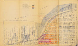
Item is a map showing two sets of topographic contour lines, streets, and block numbers (in Roman numerals) in the area from Robson Street to Raymur Avenue and Coal Harbour/Vancouver Harbour to False Creek.

Part of City of Vancouver fonds

Part of City of Vancouver fonds

Part of City of Vancouver fonds

Part of City of Vancouver fonds

Part of City of Vancouver fonds

Part of City of Vancouver fonds

Part of City of Vancouver fonds

Part of City of Vancouver fonds

Part of City of Vancouver fonds

Part of City of Vancouver fonds

Indexed guide map of the city of Vancouver and suburbs
Part of City of Vancouver Archives technical and cartographic drawing collection
Part is a map showing district lots, blocks, and boundaries between the City of Vancouver, Point Grey, South Vancouver, Burnaby, New Westminster, and parts of Richmond, North Vancouver and West Vancouver. Concentric circles indicate the distance in miles from the intersection of Main Street and Hastings Street in intervals of 1/2 mile.

Part of City of Vancouver Archives technical and cartographic drawing collection
Item is a map of the southwest coast of British Columbia from Cortes Island to Alta Lake and Chilko Lake to the northern tip of Gabriola Island. Map shows timber leases, Crown granted land, parks, municipalities, power lines, roads, railways, elevation of lakes and some mountains, hospitals, schools and canneries.

Vancouver North. British Columbia
Part of City of Vancouver Archives technical and cartographic drawing collection
Item is a topographical map showing the eastern portion of Sechelt Peninsula, Keats Island, southern portion of Gambier Island, Bowen Island, West Vancouver, North Vancouver, and Vancouver. City streets and blocks are shown, as well as surveyed parcels of land. Map also shows depth contours in fathoms for Howe Sound and Burrard Inlet.

Part of City of Vancouver Archives technical and cartographic drawing collection
Item is a map showing New Westminster Land District, including lands alienated or covered by application under the Land Act; surveyed timber leases, licences, or berths; Indian reserves; Government reserves; provincial forest boundaries; tree farm licences; municipality boundaries; and park boundaries. Includes a key plan of maps published in the same publisher's series and a reliability diagram noting data sources.

City of Vancouver : Canadian Pacific town site
Part of City of Vancouver Archives technical and cartographic drawing collection
Part contains four maps. The main map shows district lots and block numbers in Vancouver from Vine Street in the west to Boundary Avenue (Glen Drive) in the east and Stanley Park in the north to 9th Avenue (Broadway) in the south. Three smaller maps include an index plan to district lots in Vancouver, South Vancouver, New Westminster, and Burnaby; a world map showing Canadian Pacific mail steamship lines; and an index plan of Vancouver city limits. Part has been annotated with text describing a June 1888 land clearance plan and hand colouring indicating clearance status.
![[Second section of] Shaughnessy Heights](/uploads/r/null/9/4/d/94d42178bb60a8c60cdc002199430e863ae830696947ad73807b5fd11046c39a/72c651d3-6742-4c5c-a0bc-d83c3526a9ba-MAP330_142.jpg)
[Second section of] Shaughnessy Heights
Part of City of Vancouver Archives technical and cartographic drawing collection
Item is a map showing lot subdivision of the southern portion of Shaughnessy Heights (commonly referred to as "Second Shaughnessy") at January 1st, 1932.
Canadian Pacific Railway Company

Plan of the City of Vancouver, British Columbia
Part of City of Vancouver Archives technical and cartographic drawing collection
Item is a map showing District Lots, blocks and lots for the City of Vancouver with an inset of an index plan. The sheet also includes an index plan showing the Lower Mainland north of 16th Avenue, and an inset map of Stanley Park.

Municipality of South Vancouver
Part of City of Vancouver Archives technical and cartographic drawing collection
Item is a map sheet; the main map shows District Lots, blocks and lots, street addresses, schools, and a cemetery. The inset map shows electric streetcar lines in from Vancouver to New Westminster.

Part of City of Vancouver Archives technical and cartographic drawing collection
Item is a map showing subdivisions of townships in Coquitlam, Port Moody, Pitt Meadows, Surrey, Langley, Sumas, Sardis and Chilliwack. The west coast of British Columbia from Burrard Inlet to the Sechelt peninsula is shown as well as Vancouver Island and the surrounding Gulf Islands. Trails, post offices and railway stations are included.

Municipality of South Vancouver
Part of City of Vancouver Archives technical and cartographic drawing collection
Item is a map showing legal addresses, streets and schools in South Vancouver. A small key plan shows the location of the area covered by the primary map in relation to the rest of the Lower Mainland.

University Endowment Lands : plan of units no. 1 and 2
Part of City of Vancouver Archives technical and cartographic drawing collection
Item is a map showing streets, land subdivision, properties disposed of, and buildings in the University Endowment Lands north of University Boulevard. Additional blocks have been filled in by hand, likely by J.S. Matthews.

Plan of the townsite of North Vancouver
Part of City of Vancouver Archives technical and cartographic drawing collection
item is a map showing lots and land subdivision in North Vancouver, most likely related to real estate sales. Index map shows the location of North Vancouver relative to Greater Vancouver.

Part of City of Vancouver Archives technical and cartographic drawing collection
Part contains a map of East Vancouver Heights showing streets, block numbers and lot numbers, an index map showing the location of East Vancouver Heights in relation to the rest of the city, and text promoting the area.

Plan of Lot 6311, Vancouver, B.C. fronting on Kitsilano Indian Reserve No. 6
Part of City of Vancouver Archives technical and cartographic drawing collection
Item is a survey map showing lot numbers, boundaries, pipelines, bearings and landmarks on the Kitsilano Indian Reserve, as well as shorelines and the rights-of-way for the Burrard Bridge and Canadian Pacific Railway.

Part of City of Vancouver Archives technical and cartographic drawing collection
Item is a map showing lot numbers, lot boundaries, major streets and property sold or reserved in the area bounded by Campbell Street (Alma Street), present-day Trafalgar Street (unnamed on map), English Bay, and 16th Avenue.

Part of City of Vancouver Archives technical and cartographic drawing collection
Item is a map showing land subdivision in the New Westminster District. The map shows lands alienated or covered by applications under the "Land Act"; surveyed timber leases, licences, and births; and Indian reserves; shows land district boundaries; park boundaries; provincial forest boundaries; forest management licences; and municipal boundaries.
The map appears to be based on the National Topographic Series 1:250,000 map 92G, with other data added.

Sectional map : City of Vancouver, B.C. : Sheet no. S.V. 23
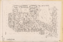
Item is sheet S.V. (South Vancouver) 23 of a City of Vancouver Surveys Branch sectional plan of Vancouver. Item shows area bounded by Vivian Street to Kerr Street and 45th Avenue to 54th Avenue.

Item is a map showing district lot, block, and lot numbers, and both current and former street names.

Item is a map showing wards, district lots, streetcar lines, railways, and names of businesses occupying waterfront sites on False Creek and Burrard Inlet.

Map of Granville Street, downtown Vancouver
Item is a map showing Granville Street from the Granville Street Bridge over False Creek in the southwest to the train yard and waterfront below Cordova Street in the northeast. Numbered city blocks on either side of the street are depicted, with numbers and occupants' names (including businesses) shown for most of the properties. The location of the publisher's office on Seymour Street is shown.

Part of City publications collection

Part of City publications collection

Part of City publications collection


Part of City publications collection
Part of City publications collection