Showing 11 results
Archival description11 results with digital objects Show results with digital objects
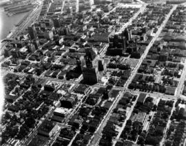
![[Aerial photograph of downtown Vancouver looking north]](/uploads/r/null/2/4/24032a0f19bc217e5bb533d7218824f932301e972f1020a352118b50afcf8a93/8e2450db-6794-4283-95a6-7641bc80437d-A69847_142.jpg)
[Aerial photograph of downtown Vancouver looking north]
![[View of] 555 Howe Street [after snow storm]](/uploads/r/null/4/2/429f9afdecfc8918791fb142cd48e010d86cbe39295b8ce9f089cc1a2fe58301/166dbacc-97e8-40d1-af8f-a5e626ea29ab-A59798_142.jpg)
[View of] 555 Howe Street [after snow storm]
![[Aerial view of Downtown Vancouver looking south from Burrard Inlet]](/uploads/r/null/3/2/32bc12be65a895f144d669768ee019e6abc83bc4018b11b3ecf96930fbd98786/024e645a-ce5d-4e73-a4e1-efb2ad9b7995-A71518_142.jpg)
[Aerial view of Downtown Vancouver looking south from Burrard Inlet]
![[View of downtown Vancouver from Burrard Inlet]](/uploads/r/null/2/2/227f3e3d1efc46952bc6af839b20a2240795e45197b4979434792a196b0de198/3696f49f-093e-41b3-9aa6-3d0385dc0805-A37857_142.jpg)
[View of downtown Vancouver from Burrard Inlet]
Aerial photo, oblique, downtown Vancouver

Aerial photo, oblique, False Creek, Vancouver
![[Aerial view of Vancouver]](/uploads/r/null/9/b/9b3acec26123edc53f11bf2f41f3286d09254ffea9918cd31b6715395ebe18d0/26473909-fe49-4474-8c3f-05eb1e8ab059-CVA1376-252_142.jpg)
[Aerial view of Vancouver]

Harbour skyline

Aerial photo, oblique, CPR docks in foreground, looking south Granville Street at centre

Aerial photo, oblique, downtown Vancouver to North Shore Mountains

Aerial photo, vertical, False Creek, Fairview to Kits Point