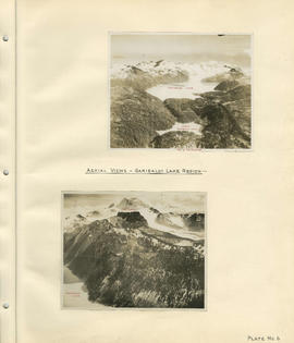
Aerial views - Garibaldi Lake region
- COV-S40-MAP 939-: LEG1153.039
- Item
- [1931]
Part of City of Vancouver fonds
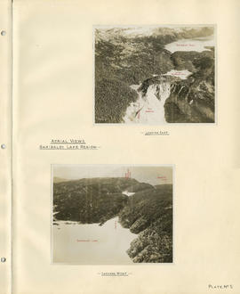
Aerial views - Garibaldi Lake region
Part of City of Vancouver fonds
Aerial views - Garibaldi Lake region
Part of City of Vancouver fonds
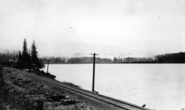
![Alouet [Alouette] Lake](/uploads/r/null/3/5/d/35d07e70a6eec4b2ed7d4908a502a02885bf1550b53911c59b0177c0661b72f7/61c2489d-499a-4835-bc4f-c9cb255d4683-CVA289-002_142.jpg)
Part of William Orson Banfield fonds
Part of William Orson Banfield fonds
Part of William Orson Banfield fonds

Part of William Orson Banfield fonds

A.S. Bailey : Duke of Portland Ranch, misc.


Aspen Grove, Merritt : highway, cattle, tree

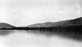
Board of Trade trip, Okanagan and Kootenays : Kalamalka Lake near Vernon
Part of William Orson Banfield fonds
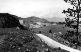
![Botahnie [Botanie] Lake](/uploads/r/null/c/0/e/c0e5167d9f8ec765ddc2598f76c81d19fce9c1a5427f92f4aa2910932c57f91d/1809a339-5297-44b7-8a1e-3386be98462e-2005-040_142.jpg)
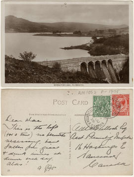
This postcard includes personal correspondence addressed to Culloch, Assistant Plumbing Inspector, of Vancouver.

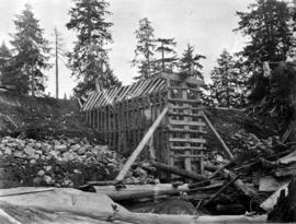
Burwell Lake, stream outlet from Burwell Lake before Dam was started
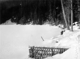
![Burwell Lake, view N[orth. W[est]. [north east?] along Dam face showing lake at its original wate...](/uploads/r/null/5/1/512924ce9846db6e812b5cd4146af1b202a8bf36b1f63f48d1666f0f3d6255b8/c56c1672-36d7-465d-afb4-dcc7bd262245-CVA275-28_142.jpg)

Burwell Lake, view of Crib Dam looking north
Burwell Lake, view of Dam face after completion of repairs
Burwell Lake, view of lake north side from Spillway
Burwell Lake, view of Spillway Dam showing leaks
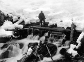
![Burwell Lake, view S[outh]. E[ast]. Along east shore of lake](/uploads/r/null/3/1/3151c8f33bc846f38da75ad100fc9be75a2c332d02c5769fd4431e74fb66bc89/0760f179-f6b4-43e4-915a-2947d9e55355-CVA275-29_142.jpg)
Burwell Lake, view S[outh]. E[ast]. Along east shore of lake
![Cascade M[oun]t[ain] from one of Vermillion Lakes](/uploads/r/null/2/6/9/269a3563be07eb362319f8e331d8510ccfb016dd3006f9d45370deb52b3a2597/4044b301-9dec-47c2-8d6d-e18ffa0727e3-CVA289-003_142.jpg)
Cascade M[oun]t[ain] from one of Vermillion Lakes
Part of William Orson Banfield fonds
Part of City of Vancouver fonds
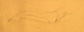
Item is a map showing the results of a preliminary survey of Cheakamus Lake and surrounding terrain. This map appears to be a draft of potions of the base map for MAP 1077.01, MAP 1077.02 and MAP 1119.

Part of City of Vancouver Archives technical and cartographic drawing collection
Map is a topographical plan showing a proposed hydroelectric development in the Cheakamus River area, between Garibaldi Lake and Daisy Lake, and a profile along the tunnel and pipeline route. Included on the map are Daisy Lake, Garibaldi Lake, Cheakamus River, various creeks, including Parnassus Creek and Scott Creek, bluffs, and ponds. Also indicated on the map are the locations of a pipeline, tunnel and tunnel intake, the Daisy Lake Trail and other trails, a construction shaft, proposed dam, proposed Daisy Lake Reservoir, and the power station for the Garibaldi-Daisy Lake Development. The map was created to accompany E.A. Cleveland's "Report on a Preliminary Investigation of the Cheakamus River Power Possibilities made for the City of Vancouver."

Part of City of Vancouver Archives technical and cartographic drawing collection
Map is a plan showing the location of power houses, dams and pipes for the Garibaldi-Daisy Lake development, Cheakamus Lake-McGuire, McGuire-Brandywine, Cheakamus Canyon and Daisy Lake Dam areas. Map created to accompany E.A. Cleveland's "Report on a Preliminary Investigation of the Cheakamus River Power Possibilities made for the City of Vancouver."

Part of City of Vancouver Archives technical and cartographic drawing collection
Map is a plan of the proposed development of the Cheakamus Lake for hydroelectric power. Includes a capacity diagram of Cheakamus Lake with dam at section A-B and a plan of the proposed dam site. The map also shows elevations and types of terrain. Map created to accompany E.A. Cleveland's "Report on a Preliminary Investigation of the Cheakamus River Power Possibilities made for the City of Vancouver." A note on the map reads "Traverse from Sta. 257-50 to Sta. 371-10 by C.W. Williams 1923, Cheakamus Lake from plan by Williams (1923) except soundings as shown." Map has been numbered Tube 56.

Part of City of Vancouver Archives technical and cartographic drawing collection
Map is a plan showing the location of power houses, dams and pipes for the Garibaldi-Daisy Lake development, Cheakamus Lake-McGuire, McGuire-Brandywine, Cheakamus Canyon and Daisy Lake Dam areas. Map created to accompany E.A. Cleveland's "Report on a Preliminary Investigation of the Cheakamus River Power Possibilities made for the City of Vancouver."

Chilliwack Lake scheme & Jones Lake scheme
Part of City of Vancouver fonds
Item is a map depicting proposed hydro-electric development north-west of Chilliwack Lake. The map shows the location so proposed dams, flumes, tunnels and the location of a power house on the Fraser River west of Jones Lake.
Part of City of Vancouver fonds
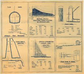
Item is an architectural drawing sheet with six drawings related to proposed hydro electric development on the Chilliwack River: Tunnel section; Spillway section-rock-filled timber crib dam at Chilliwack Lake; Tunnel intake; Tunnel outlet & surge tank; Diversion & storage dam; and Power house and tailrace. Each drawing includes cost and quantity estimates for construction materials.

Cultus Lake : misc., swimming, etc.
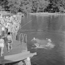
Cultus Lake : misc., swimming, etc.

Cultus Lake : misc., swimming, etc.

Cultus Lake : misc., swimming, etc.

Cultus Lake : misc., swimming, etc.
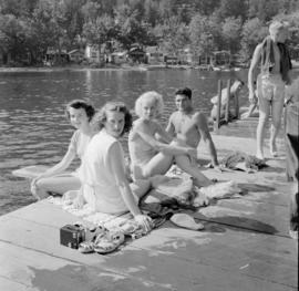
Cultus Lake : misc., swimming, etc.
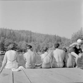
Cultus Lake : misc., swimming, etc.
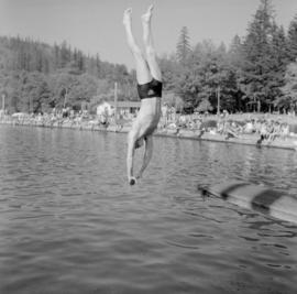
Cultus Lake : misc., swimming, etc.

Part of George Thompson fonds
Part of William Orson Banfield fonds
Part of William Orson Banfield fonds
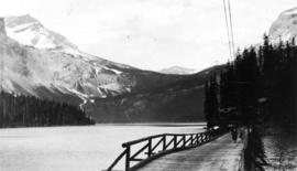
![[Emerald lake in the Rockies]](/uploads/r/null/5/1/51a84e42bc2ecf71331f39b617845a295a624b74cd6efeb00c96927713815a18/34c0aa3f-5ee9-445b-90f0-af00c30db1f0-A20180_142.jpg)

Eric C. Hamber standing on beach
Part of Hamber family fonds


Garibaldi Lake, Daisy Lake and Cheakamus River
Part of City of Vancouver fonds
Item is a sheet containing the following survey photographs: Stillwater below Daisy Lake; Looking up Cheakamus River from canyon dam site; Leakage from Garibaldi Lake through lava into Garibaldi Creek; Looking up-stream from near Cheakamus Canyon power station; Looking up Cheakamus River from P.G.E. Rlwy. bridge Mile 19.1; Looking up Cheakamus River to Daisy Lake dam site; Looking down Cheakamus river from canyon dam site.