![[Woman playing golf at Shaughnessy Golf Links]](/uploads/r/null/5/2/52b65cae32419a06b2aba969fbed264594e7bbeed9124465a60b584c831621c1/ee72f45e-c7ad-4a47-8d13-55633915a82f-A09373_142.jpg)
[Woman playing golf at Shaughnessy Golf Links]
- AM54-S4-: Park N17.1
- Item
- [192-?]
Part of Major Matthews collection
168 results with digital objects Show results with digital objects
[Woman playing golf at Shaughnessy Golf Links]
Part of Major Matthews collection
![[Woman playing golf at Shaughnessy Golf Links]](/uploads/r/null/b/6/b63922f1d6d5bcc74b9af9bd157207382cb6c45f937aef9c6e44d6d00646df26/7fe95cf0-004e-4707-b720-a4c9d9673aab-A09374_142.jpg)
[Woman playing golf at Shaughnessy Golf Links]
Part of Major Matthews collection
![[View of twelfth fairway at Jericho Country Club]](/uploads/r/null/3/b/3b8ae3229c028aa88763cf3d0ff86254e0ef0853ab07d82f1e7edd6e8a0d84fd/62c603b9-0509-4aa8-86c7-8adda931ffe7-A25809_142.jpg)
[View of twelfth fairway at Jericho Country Club]
Part of Major Matthews collection
![[View of the McCleery Golf Course]](/uploads/r/null/9/6/96df14f046a14a4e0224f3ea2b5453721a5bdc174c9b462be541a7c387f3e219/f1d2ba74-0f49-458e-ae1d-852090b479ce-A62553_142.jpg)
[View of the McCleery Golf Course]
Part of Major Matthews collection
![[View of the McCleery Golf Course]](/uploads/r/null/b/8/b81c4624512fd3c2615be45e96a60733dda76e878df09ad1afd308f0dfa3f9e7/7ebc6f76-e7a4-465d-a57c-6bd3b7553f59-A62551_142.jpg)
[View of the McCleery Golf Course]
Part of Major Matthews collection
![[View of the golf course visited by Douglas Haig, 1st Earl Haig (Field Marshal)]](/uploads/r/null/c/6/c65415563a46f76052ddc86e293c78207f18d9431dc67db6b0714850887544a9/deddc0ba-9eee-46a9-9876-09507b71027b-A60899_142.jpg)
[View of the golf course visited by Douglas Haig, 1st Earl Haig (Field Marshal)]
Part of Major Matthews collection
![[View of the fourth green at Jericho Country Club]](/uploads/r/null/3/8/38b9bf350dcbadfbea27cc83f81d07bd4e60ae6477733a440f028f4fb1222296/81464b53-e592-4f24-8133-afa598d68e27-A25808_142.jpg)
[View of the fourth green at Jericho Country Club]
Part of Major Matthews collection

View of the Capilano Golf Course
Part of Karl Haspel fonds
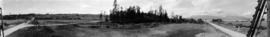
Part of Major Matthews collection
Photograph also shows Queen Mary school in the distance.
![[View of Granville Street and 37th from the 5200 block, Shaughnessy]](/uploads/r/null/4/7/474b6dcf8ef35087ef9b76000cfbe43c23bd03fbd291f22d3ab8f42be1c46994/34a9c2f5-a821-4376-85e7-c727125ccbbb-A63184_142.jpg)
[View of Granville Street and 37th from the 5200 block, Shaughnessy]
Part of Major Matthews collection
Photograph also shows the Shaughnessy Golf Club and Course far right.

Part of Karl Haspel fonds

Part of Karl Haspel fonds

Part of Karl Haspel fonds

Victoria : misc. beaches and golf courses

Victoria : misc. beaches and golf courses

Part of City of Vancouver Archives sound recording and moving image collection
Item is a documentary film documenting Stanley Park, downtown Vancouver, the Vancouver Planetarium, and Vanier Park. The film documents a number of attractions within Stanley Park including the Stanley Park Miniature Railway, Stanley Park Junction, various sections of the seawall, the Brockton Point Lighthouse, Coal Harbour Marina, Elek Imredy's sculpture Girl in a Wetsuit, the replica figurehead of the RMS Empress of Japan, tennis courts, Prospect Point lookout, Lost Lagoon, the Stanley Park Golf Course, totem poles, and the Lions Gate (First Narrows) Bridge (1938-). The film also includes footage of birds including Canada geese, seagulls, swans, mallard and wood ducks, and peacocks. The film documents Vancouver Harbour and its facilities, and includes footage of shipping containers, cranes, cargo ships, seabus, and a floatplane.
The film also documents downtown Vancouver and includes footage of numerous prominent buildings including the Marine Building, Vancouver Harbour Centre, Bayshore Inn, the Westcoast Energy Building, Hotel Vancouver, the Provincial Court House, Robson Square under construction, the Georgia Medical Dental Building, the Bank of Nova Scotia Tower, TD Tower, the Vancouver Block, Commodore Ballroom, Sun Tower, Dominion Building, Andrew Wesley Church, and the Hudson's Bay Company building. The film also contains night footage of the Vancouver skyline, Granville Street with illuminated signs, a fountain lit by coloured lights, and neon signs in Chinatown, including those for the Marco Polo Chinese Smorgasbord, Loon Foon Kwok restaurant, Ming's, South Seas Dining Lounge, Ho Inn Chop Suey, and Bing C. Wong & Associates Accounting and Taxation Service.
Film also includes footage of the exterior of the Bloedel Conservatory, a tugboat in False Creek, the downtown Vancouver skyline as viewed from Kitsilano, an old house (number 1160, street unknown), sailboats in English Bay, the Vancouver Planetarium, Vanier Park, and Beach Avenue as seen across False Creek from Vanier Park.
University Golf Club Vancouver : an outstanding public course and clubhouse
University Golf Club Vancouver
Item includes history of the club, new construction, list of facilities, tournament package.

Trees on Fraserview Golf Course

Totem pole, Stanley Park, golf course

Totem pole, Stanley Park, golf course

Totem pole, Stanley Park, golf course

Part of William Orson Banfield fonds

Part of William Orson Banfield fonds
![The gulf [at a golf course]](/uploads/r/null/8/7/9/8791d91fa2236934bb59df2e62ce944da29401b059795ea88ab826a7b7e19265/5713bb0a-f25a-4178-8a5f-fd50037cb484-CVA289-005_142.jpg)
Part of William Orson Banfield fonds

Part of William Orson Banfield fonds

Photograph shows depression adjacent to fairway where stream flows


Sketch plan showing suggested area for municipal golf links, Vancouver, B.C.
Item is a map showing layout of proposed golf course and topographic contour lines for the area bounded by Victoria Drive, Kerr Street, 59th Avenue, and Marine Drive.

Sheet W : Fraser River to French Street and Fifty-ninth Avenue to Seventy-first Avenue
Part of City of Vancouver Archives technical and cartographic drawing collection
Item is a section showing the area from Fraser River to French Street and Fifty-ninth Avenue to Seventy-first Avenue. Includes streets and roads; blocks, lots and legal descriptions; and parks and golf courses.
Vancouver (B.C.). Office of the City Engineer

Sheet W : Fraser River to French Street and Fifty-ninth Avenue to Seventy-first Avenue
Part of City of Vancouver Archives technical and cartographic drawing collection
Item is a section showing the area from the Fraser River to French Street and Fifty-ninth Avenue to Seventy-first Avenue. Includes streets, roads, blocks, lots, legal descriptions, parks and golf courses.
Vancouver (B.C.). Office of the City Engineer

Sheet W : Fraser River to French Street and Fifty-ninth Avenue to Seventy-first Avenue
Part of City of Vancouver fonds
Item is a section showing the area from Fraser River to French Street and Fifty-ninth Avenue to Seventy-first Avenue. Includes streets and roads; blocks, lots and legal descriptions; and parks and golf courses. Map is hand coloured to show tax sale property for sale, property with no water, street widening and drainage, replotting, reserved land for schools, reserved land for parks, sundry land, capital assets not including schools and parks, schools, and parks, as applicable.
Vancouver (B.C.). Office of the City Engineer

Sheet U : Churchill Street to Cambie Street and Forty-ninth Avenue to Park Drive
Part of City of Vancouver Archives technical and cartographic drawing collection
Item is a section showing the area from Churchill Street to Cambie Street and Forty-ninth Avenue to Park Drive. Includes streets and roads; blocks, lots and legal descriptions; and parks and golf courses.
Vancouver (B.C.). Office of the City Engineer

Sheet U : Churchill Street to Cambie Street and Forty-ninth Avenue to Park Drive
Part of City of Vancouver Archives technical and cartographic drawing collection
Item is a section showing the area from Churchill Street to Cambie Street and Forty-ninth Avenue to Park Drive. Includes streets, roads, blocks, lots, legal descriptions, parks and golf courses.
Vancouver (B.C.). Office of the City Engineer

Sheet T : Marine Crescent to Granville Street and Forty-ninth Avenue to Sixty-first Avenue
Part of City of Vancouver Archives technical and cartographic drawing collection
Item is a section showing the area from Marine Crescent to Granville Street and Forty-ninth Avenue to Sixty-first Avenue. Includes streets and roads; blocks, lots and legal descriptions; and parks and golf courses.
Vancouver (B.C.). Office of the City Engineer

Sheet T : Larch Street to Granville Street and Forty-ninth Avenue to Sixty-first Avenue
Part of City of Vancouver Archives technical and cartographic drawing collection
Item is a section showing the area from Larch Street to Granville Street and Forty-ninth Avenue to Sixty-first Avenue. Includes streets, roads, blocks, lots, legal descriptions, parks and golf courses.
Vancouver (B.C.). Office of the City Engineer

Sheet S.V. 4 : Ash Street to St. George Street and Fifty-first Avenue to Sixty-third Avenue
Part of City of Vancouver Archives technical and cartographic drawing collection
Item is a section showing the area from Ash Street to St. George Street and Fifty-first Avenue to Sixty-third Avenue. Includes streets, roads, blocks, lots, legal descriptions, parks, golf courses, hospitals and schools.
Vancouver (B.C.). Office of the City Engineer

Sheet S.V. 3 : Cambie Street to Prince Edward Street and Thirty-ninth Avenue to Fiftieth Avenue
Part of City of Vancouver Archives technical and cartographic drawing collection
Item is a section showing the area from Cambie Street to Prince Edward Street and Thirty-ninth Avenue to Fiftieth Avenue. Map shows streets, roads, blocks, lots and legal descriptions, and the locations of parks, schools, golf courses and Mountainview Cemetery.
Vancouver (B.C.). Office of the City Engineer

Sheet S.V. 17 : Jellicoe Street to Boundary Road and Sixty-third Avenue to Fraser River
Part of City of Vancouver Archives technical and cartographic drawing collection
Item is a section showing the area from Jellicoe Street to Boundary Road and Sixty-third Avenue to the Fraser River. Includes streets, roads, railway lines, blocks, lots, legal descriptions, parks and golf courses.
Vancouver (B.C.). Office of the City Engineer

Sheet S.V. 16 : Dawson Street to Boundary Road and Fiftieth Avenue to Sixty-third Avenue
Part of City of Vancouver Archives technical and cartographic drawing collection
Item is a section showing the area from Dawson Street to Boundary Road and Fiftieth Avenue to Sixty-third Avenue. Includes streets, roads, blocks, lots, legal descriptions, parks and golf courses.
Vancouver (B.C.). Office of the City Engineer

Sheet S.V. 12 : Fleming Street to Raleigh Street and Forty-eighth Avenue to Newport Avenue
Part of City of Vancouver Archives technical and cartographic drawing collection
Item is a section showing the area from Fleming Street to Raleigh Street and Forty-eighth Avenue to Newport Avenue. Includes streets, roads, blocks, lots, legal descriptions, parks, golf courses and schools. Annotations in pencil.
Vancouver (B.C.). Office of the City Engineer

Sheet S : Musqueam Reserve to Macdonald Street and Forty-ninth Avenue to Fraser River
Part of City of Vancouver Archives technical and cartographic drawing collection
Item is a section showing the area from Musqueam Reserve to Macdonald Street and Forty-ninth Avenue to the Fraser River. Includes streets and roads; blocks, lots and legal descriptions; and parks and golf courses.
Vancouver (B.C.). Office of the City Engineer

Sheet S : Musqueam Reserve to Macdonald Street and Forty-ninth Avenue to Fraser River
Part of City of Vancouver Archives technical and cartographic drawing collection
Item is a section showing the area from the Musqueam Reserve to Macdonald Street and Forty-ninth Avenue to Fraser River. Includes streets, roads, blocks, lots, and legal descriptions. Map indicates the locations of the Point Grey Golf and Country Club and the Celtic Cannery. Annotations in red ink.
Vancouver (B.C.). Office of the City Engineer

Sheet Q : Churchill Street to Cambie Street and Thirty-eighth Street to Forty-ninth Avenue
Part of City of Vancouver Archives technical and cartographic drawing collection
Item is a section showing the area from Churchill Street to Cambie Street and Thirty-eighth Street to Forty-ninth Avenue. Includes streets and roads; blocks, lots and legal descriptions; and schools and golf courses.
Vancouver (B.C.). Office of the City Engineer

Sheet Q : Churchill Street to Cambie Street and Thirty-eighth Street to Forty-ninth Avenue
Part of City of Vancouver Archives technical and cartographic drawing collection
Item is a section showing the area from Churchill Street to Cambie Street and Thirty-eighth Street to Forty-ninth Avenue. Includes streets, roads, blocks, lots, legal descriptions, parks, golf courses and schools. Annotations in pencil.
Vancouver (B.C.). Office of the City Engineer

Sheet P : Trafalgar Street to Granville Street and Thirty-ninth Avenue to Forty-ninth Street
Part of City of Vancouver Archives technical and cartographic drawing collection
Item is a section showing the area from Trafalgar Street to Granville Street and Thirty-ninth Avenue to Forty-ninth Street. Includes streets, roads, blocks, lots, legal descriptions, parks, golf courses, schools and community centres. Annotations in red pencil.
Vancouver (B.C.). Office of the City Engineer

Sheet O : Holland Street to Elm Street and Thirty-eighth Avenue to Forty-ninth Avenue
Part of City of Vancouver Archives technical and cartographic drawing collection
Item is a section showing the area from Holland Street to Elm Street and Thirty-eighth Avenue to Forty-ninth Avenue. Includes streets, roads and sewers; blocks, lots and legal descriptions; and golf courses, parks and schools.
Vancouver (B.C.). Office of the City Engineer

Sheet O : Holland Street to Elm Street and Thirty-eighth Avenue to Forty-ninth Avenue
Part of City of Vancouver Archives technical and cartographic drawing collection
Item is a section showing the area from Holland Street to Elm Street and Thirty-eighth Avenue to Forty-ninth Avenue. Includes streets, roads, blocks, lots, legal descriptions, parks, golf courses and schools. Annotations in ink and pencil.
Vancouver (B.C.). Office of the City Engineer

Sheet M : Granville Street to South Cambie Street and Twenty-seventh Avenue to Thirty-eighth Avenue
Part of City of Vancouver Archives technical and cartographic drawing collection
Item is a section showing the area from Granville Street to South Cambie Street and Twenty-seventh Avenue to Thirty-eighth Avenue. Includes streets, roads, blocks, lots, legal descriptions, parks, hospitals, golf courses, reservoirs and government buildings.
Vancouver (B.C.). Office of the City Engineer

Sheet M : Granville Street to Kersland Drive and Twenty-seventh Avenue to Thirty-eighth Avenue
Part of City of Vancouver fonds
Item is a section showing the area from Granville Street to Kersland Drive and Twenty-seventh Avenue to Thirty-eighth Avenue. Includes streets and roads; blocks, lots and legal descriptions; and golf courses, parks and government buildings. The map is hand coloured to show tax sale property for sale, property with no water, street widening and drainage, replotting, reserved land for schools, reserved land for parks, sundry land, capital assets not including schools and parks, schools, and parks, as applicable.