
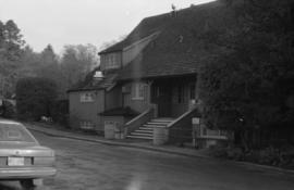
Historical : original appearance, Shaughnessy golf course
- AM1502-S1-2-: CVA 1502-282
- Item
- Feb. 1970
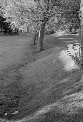
Historical : original appearance, Shaughnessy golf course
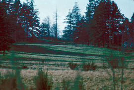
Historical : Shaughnessy golf course

Historical : original site, Shaughnessy Golf Course
![[Aerial view from helicopter] - Shaughnessy Golf Club House](/uploads/r/null/5/d/5/5d5d8792969484ccece23357dbd8823275df30c087900509f9ad9548c867dd0d/09e33ad9-ff16-4e4b-9552-5a181fd0d2dc-CVA160-23_142.jpg)
[Aerial view from helicopter] - Shaughnessy Golf Club House
Part of William Orson Banfield fonds
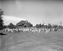
![Park tour, opening [of] Q.E. [Queen Elizabeth] Golf Course](/uploads/r/null/9/b/0/9b03903c0ebb9e780c8cd7c58f301b8aa5779b09c280a237f3449b86ff8e2dc2/0bb3eb60-3325-4ebf-8437-c5c231cc993a-CVA289-161_142.jpg)
Park tour, opening [of] Q.E. [Queen Elizabeth] Golf Course
Part of William Orson Banfield fonds
![Park tour, Q.E. [Queen Elizabeth] Golf Course, Rathie tees off](/uploads/r/null/8/5/a/85a5339734dd25c50dbd465a7cfd9712a78cb9c082b4a3f6bcd8579937b2103b/201cb627-30de-444c-af30-5a7acfaf28ad-CVA289-162_142.jpg)
Park tour, Q.E. [Queen Elizabeth] Golf Course, Rathie tees off
Part of William Orson Banfield fonds
![Park tour, Q.E. [Queen Elizabeth] Golf Course, Wainburn tees off](/uploads/r/null/3/1/6/31684c8eff04796ee32b4683e4de074e681a0ce6d2c96bdb62331b8c9d6e8bc3/f198013b-364f-4855-be3b-83f4c4ae71ee-CVA289-163_142.jpg)
Park tour, Q.E. [Queen Elizabeth] Golf Course, Wainburn tees off
Part of William Orson Banfield fonds
![Park tour, Rathie opening Q.E. [Queen Elizabeth] Golf Course](/uploads/r/null/1/c/8/1c888f5633fda80137cbbe8d41214d8c3652c0b661778542d13800b6a6444826/778abd4f-e53e-4bb6-a4b0-d9a49b0d1706-CVA289-164_142.jpg)
Park tour, Rathie opening Q.E. [Queen Elizabeth] Golf Course
Part of William Orson Banfield fonds
![Park tour, Rathie opening Q.E. [Queen Elizabeth] Golf Course](/uploads/r/null/5/0/7/507b65bb2c74e4090f9019b641f0a106def4dbcf372873456ae18765557d0f0b/e1ceb1e9-1e6a-4093-8a54-e959a6139e72-CVA289-165_142.jpg)
Park tour, Rathie opening Q.E. [Queen Elizabeth] Golf Course
Part of William Orson Banfield fonds
![Park tour, Q.E. [Queen Elizabeth] Golf Course, the first ball](/uploads/r/null/c/5/2/c5232d7cb6a179549691c53a6d57cdb149c692be5d65a74aa5070f5a86b82c15/e21407c2-255e-4ef5-92da-df56d829cc99-CVA289-168_142.jpg)
Park tour, Q.E. [Queen Elizabeth] Golf Course, the first ball
Part of William Orson Banfield fonds
![Park tour, Q.E. [Queen Elizabeth] Golf Course, first tee](/uploads/r/null/8/0/e/80e8d33d2645f41523fe8323b58c9b25b223a861a922b4ffae5dfd3ac40100ab/cdb524b6-3fd1-4bb4-8f7c-6d3ac58314b6-CVA289-169_142.jpg)
Park tour, Q.E. [Queen Elizabeth] Golf Course, first tee
Part of William Orson Banfield fonds
Part of Major Matthews collection
Oblique view showing the R.C.A.F. Jericho Air Station, the Jericho Golf Course, Locarno Beach, a boathouse, the Canadian Life Saving Association building and the houses at the foot of Imperial (Discovery) Street
![[View of the McCleery Golf Course]](/uploads/r/null/b/8/b81c4624512fd3c2615be45e96a60733dda76e878df09ad1afd308f0dfa3f9e7/7ebc6f76-e7a4-465d-a57c-6bd3b7553f59-A62551_142.jpg)
[View of the McCleery Golf Course]
Part of Major Matthews collection
![[View of the McCleery Golf Course]](/uploads/r/null/9/6/96df14f046a14a4e0224f3ea2b5453721a5bdc174c9b462be541a7c387f3e219/f1d2ba74-0f49-458e-ae1d-852090b479ce-A62553_142.jpg)
[View of the McCleery Golf Course]
Part of Major Matthews collection
Part of Major Matthews collection
Photograph shows an oblique view of R.C.A.F. Jericho Air Station at Locarno Beach and the Jericho golf course
Part of Major Matthews collection
Photograph shows an oblique view of R.C.A.F. Jericho Air Station at Locarno Beach, Jericho golf course and Imperial (Discovery) Street

Part of Major Matthews collection
Photograph shows an oblique view


Langara Golf Course - Field House, side
Part of City of Vancouver fonds

Langara Golf Course - Field House, front
Part of City of Vancouver fonds

Fraserview Golf Course, Field House
Part of City of Vancouver fonds
Fraserview Golf Course, Field House
Part of City of Vancouver fonds

Part of City of Vancouver fonds
Photograph shows area where stream believed to flow

Photograph shows depression adjacent to fairway where stream flows
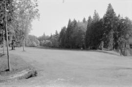


Trees on Fraserview Golf Course
Golf - B.C. Amateur Championships
Part of Stuart Thomson fonds
Negative envelope notes that the championship is on the Quilchena Golf Course.
![Marine [Drive] Golf and Country Club](/uploads/r/null/2/2/22dd7d67e047d71c0f207458004881b05bf22a940c8bddaaa2db847cb332fbf4/a7febf44-080b-476f-8dcf-0db0ea97ca43-A17196_142.jpg)
Marine [Drive] Golf and Country Club
Part of Stuart Thomson fonds

Pee Wee Golf Course - Cardero Street and Georgia Street
Part of Stuart Thomson fonds
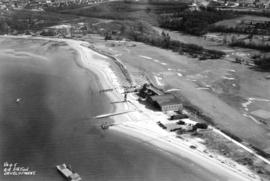
![[View of the fourth green at Jericho Country Club]](/uploads/r/null/3/8/38b9bf350dcbadfbea27cc83f81d07bd4e60ae6477733a440f028f4fb1222296/81464b53-e592-4f24-8133-afa598d68e27-A25808_142.jpg)
[View of the fourth green at Jericho Country Club]
Part of Major Matthews collection
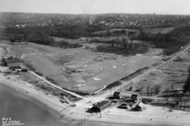
![[View of twelfth fairway at Jericho Country Club]](/uploads/r/null/3/b/3b8ae3229c028aa88763cf3d0ff86254e0ef0853ab07d82f1e7edd6e8a0d84fd/62c603b9-0509-4aa8-86c7-8adda931ffe7-A25809_142.jpg)
[View of twelfth fairway at Jericho Country Club]
Part of Major Matthews collection
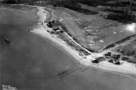
![[Land being cleared for the Shaughnessy Heights Golf Club]](/uploads/r/null/c/f/cfd21ea2d3777879cf1f21ddde4d3f72ea9c19e0afad7558b39aedab6547dce0/6d3cf00d-0514-4067-bec7-eb305ec3696a-A25885_142.jpg)
[Land being cleared for the Shaughnessy Heights Golf Club]
Part of Major Matthews collection

Sketch plan showing suggested area for municipal golf links, Vancouver, B.C.
Item is a map showing layout of proposed golf course and topographic contour lines for the area bounded by Victoria Drive, Kerr Street, 59th Avenue, and Marine Drive.
![City of Vancouver [park sites June/80]](/uploads/r/null/9/4/9484add7c4684ea3838e4d00ee8add3ecf85d78d5aa8fe2780cae273e59556a5/bd2464d8-2aa9-4501-aba6-8b3f7d130a42-MAP1032_142.jpg)
City of Vancouver [park sites June/80]
Part of City of Vancouver Archives technical and cartographic drawing collection
Map is a City Engineering Department base map of Vancouver, with parks hand-coloured in green. Shows city blocks and Canadian Pacific, Canadian National and Great Northern Railway lines. Golf courses, hospitals, schools, theatres and other structures are identified. "Metric Vancouver" and "Guide Map 15" appear in the bottom right corner of the map.

Part of City of Vancouver Archives technical and cartographic drawing collection
Map is a City Engineering Department base map of Vancouver, showing city blocks and Canadian Pacific, Canadian National and Great Northern Railway lines. Parks, golf courses, hospitals, schools, theatres and other structures are identified. "Guide Map 15" appears in the bottom right corner of the map.

Part of City of Vancouver Archives technical and cartographic drawing collection
Map is a City Engineering Department base map of Vancouver, showing city blocks and Canadian Pacific, Canadian National and Great Northern Railway lines. Parks, golf courses, hospitals, schools, theatres and other structures are identified. "Metric Vancouver" and "Guide Map 15" appear in the bottom right corner of the map.

City of Vancouver, British Columbia
Part of City of Vancouver Archives technical and cartographic drawing collection
Item is the eastern half of a map showing city blocks, transportation infrastructure, recreational facilities, hospitals, schools, theatres and other structures are identified. MAP 1036b is the western half of this map.
Vancouver (B.C.). Engineering Services

City of Vancouver, British Columbia
Part of City of Vancouver Archives technical and cartographic drawing collection
Item is the western half of a map showing city blocks, transportation infrastructure, recreational facilities, hospitals, schools, theatres and other structures are identified. MAP 1036 is the eastern half of this map.
Vancouver (B.C.). Engineering Services
Part of City of Vancouver Archives technical and cartographic drawing collection
Item is a sectional map of a portion of Vancouver showing the area from Musqueam Indian Reserve to Balaclava Street and Forty-ninth Avenue to Forty-first Avenue. Includes streets, blocks, lots and legal descriptions, and the locations of schools, parks and golf courses.

Part of City of Vancouver Archives technical and cartographic drawing collection
Item is a sectional map of a portion of Vancouver showing the area from Musqueam Indian Reserve to Macdonald Street and North Arm of the Fraser River to Forty-ninth Avenue. Includes streets, blocks, lots and legal descriptions, and golf courses.
![[Sheet 70 : Macdonald Street to Cypress Street and Fifty-seventh Avenue to Forty-ninth Avenue]](/uploads/r/null/f/9/f92d773f16070e3762b2b8519c7993087e55cec394d3c593367dd2f160a3e9ad/b01f6a8d-18a1-4872-b084-475fd79e81da-MAP339_142.jpg)
[Sheet 70 : Macdonald Street to Cypress Street and Fifty-seventh Avenue to Forty-ninth Avenue]
Part of City of Vancouver Archives technical and cartographic drawing collection
Item is a sectional map of a portion of Vancouver showing the area from Macdonald Street to Cypress Street and Fifty-seventh Avenue to Forty-ninth Avenue. Includes streets, blocks, lots and legal descriptions, and the locations of golf courses, parks and railways.
![[Sheet 75 : Nanaimo Street to Kerr Street and Bobolink Avenue to Forty-ninth Avenue]](/uploads/r/null/d/1/d14981939464fabe5e1b9488ecd26d62b3e16b1f4d1b8e00ece1bac6fa0dbdfa/a8e1d890-9726-473c-8f49-69d918d62d56-MAP339_142.jpg)
[Sheet 75 : Nanaimo Street to Kerr Street and Bobolink Avenue to Forty-ninth Avenue]
Part of City of Vancouver Archives technical and cartographic drawing collection
Item is a sectional map of a portion of Vancouver showing the area from Nanaimo Street to Kerr Street and Bobolink Avenue to Forty-ninth Avenue. Includes streets, blocks, lots and legal descriptions, and the locations of schools, parks and golf courses.
![[Sheet 79 : Gladstone Street to Kerr Street and North Arm of Fraser River to Bobolink Avenue]](/uploads/r/null/7/9/79214408afd85e4ab6ccc7eec43ecc85caf5ce5dedb9cfeb219866aa0091a733/7696de5a-3bba-4c2d-bc6c-83bf14bcf845-MAP339_142.jpg)
[Sheet 79 : Gladstone Street to Kerr Street and North Arm of Fraser River to Bobolink Avenue]
Part of City of Vancouver Archives technical and cartographic drawing collection
Item is a sectional map of a portion of Vancouver showing the area from Gladstone Street to Kerr Street and North Arm of Fraser River to Bobolink Avenue. Includes streets, blocks, lots and legal descriptions, and the locations of schools, golf courses and the Canadian Pacific Railway.
![[Sheet 88 : Macdonald Street to Angus Drive and Edgington Avenue to Fifty-seventh Avenue]](/uploads/r/null/5/9/595b991e091f624b5f74507db063dddb150624fbef03fe1d577f8d7a32bb9088/8afa1350-f31b-43bd-a14f-0ea9082c21fe-MAP339_142.jpg)
[Sheet 88 : Macdonald Street to Angus Drive and Edgington Avenue to Fifty-seventh Avenue]
Part of City of Vancouver Archives technical and cartographic drawing collection
Item is a sectional map of a portion of Vancouver showing the area from Macdonald Street to Angus Drive and Edgington Avenue to Fifty-seventh Avenue. Includes streets, blocks, lots and legal descriptions, and the locations of schools, parks and golf courses.

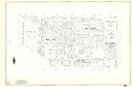
Sheet 66 : Musqueam Indian Reserve to Balaclava Street and Forty-ninth Avenue to Forty-first Avenue
Part of City of Vancouver Archives technical and cartographic drawing collection
Item is a section showing the area from Musqueam Indian Reserve to Balaclava Street and Forty-ninth Avenue to Forty-first Avenue. Includes streets, blocks, lots and legal descriptions, and the locations of schools, parks and golf courses.
Vancouver (B.C.). Engineering Services

Part of City of Vancouver Archives technical and cartographic drawing collection
Item is a section showing the area from Musqueam Indian Reserve to Macdonald Street and North Arm of the Fraser River to Forty-ninth Avenue. Includes streets, blocks, lots and legal descriptions, and golf courses.
Vancouver (B.C.). Engineering Services

Sheet 70 : Macdonald Street to Cypress Street and Fifty-seventh Avenue to Forty-ninth Avenue
Part of City of Vancouver Archives technical and cartographic drawing collection
Item is a section showing the area from Macdonald Street to Cypress Street and Fifty-seventh Avenue to Forty-ninth Avenue. Includes streets, blocks, lots and legal descriptions, and the locations of golf courses, parks and railways.
Vancouver (B.C.). Engineering Services

Sheet 75 : Nanaimo Street to Kerr Street and Bobolink Avenue to Forty-ninth Avenue
Part of City of Vancouver Archives technical and cartographic drawing collection
Item is a section showing the area from Nanaimo Street to Kerr Street and Bobolink Avenue to Forty-ninth Avenue. Includes streets, blocks, lots and legal descriptions, and the locations of schools, parks and golf courses.
Vancouver (B.C.). Engineering Services