
Aerial view of Camosun Park
Aerial view of Camosun Park
Aerial view of Camosun Park

Aerial view of Memorial West Park
Aerial view of Memorial West Park
Aerial view of Memorial West Park

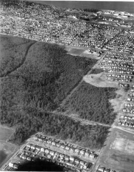
Aerial view of Musqueam Park
Aerial view of Musqueam Park
Aerial view of Musqueam Park
![[Aerial photograph of University of British Columbia Endowment Land area, showing some farm land]](/uploads/r/null/7/0/70e1f604470000e7a05baa46d299f27cb13e52173626249485a3a2586cb9f054/90b2a170-3763-41e7-a2ac-edba3984d880-A72733_142.jpg)
[Aerial photograph of University of British Columbia Endowment Land area, showing some farm land]
Aerial view of Camosun Park

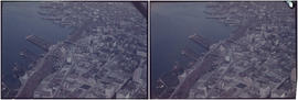
Vancouver looking east, aerial

Vancouver looking north, aerial
![Aerial shot [of Vancouver]](/uploads/r/null/c/c/0/cc035757f6056e5e389720ff3d3b0e7e6552cbc6be1f1c972742f757bcd3a956/83992969-d0c5-48e2-9424-c0c010dca053-2011-010_142.jpg)
Aerial shot [of Vancouver]
![Aerial shot [of Vancouver]](/uploads/r/null/f/c/c/fcc129728ab4d72f4aa71fbff5f147adfc18ef2cf52c9c185c735a3bba89e1ca/09c4738e-b929-489f-b40f-df3d3f14a14a-2011-010_142.jpg)
Aerial shot [of Vancouver]
![Aerial shot [of Vancouver]](/uploads/r/null/0/a/a/0aa98f09e32d52bf4e7b8c01bb2f0235468070788b009291a6b7a250fafeb0ab/02216a4e-d4d0-475e-b757-6d2d150fe4f3-2011-010_142.jpg)
Aerial shot [of Vancouver]
![Aerial shot [of Vancouver]](/uploads/r/null/d/f/9/df9c128ea494424f20f4032e34a27f6c3053e1c3d9b2864ada5a93bfcef3e447/ea869fe1-7d93-4477-bde8-81a38c461d15-2011-010_142.jpg)
Aerial shot [of Vancouver]
![Aerial shot [of Vancouver]](/uploads/r/null/6/2/0/62049c44c41e27f9fe84da5fb0c74b557386495259f6d5672986c10db795f7ba/64749fb0-a849-4863-ac34-8086bb1fbb5f-2011-010_142.jpg)
Aerial shot [of Vancouver]
![Aerial shot [of Vancouver]](/uploads/r/null/7/1/0/7103b7b5134535566200ccd1ab6019b45532c70ac1d912038736af953873f1a0/c079986f-cb08-40d2-86c5-7d1d311ebd89-2011-010_142.jpg)
Aerial shot [of Vancouver]
![Aerial shot [of Vancouver]](/uploads/r/null/c/1/0/c10af4f74e877231e7f762f21a3e7573025487ea7628e2203fa8059be348614d/c727b0e2-4b73-42fc-8beb-38999fa31ba2-2011-010_142.jpg)
Aerial shot [of Vancouver]
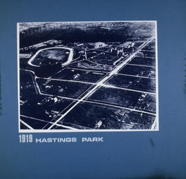
Hastings Park

1957 Aerial photos of BC Sugar

1957 Aerial photos of BC Sugar

1957 Aerial photos of BC Sugar

1957 Aerial photos of BC Sugar

Aerial photo of BC Sugar Refinery site

Aerial photograph of BC Sugar refinery and surrounding area

Aerial photograph of BC Sugar refinery and surrounding area

Aerial photograph of BC Sugar refinery and surrounding area
![Misc. items [1 of 30]](/uploads/r/null/5/a/5/5a53ff225a798d8ced445811bc411f83a049057ef739e2906d7536085522c195/daf0a703-1f7a-44a4-a9ba-acb927a42b76-2011-130_142.jpg)
Misc. items [1 of 30]
![L[as] V[egas] and Air Travel to Van. Airport - Sept, 1973 and UBC Japanese Garden](/uploads/r/null/7/2/3/7236623b840d44ebec7bcabd6c23aa2b980981867f038dd227a30268c6418fbe/3c0cf91f-ad59-4a4c-99ae-801a909b7a02-2012-010_142.jpg)
L[as] V[egas] and Air Travel to Van. Airport - Sept, 1973 and UBC Japanese Garden
![Vancouver, B.C. East of N. [north] End of Lion's Gate Br. [bridge]](/uploads/r/null/6/c/1/6c17477fe4843e6552e79e511c4a8ea7aeb8ec20926264b8101326b6d03700e6/f3eca68f-c724-4044-8bce-bb4d229a2568-2014-055_142.jpg)
Vancouver, B.C. East of N. [north] End of Lion's Gate Br. [bridge]
![Vancouver, B.C. N. [north] W. [west] of Burrard Bridge](/uploads/r/null/c/9/b/c9bc62f0498b0fd931c76b545c4eaaf97dd1b608f5d18f97f2f49f032f47eba1/65847175-475d-4b72-b005-c9bed2aa284d-2014-055_142.jpg)
Vancouver, B.C. N. [north] W. [west] of Burrard Bridge
![Vancouver, B.C. Cloverleaf - N. [north] End Granville Bridge](/uploads/r/null/a/1/c/a1ca23293aba4a0df735121e9f46a98d76eaf6d0141da0d7cf5437c9a109c4b6/1a0404fe-80ee-4ef0-8cae-911f5ab9c506-2014-055_142.jpg)
Vancouver, B.C. Cloverleaf - N. [north] End Granville Bridge
2nd Narrows Bridge under Construction
Woodward's New Development

Vancouver, B.C. Burrard Bridge
![Vancouver, B.C. N. [north] End Lion's Gate Bridge](/uploads/r/null/6/f/e/6feff36adf72e7a2b8184d907d1a619f3fb3c9d6f42e1f57abe09c79289129ac/51d5d38f-bf43-4380-8c69-4134019a091c-2014-055_142.jpg)
Vancouver, B.C. N. [north] End Lion's Gate Bridge

Vancouver, B.C. University of British Columbia
Vancouver, B.C. Docks

Woodward's New Development 1k.

Deas Island Tunnel, 1k.
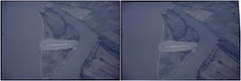
Deas Island Tunnel, 1k.
Deas Island Tunnel, 1k.

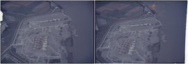
Annacis Island

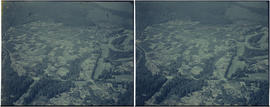
British properties
Vancouver Airport & Admin buildings

Ambleside & West Lion's Gate Bridge
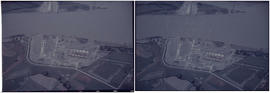
Deas Island Tunnel, 1k.
![Vancouver, B.C. Cambie Br. [bridge]](/uploads/r/null/d/a/9/da9942388ff02d1a8b65d1bfeb1c75a017e0cd4ae269e5557f50a4cb73df2adc/9b8ee4bb-f63f-4874-9e80-aeb2fd1058c2-2014-055_142.jpg)
Vancouver, B.C. Cambie Br. [bridge]

Vancouver, B.C. Seaforth Bar.
![Vancouver, B.C. Connaught Br. [Cambie Bridge] and west](/uploads/r/null/8/1/2/812afcfdc1ae047980e6d5f922d44782e2cc8b2e14671603fe495311c69a4120/22405b60-cda0-4fc6-bd59-01a4219b4892-2014-055_142.jpg)
Vancouver, B.C. Connaught Br. [Cambie Bridge] and west

Vancouver, B.C. University of British Columbia