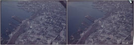
Aerial view of Downtown Vancouver, West End and Yaletown, with Granville Street Bridge and Burrard Street Bridge, and C.P.R. [Canadian Pacific Railway] train yards
Aerial view of Vancouver City Hall and residential housing, facing east, on Cambie Street
Aerial view of Mount Pleasant, False Creek, at Main Street and Terminal Avenue, with Canadian Central Station, Opsal Steel, Murrin Substation and Georgia Viaduct
Aerial view of False Creek, facing Mount Pleasant and Fairview, with Cambie Street Bridge, Vancouver General Hospital, Vancouver City Hall
Close aerial view of Vancouver City Hall, with Cambie Street and cars
Aerial view of Downtown Vancouver with Stanley Park, North Vancouver, West Vancouver, North Shore mountains and Burrard, Granville and Cambie Street bridges
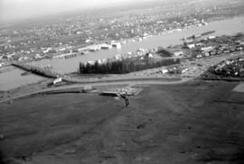
Aerial view of False Creek at 2nd Avenue with Cambie Street Bridge and Canadian Western Cooperage sawmill
Aerial view of False Creek at Stamp's Landing with Cambie Street Bridge and Heather Civic Marina and Yaletown Marina
Aerial view of Downtown Vancouver and False Creek, with Fairview, Stanley Park, Cambie Street Bridge, North Vancouver, Lions Gate Bridge, and law courts under construction
Aerial view of Downtown Vancouver and False Creek, between Burrard Street and Granville Street Bridge, with train bridge and Granville Island
Black and white (grainy) pre-1937
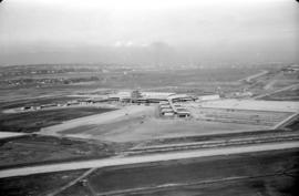
Aerial view of airport terminal, runways and approaches to Sea Island


![[Aerial view looking north over] Granville Island](/uploads/r/null/8/3/83f9be0a597100103c181fa4d68c68baa4a0802471126afafea3b7850103e12b/ea9e7fb6-7465-4fa6-8fa9-18923e3d9307-A49646_142.jpg)
![[Aerial view looking northwest towards the Downtown waterfront]](/uploads/r/null/c/c/cc62f979c7614b3405e2bfbfcd8cf6172232e958fc2dcd17a970dbbf3d28b4d8/4699d55d-d238-4161-854b-fa983bd7d738-A71613_142.jpg)
![[Aerial view looking west over Burnaby towards Vancouver]](/uploads/r/null/3/e/3ee0bad707202c9fbcaad91d585345ec93cbe9ec0be93643a8c82dd4f323bdde/1d10f88f-abea-4b79-b07a-e27dfe5d6cd0-A71608_142.jpg)
![[Aerial view of rail yard and industrial area]](/uploads/r/null/9/f/9f92989deb2b54597c6743bd67717653fc644c23b6fc48e55d2e1b9dbf6e8489/763b5a38-9eae-4b16-bedc-45ca5c32d888-A71602_142.jpg)
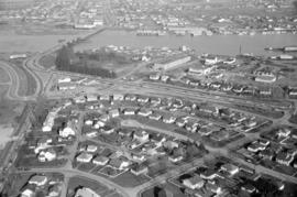
![[Aerial view of shopping centres]](/uploads/r/null/d/2/d21dcc14ced0356484b5666789f851fac68a175214b4718fae1444fec7417944/1f264270-6b68-43e6-be2e-f5b59df5d035-A71605_142.jpg)
![[Aerial view of Richmond Centre mall]](/uploads/r/null/2/e/2ee69f17353dd5eafd9d3c5d8d0ae7f95f74b5669c564c68a4c72ffafb9cda20/e0752fe7-4588-4c42-a25c-ef561bf4ed68-A71603_142.jpg)
![[Aerial view over Burnaby]](/uploads/r/null/3/3/331b6e68239af4202f445b5284f51f9a4cb22c20b12ed83ca8ea7f7333df1d07/025da952-0a47-40b0-8988-6a3f80af1576-A71612_142.jpg)
![Vancouver, B.C. N. [north] W. [west] of Burrard Bridge](/uploads/r/null/c/9/b/c9bc62f0498b0fd931c76b545c4eaaf97dd1b608f5d18f97f2f49f032f47eba1/65847175-475d-4b72-b005-c9bed2aa284d-2014-055_142.jpg)
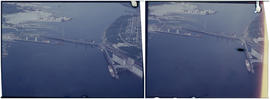
![Vancouver, B.C. N. [north] End Lion's Gate Bridge](/uploads/r/null/6/f/e/6feff36adf72e7a2b8184d907d1a619f3fb3c9d6f42e1f57abe09c79289129ac/51d5d38f-bf43-4380-8c69-4134019a091c-2014-055_142.jpg)