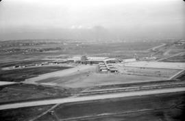
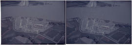
Aerial view of airport terminal, runways and approaches to Sea Island
Aerial view of Fraser River
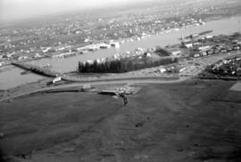
Aerial view of Fraser River

North Arm of Fraser River

University of British Columbia and Norman Mackenzie House

University of British Columbia and North Arm of the Fraser River

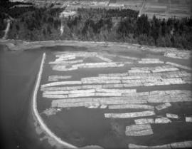
Log boom near northern mouth of the Fraser River

University Endowment Lands and log boom
UBC and log boom near northern mouth of the Fraser River

Burrard Inlet and University of BC

UBC and log boom near northern mouth of the Fraser River

Northern mouth of the Fraser River

Log boom in North Arm of Fraser River

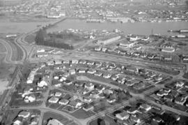
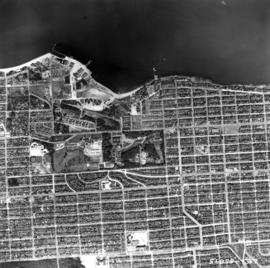
University Endowment Lands

University Endowment Lands

Aerial view of Vancouver and environs showing North Shore, Burrard Inlet, Vancouver and the Fraser River estuary and east.

Aerial photo, vertical, Exhibition Park, Vancouver

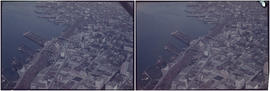
Aerial photo, oblique, CPR docks in foreground, looking south Granville Street at centre
Aerial photo, vertical, Jericho Beach Park and Kitsilano

Aerial photo, vertical, False Creek, Fairview to Kits Point

Aerial photo, vertical, Iona Island and Fraser River
![[Aerial view looking north over] Granville Island](/uploads/r/null/8/3/83f9be0a597100103c181fa4d68c68baa4a0802471126afafea3b7850103e12b/ea9e7fb6-7465-4fa6-8fa9-18923e3d9307-A49646_142.jpg)
[Aerial view looking north over] Granville Island
![[Aerial view looking northwest towards the Downtown waterfront]](/uploads/r/null/c/c/cc62f979c7614b3405e2bfbfcd8cf6172232e958fc2dcd17a970dbbf3d28b4d8/4699d55d-d238-4161-854b-fa983bd7d738-A71613_142.jpg)
[Aerial view looking northwest towards the Downtown waterfront]
![[Aerial view looking west over Burnaby towards Vancouver]](/uploads/r/null/3/e/3ee0bad707202c9fbcaad91d585345ec93cbe9ec0be93643a8c82dd4f323bdde/1d10f88f-abea-4b79-b07a-e27dfe5d6cd0-A71608_142.jpg)
[Aerial view looking west over Burnaby towards Vancouver]
![[Aerial view of rail yard and industrial area]](/uploads/r/null/9/f/9f92989deb2b54597c6743bd67717653fc644c23b6fc48e55d2e1b9dbf6e8489/763b5a38-9eae-4b16-bedc-45ca5c32d888-A71602_142.jpg)
[Aerial view of rail yard and industrial area]
![[Aerial view of shopping centres]](/uploads/r/null/d/2/d21dcc14ced0356484b5666789f851fac68a175214b4718fae1444fec7417944/1f264270-6b68-43e6-be2e-f5b59df5d035-A71605_142.jpg)
[Aerial view of shopping centres]
![[Aerial view of Richmond Centre mall]](/uploads/r/null/2/e/2ee69f17353dd5eafd9d3c5d8d0ae7f95f74b5669c564c68a4c72ffafb9cda20/e0752fe7-4588-4c42-a25c-ef561bf4ed68-A71603_142.jpg)
[Aerial view of Richmond Centre mall]
![[Aerial view over Burnaby]](/uploads/r/null/3/3/331b6e68239af4202f445b5284f51f9a4cb22c20b12ed83ca8ea7f7333df1d07/025da952-0a47-40b0-8988-6a3f80af1576-A71612_142.jpg)
[Aerial view over Burnaby]
![Vancouver, B.C. N. [north] W. [west] of Burrard Bridge](/uploads/r/null/c/9/b/c9bc62f0498b0fd931c76b545c4eaaf97dd1b608f5d18f97f2f49f032f47eba1/65847175-475d-4b72-b005-c9bed2aa284d-2014-055_142.jpg)
Vancouver, B.C. N. [north] W. [west] of Burrard Bridge
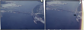
2nd Narrows Bridge under Construction
![Vancouver, B.C. N. [north] End Lion's Gate Bridge](/uploads/r/null/6/f/e/6feff36adf72e7a2b8184d907d1a619f3fb3c9d6f42e1f57abe09c79289129ac/51d5d38f-bf43-4380-8c69-4134019a091c-2014-055_142.jpg)
Vancouver, B.C. N. [north] End Lion's Gate Bridge

Vancouver, B.C. University of British Columbia
Vancouver, B.C. Docks

Woodward's New Development 1k.

Deas Island Tunnel, 1k.
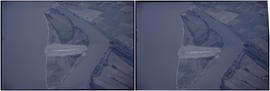
Deas Island Tunnel, 1k.

Annacis Island
Deas Island Tunnel, 1k.
![Vancouver, B.C. Connaught Br. [Cambie Bridge] and west](/uploads/r/null/8/1/2/812afcfdc1ae047980e6d5f922d44782e2cc8b2e14671603fe495311c69a4120/22405b60-cda0-4fc6-bd59-01a4219b4892-2014-055_142.jpg)
Vancouver, B.C. Connaught Br. [Cambie Bridge] and west
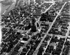
Aerial view of downtown Vancouver looking north along Granville Street

Aerial view of Brockton Point in Stanley Park looking south
![[View of] Dominion Mills, Ltd. South Vancouver, B.C.](/uploads/r/null/3/d/3df103cdd0c70f0cee1a01cdc4efef424d87ee1cc70cc1584551d8e4149d6e11/a0506029-def0-4762-b5d9-caf30483e8ab-CVA1376-25_142.jpg)
[View of] Dominion Mills, Ltd. South Vancouver, B.C.
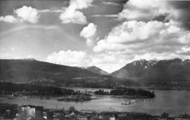
Mountain-girt Harbour

Sea Island airport, aerial photo, east
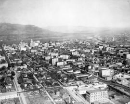
Aerial photo, oblique, downtown Vancouver

Aerial photo, oblique, False Creek, Vancouver

Aerial photo, oblique, downtown Vancouver to North Shore Mountains

Aerial photo, vertical, University of British Columbia and University Endowment Lands

Aerial photo, vertical, Deadman's Island, Coal Harbour and surrounding area
![[Aerial view looking west over Burnaby towards Vancouver]](/uploads/r/null/a/1/a1972aaa0fedf64a8da64c0a3f99647764ec26034813d610dc060d54afdfe1bf/0b1d7503-6b52-44de-a829-67274f54d77c-A71609_142.jpg)
[Aerial view looking west over Burnaby towards Vancouver]