![Vancouver, B.C. East of N. [north] End of Lion's Gate Br. [bridge]](/uploads/r/null/6/c/1/6c17477fe4843e6552e79e511c4a8ea7aeb8ec20926264b8101326b6d03700e6/f3eca68f-c724-4044-8bce-bb4d229a2568-2014-055_142.jpg)
Vancouver, B.C. East of N. [north] End of Lion's Gate Br. [bridge]
![Vancouver, B.C. N. [north] W. [west] of Burrard Bridge](/uploads/r/null/c/9/b/c9bc62f0498b0fd931c76b545c4eaaf97dd1b608f5d18f97f2f49f032f47eba1/65847175-475d-4b72-b005-c9bed2aa284d-2014-055_142.jpg)
Vancouver, B.C. N. [north] W. [west] of Burrard Bridge
![Vancouver, B.C. Cloverleaf - N. [north] End Granville Bridge](/uploads/r/null/a/1/c/a1ca23293aba4a0df735121e9f46a98d76eaf6d0141da0d7cf5437c9a109c4b6/1a0404fe-80ee-4ef0-8cae-911f5ab9c506-2014-055_142.jpg)
Vancouver, B.C. Cloverleaf - N. [north] End Granville Bridge
2nd Narrows Bridge under Construction
Woodward's New Development

Vancouver, B.C. Burrard Bridge
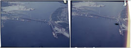
![Vancouver, B.C. N. [north] End Lion's Gate Bridge](/uploads/r/null/6/f/e/6feff36adf72e7a2b8184d907d1a619f3fb3c9d6f42e1f57abe09c79289129ac/51d5d38f-bf43-4380-8c69-4134019a091c-2014-055_142.jpg)
Vancouver, B.C. N. [north] End Lion's Gate Bridge

Vancouver, B.C. University of British Columbia
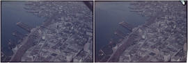
Vancouver, B.C. Docks

Woodward's New Development 1k.

Deas Island Tunnel, 1k.
Deas Island Tunnel, 1k.
Deas Island Tunnel, 1k.

Annacis Island

British properties
Vancouver Airport & Admin buildings

Ambleside & West Lion's Gate Bridge
Deas Island Tunnel, 1k.
![Vancouver, B.C. Cambie Br. [bridge]](/uploads/r/null/d/a/9/da9942388ff02d1a8b65d1bfeb1c75a017e0cd4ae269e5557f50a4cb73df2adc/9b8ee4bb-f63f-4874-9e80-aeb2fd1058c2-2014-055_142.jpg)
Vancouver, B.C. Cambie Br. [bridge]

Vancouver, B.C. Seaforth Bar.
![Vancouver, B.C. Connaught Br. [Cambie Bridge] and west](/uploads/r/null/8/1/2/812afcfdc1ae047980e6d5f922d44782e2cc8b2e14671603fe495311c69a4120/22405b60-cda0-4fc6-bd59-01a4219b4892-2014-055_142.jpg)
Vancouver, B.C. Connaught Br. [Cambie Bridge] and west

Vancouver, B.C. University of British Columbia
Aerial view of Pacific Terminal showing grain elevators and shipping containers in Vancouver Harbour
Aerial view of Pacific Terminal showing grain elevators and shipping containers in Vancouver Harbour
Aerial view of Pacific Terminal showing grain elevators and shipping containers in Vancouver Harbour
Aerial view of Pacific Terminal showing grain elevators and shipping containers in Vancouver Harbour
Aerial view of downtown Vancouver
Aerial view of downtown Vancouver
Aerial of Vancouver, B.C.
Aerial of Vancouver, B.C.
Aerial shot of the West End from over English Bay with Denman Street meeting Beach Avenue near the Old Boat House
Aerial shot of the West End from over English Bay with Denman Street meeting Beach Avenue near the Old Boat House
Summer 1982 - Aerial shot from the south side of False Creek before Expo
Summer 1982 - Aerial shot from the south side of False Creek before Expo
Aerial of Vancouver, B.C. [over False Creek]
Aerial of Vancouver, B.C. [over False Creek]
Aerial shot from over Stanley Park
Aerial shot from over Stanley Park

Vancouver looking north from 22nd Avenue
![[View of] Dominion Mills, Ltd. South Vancouver, B.C.](/uploads/r/null/3/d/3df103cdd0c70f0cee1a01cdc4efef424d87ee1cc70cc1584551d8e4149d6e11/a0506029-def0-4762-b5d9-caf30483e8ab-CVA1376-25_142.jpg)
[View of] Dominion Mills, Ltd. South Vancouver, B.C.
![[Aerial view of Vancouver]](/uploads/r/null/9/b/9b3acec26123edc53f11bf2f41f3286d09254ffea9918cd31b6715395ebe18d0/26473909-fe49-4474-8c3f-05eb1e8ab059-CVA1376-252_142.jpg)
[Aerial view of Vancouver]
![[Aerial view of fire at Vancouver sawmill]](/uploads/r/null/2/6/261c182ef20aa4aa00d0b46917096bf17c339730ec5975e81a6c1fbc2b63158f/05be5137-bdbf-42ad-a142-3e73d5538015-A71287_142.jpg)
[Aerial view of fire at Vancouver sawmill]
![[R.C.A.F. Maritime Air Command plane No. 102 flying over English Bay]](/uploads/r/null/1/3/13b6c7a118ed10801cfbe633df28806771f06f62a484edbf5de83c5acd20e0a4/ff8af309-b1af-4c30-9216-ba8a2859660d-A71302_142.jpg)
[R.C.A.F. Maritime Air Command plane No. 102 flying over English Bay]
![[Aerial photograph of downtown Vancouver looking north]](/uploads/r/null/2/4/24032a0f19bc217e5bb533d7218824f932301e972f1020a352118b50afcf8a93/8e2450db-6794-4283-95a6-7641bc80437d-A69847_142.jpg)
[Aerial photograph of downtown Vancouver looking north]
![[Aerial view of Downtown Vancouver looking south from Burrard Inlet]](/uploads/r/null/3/2/32bc12be65a895f144d669768ee019e6abc83bc4018b11b3ecf96930fbd98786/024e645a-ce5d-4e73-a4e1-efb2ad9b7995-A71518_142.jpg)
[Aerial view of Downtown Vancouver looking south from Burrard Inlet]
![[Aerial view of rail yard and industrial area]](/uploads/r/null/9/f/9f92989deb2b54597c6743bd67717653fc644c23b6fc48e55d2e1b9dbf6e8489/763b5a38-9eae-4b16-bedc-45ca5c32d888-A71602_142.jpg)
[Aerial view of rail yard and industrial area]
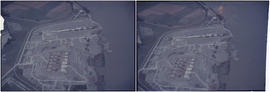
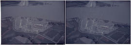
![[Aerial view of Richmond Centre mall]](/uploads/r/null/2/e/2ee69f17353dd5eafd9d3c5d8d0ae7f95f74b5669c564c68a4c72ffafb9cda20/e0752fe7-4588-4c42-a25c-ef561bf4ed68-A71603_142.jpg)
[Aerial view of Richmond Centre mall]
![[Aerial view of industrial area]](/uploads/r/null/5/d/5dd69372e15c5f349b4b4b8cdb7a12063cbbf02d158ab97d57ba863214b5c209/5f3baa69-a2f9-4adb-a590-4b420086d51d-A71604_142.jpg)
[Aerial view of industrial area]
![[Aerial view of shopping centres]](/uploads/r/null/d/2/d21dcc14ced0356484b5666789f851fac68a175214b4718fae1444fec7417944/1f264270-6b68-43e6-be2e-f5b59df5d035-A71605_142.jpg)
[Aerial view of shopping centres]
![[Aerial view of a shopping centre]](/uploads/r/null/1/5/156ef6b6f2bbd9391835c1b458d9e5fa7ba0e39f8fd2abeb2812e6ee46100008/a8e98ea8-442f-4d1a-acbf-ff2cc8319fa1-A71606_142.jpg)
[Aerial view of a shopping centre]
![[Aerial view of shopping centres]](/uploads/r/null/1/0/10ff59da2ba368988732f96fd1cd6e8fa091b0be501fa556439f7a93e5f7da6e/ac882c6d-a7cb-45e1-94f7-e89b0f645a16-A71607_142.jpg)
[Aerial view of shopping centres]
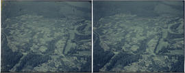
![[Aerial view looking west over Burnaby towards Vancouver]](/uploads/r/null/3/e/3ee0bad707202c9fbcaad91d585345ec93cbe9ec0be93643a8c82dd4f323bdde/1d10f88f-abea-4b79-b07a-e27dfe5d6cd0-A71608_142.jpg)
[Aerial view looking west over Burnaby towards Vancouver]
![[Aerial view looking west over Burnaby towards Vancouver]](/uploads/r/null/a/1/a1972aaa0fedf64a8da64c0a3f99647764ec26034813d610dc060d54afdfe1bf/0b1d7503-6b52-44de-a829-67274f54d77c-A71609_142.jpg)
[Aerial view looking west over Burnaby towards Vancouver]
![[Aerial view over Burnaby]](/uploads/r/null/0/3/037ecb1cc7577fad52b33cbaec0eaf096ffaba433660c44f741e17d03dfdfabd/2b0ca722-06fa-4545-9dc1-41843e30b8ec-A71610_142.jpg)
[Aerial view over Burnaby]
![[Aerial view over Burnaby]](/uploads/r/null/0/0/000c0196f6c810d76eb723bd8a3264ee3e43b53d6e32e7ad08a8e01e6712e7d7/75a245f8-8a3d-404d-bc50-219fadd7d908-A71611_142.jpg)
[Aerial view over Burnaby]
![[Aerial view over Burnaby]](/uploads/r/null/3/3/331b6e68239af4202f445b5284f51f9a4cb22c20b12ed83ca8ea7f7333df1d07/025da952-0a47-40b0-8988-6a3f80af1576-A71612_142.jpg)
[Aerial view over Burnaby]
![[Aerial view looking northwest towards the Downtown waterfront]](/uploads/r/null/c/c/cc62f979c7614b3405e2bfbfcd8cf6172232e958fc2dcd17a970dbbf3d28b4d8/4699d55d-d238-4161-854b-fa983bd7d738-A71613_142.jpg)
[Aerial view looking northwest towards the Downtown waterfront]
![[Aerial view looking over the Downtown waterfront]](/uploads/r/null/1/6/1644eebceda09466c9aac6a8534ea82b04164ab39d5d756ec4cc902d5ba16e30/d4c9f855-498d-4971-a368-0f672d3a89a4-A71614_142.jpg)
[Aerial view looking over the Downtown waterfront]