Print preview Close

Showing 224 results

Archival description
City of Vancouver Archives technical and cartographic drawing collection Schools
Print preview View:

212 results with digital objects Show results with digital objects

Vancouver, British Columbia : [urban analysis maps]

Maps show land use, land slope and elevation, density of buildings, structural material of buildings, height of buildings, water supply systems, sewage systems, electric power systems, gas trunk systems, population distribution, daytime population distribution, dwelling units, schools, hospitals and doctors, land transportation, port facilities, food manufacturing, textile manufacturing, wood product manufacturing, metal product manufacturing, transportation equipment manufacturing, non-metallic mineral and chemical products manufacturing, retail and wholesale food enterprises, retail and wholesale building materials enterprises, retail and wholesale drugs, general merchandise, apparel and accessories enterprises, retail and wholesale clothing and shoes enterprises, retail and wholesale furnishing enterprises and hotels and eating places in the Greater Vancouver area (including West Vancouver, North Vancouver, Vancouver, Burnaby, New Westminster, the northern portion of Richmond and the western portion of Coquitlam). Much of the data for these maps was derived from the 1961 census of Canada.

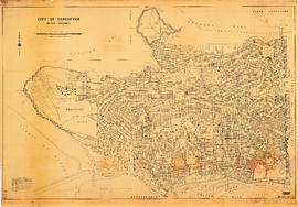
City of Vancouver

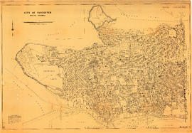
Map is a City Engineering Department base map of Vancouver, showing city blocks and Canadian Pacific, Canadian National and Great Northern Railway lines. Parks, golf courses, hospitals, schools, theatres and other structures are identified. "Metric Vancouver" and "Guide Map 15" appear in the bottom right corner of the map.

Sheet 5 : Slocan Street to Boundary Road and Seventeenth Avenue to Twenty-ninth Avenue

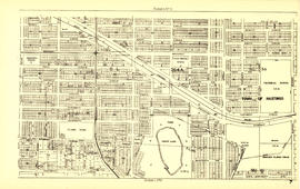
Item is a section showing the area from Slocan Street to Boundary Road and Seventeenth Avenue to Twenty-ninth Avenue. Includes streets and roads, blocks, lots, legal descriptions, railways, parks, schools and the Vancouver Preventorium (for tuberculosis patients).

Vancouver (B.C.). Office of the City Engineer

Sheet 7 : Clark Drive to Slocan Street and Seventh Avenue to Eighteenth Avenue

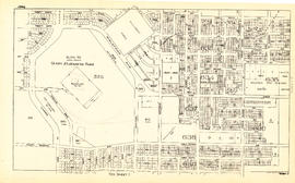
Item is a section showing the area from Clark Drive to Slocan Street and Seventh Avenue to Eighteenth Avenue. Includes streets and roads, blocks, lots, legal descriptions, railways, parks and schools. Some annotations have been made in green ink.

Vancouver (B.C.). Office of the City Engineer

Sheet 13 : Ontario Street to Clark Drive and First Avenue to Sixteenth Avenue

Item is a section showing the area from Ontario Street to Clark Drive and First Avenue to Sixteenth Avenue. Includes streets, roads, blocks, lots, legal descriptions, railways, parks and schools. Includes B.C. Electric Railway car barns.

Vancouver (B.C.). Office of the City Engineer

Sheet 14 : Main Street to Knight Street and Fifteenth Avenue to King Edward Street

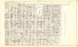
Item is a section showing the area from Main Street to Knight Street and Fifteenth Avenue to King Edward Street. Includes streets and roads, blocks, lots, legal descriptions, parks, schools and businesses.

Vancouver (B.C.). Office of the City Engineer

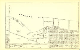
Sheet B : Imperial Street to Trutch Street and waterfront to Fourth Avenue

Item is a section showing the area from Imperial Street to Trutch Street and waterfront to Fourth Avenue. Includes streets, roads and sewers; blocks, lots and legal descriptions; and parks and schools. Map shows Jericho Air Station and crown leases.

Vancouver (B.C.). Office of the City Engineer

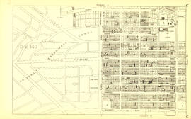
Sheet C : University Endowment Lands to Imperial Street and Fourth Avenue to Sixteenth Avenue

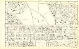
Item is a section showing the area from the University Endowment Lands to Imperial Street and Fourth Avenue to Sixteenth Avenue. Includes streets, roads, blocks, lots, legal descriptions, parks and schools.

Vancouver (B.C.). Office of the City Engineer

Sheet D : Imperial Street to Trutch Street and Fourth Avenue to Sixteenth Avenue

Item is a section showing the area from Imperial Street to Trutch Street and Fourth Avenue to Sixteenth Avenue. Includes streets and roads; blocks; lots and legal descriptions; and parks, schools and golf courses.

Vancouver (B.C.). Office of the City Engineer

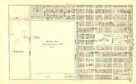
Sheet F : Wallace Street to Trafalgar Street and Sixteenth Avenue to Twenty-seventh Avenue

Item is a section showing the area from Wallace Street to Trafalgar Street and Sixteenth Avenue to Twenty-seventh Avenue. Includes streets, roads, blocks, lots, legal descriptions, parks and schools.

Vancouver (B.C.). Office of the City Engineer

Sheet J : University Endowment Lands to Wallace Street and Twenty-ninth Avenue to Thirty-eighth Avenue

Item is a section showing the area from the University Endowment Lands to Wallace Street and Twenty-ninth Avenue to Thirty-eighth Avenue. Includes streets, roads and sewers; blocks, lots and legal descriptions; and parks and schools.

Vancouver (B.C.). Office of the City Engineer

Sheet S.V. 15 : Dawson Street to Boundary Road and Foster Avenue to Fiftieth Avenue

Item is a section showing the area from Dawson Street to Boundary Road and Foster Avenue to Fiftieth Avenue. Includes streets, roads, blocks, lots, legal descriptions, parks and schools. Annotations in pencil.

Vancouver (B.C.). Office of the City Engineer

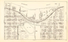
Sheet 1 : Slocan Street to Boundary Road and Triumph Street to Burrard Inlet

Item is a section showing the area bound by Slocan Street, Boundary Road, Triumph Street and the waterfront. Includes streets, roads, railways, blocks, lots, legal descriptions, quit claims, leases, parks and businesses along the waterfront.

Vancouver (B.C.). Office of the City Engineer

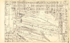
Sheet 11 : Carrall Street to Clark Drive and waterfront to Keefer Street

Item is a section showing the area from Carrall Street to Clark Drive and waterfront to Keefer Street. Includes streets and roads, blocks, lots, legal descriptions, railways, parks, schools, freight sheds, warehouses, piers and businesses along the waterfront.

Vancouver (B.C.). Office of the City Engineer

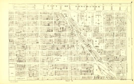
Sheet 12 : Ontario Street to Clark Drive and Keefer Street to Second Avenue

Item is a section showing the area from Ontario Street to Clark Drive and Keefer Street to Second Avenue. Includes streets, roads, blocks, lots, legal descriptions, railways, parks and schools. Includes Terminal Avenue and land used by the Great Northern Railway and the Canadian National Railway. Annotations in pencil.

Vancouver (B.C.). Office of the City Engineer

Sheet F : Wallace Street to Trafalgar Street and Sixteenth Avenue to Twenty-seventh Avenue

Item is a section showing the area from Wallace Street to Trafalgar Street and Sixteenth Avenue to Twenty-seventh Avenue. Includes streets and roads; blocks, lots and legal descriptions; and parks and schools.

Vancouver (B.C.). Office of the City Engineer

Sheet J : University Endowment Lands to Wallace Street and Twenty-seventh Avenue to Thirty-eighth Avenue

Item is a section showing the area from the University Endowment Lands to Wallace Street and Twenty-seventh Avenue to Thirty-eighth Avenue. Includes streets, roads and sewers; blocks, lots, and legal descriptions; and parks and schools.

Vancouver (B.C.). Office of the City Engineer

Sheet L : Trafalgar Street to Granville Street and Nanton Avenue to Thirty-eighth Avenue

Item is a section showing the area from Granville Street to South Cambie Street and Twenty-seventh Avenue to Thirty-eighth Avenue. Includes streets, roads, blocks, lots, legal descriptions, parks, golf courses and schools. Annotations in pencil.

Vancouver (B.C.). Office of the City Engineer

Sheet M : Granville Street to South Cambie Street and Twenty-seventh Avenue to Thirty-eighth Avenue

Item is a section showing the area from Granville Street to South Cambie Street and Twenty-seventh Avenue to Thirty-eighth Avenue. Includes streets, roads, blocks, lots, legal descriptions, parks, hospitals, golf courses, reservoirs and government buildings.

Vancouver (B.C.). Office of the City Engineer

Sheet X : South West Marine Drive to Ash Street and Fifty-ninth Avenue to Seventy-first Avenue

Item is a section showing the area from South West Marine Drive to Ash Street and Fifty-ninth Avenue to Seventy-first Avenue. Includes streets, roads, blocks, lots, legal descriptions, parks and schools.

Vancouver (B.C.). Office of the City Engineer

Sheet S.V. 2 : Cambie Street to St. George Street and Twenty-eighth Avenue to Thirty-eighth Avenue

Item is a section showing the area from Cambie Street to St. George Street and Twenty-eighth Avenue to Thirty-eighth Avenue. Map shows streets, roads, blocks, lots and legal descriptions and the locations of parks, schools, reservoirs and Mountainview Cemetery. Annotations in pencil.

Vancouver (B.C.). Office of the City Engineer

Sheet S.V. 4 : Ash Street to St. George Street and Fifty-first Avenue to Sixty-third Avenue

Item is a section showing the area from Ash Street to St. George Street and Fifty-first Avenue to Sixty-third Avenue. Includes streets, roads, blocks, lots, legal descriptions, parks, golf courses, hospitals and schools.

Vancouver (B.C.). Office of the City Engineer

Sheet 62 : Cypress Street to Oak Street and Forty-ninth Avenue to Forty-first Avenue

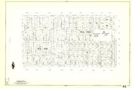
Item is a section showing the area from Cypress Street to Oak Street and Forty-ninth Avenue to Forty-first Avenue. Includes streets, blocks, lots and legal descriptions, and the locations of parks and schools.

Vancouver (B.C.). Engineering Services

Sheet 31 : Oak Street to Main Street and Sixteenth Avenue to Fourth Avenue and False Creek

Item is a section showing the area from Oak Street to Main Street and Sixteenth Avenue to Fourth Avenue and False Creek. Includes streets, blocks, lots and legal descriptions, and the locations of parks, schools and railways.

Vancouver (B.C.). Engineering Services

Sheet 35 : Rupert Street to Ardley Avenue and Grandview Highway to Fifth Avenue

Item is a section showing the area from Rupert Street to Boundary Road and Grandview Highway to Fifth Avenue. Includes streets, blocks, lots and legal descriptions, and the locations of schools and railways. Also included are streets, blocks and railways in the area from Boundary Road to Ardley Avenue in Burnaby.

Vancouver (B.C.). Engineering Services

Sheet 38 : Nanaimo Street to Rupert Street and Twenty-second Avenue to Grandview Highway

Item is a section showing the area from Nanaimo Street to Rupert Street and Twenty-second Avenue to Grandview Highway. Includes streets, blocks, lots and legal descriptions, and the locations of parks, schools and a preventorium (TB hospital).

Vancouver (B.C.). Engineering Services

Sheet 41 : Ontario Street to Inverness Street and Twenty-eighth Avenue to Sixteenth Avenue

Item is a section showing the area from Ontario Street to Inverness Street and Twenty-eighth Avenue to Sixteenth Avenue. Includes streets, blocks, lots and legal descriptions, and the locations of parks and schools.

Vancouver (B.C.). Engineering Services

Sheet 42 : Oak Street to Ontario Street and Twenty-eighth Avenue to Sixteenth Avenue

Item is a section showing the area from Oak Street to Ontario Street and wenty-eighth Avenue to Sixteenth Avenue. Includes streets, blocks, lots and legal descriptions, and the locations of parks and schools.

Vancouver (B.C.). Engineering Services

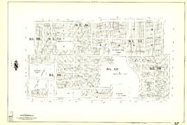
Sheet 57 : Nanaimo Street to Doman Street and Joyce Street and Forty-ninth Avenue to Forty-first Avenue

Item is a section showing the area from Nanaimo Street to Doman Street and Joyce Street and Forty-ninth Avenue to Forty-first Avenue. Includes streets, blocks, lots and legal descriptions, and the locations of parks and schools.

Vancouver (B.C.). Engineering Services

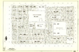
Sheet 59 : Quebec Street to Inverness Street and Forty-seventh Avenue to Thirty-seventh Avenue

Item is a section showing the area from Quebec Street to Inverness Street and Forty-seventh Avenue to Thirty-seventh Avenue. Includes streets, blocks, lots and legal descriptions, and the locations of parks, schools and Mountainview Cemetery.

Vancouver (B.C.). Engineering Services

Sheet 79 : Gladstone Street to Kerr Street and North Arm of Fraser River to Bobolink Avenue

Item is a section showing the area from Gladstone Street to Kerr Street and North Arm of Fraser River to Bobolink Avenue. Includes streets, blocks, lots and legal descriptions, and the locations of schools, golf courses and the Canadian Pacific Railway.

Vancouver (B.C.). Engineering Services

[Sheet 7 : Burrard Street to Main Street and Georgia Viaduct to Burrard Inlet]

Item is a sectional map of a portion of Vancouver showing the area from Burrard Street to Main Street and Georgia Viaduct to Burrard Inlet. Includes streets, blocks, lots and legal descriptions, and the locations of parks, beaches, schools, theatres, post office and Canadian Pacific Railway yards and piers.

[Sheet 27 : University Endowment Lands and Drummond Drive to Camosun Street and Fourteenth Avenue to Fourth Avenue]

Item is a sectional map of a portion of Vancouver showing the area from the University Endowment Lands and Drummond Drive to Camosun Street and Fourteenth Avenue to Fourth Avenue. Includes streets, blocks, lots and legal descriptions, and the locations of parks and schools.

[Sheet 35 : Rupert Street to Ardley Avenue and Grandview Highway to Fifth Avenue]

Item is a sectional map of a portion of Vancouver showing the area from Rupert Street to Boundary Road and Grandview Highway to Fifth Avenue. Includes streets, blocks, lots and legal descriptions, and the locations of schools and railways. Also included are streets, blocks and railways in the area from Boundary Road to Ardley Avenue in Burnaby.

Results 1 to 50 of 224