![Bayview [Elementary] School [at 2251 Collingwood Street]](/uploads/r/null/8/4/84146e68cd846eeeaae7e2bd5b42caedb758a2b24321969f1526b2cf31663f39/ec8a093d-2991-41d4-ae38-c216a26dc428-A58959_142.jpg)
Bayview [Elementary] School [at 2251 Collingwood Street]
![[Kitsilano] Ice Rink [at 2495 West 12th Avenue]](/uploads/r/null/e/b/eb721478621e4bda9a57c84a63bed97f2584c3d59a11c99b4a350144e51252bd/dc26c67f-7ca8-4fe5-807c-7e3c8c3c65dc-A58967_142.jpg)
[Kitsilano] Ice Rink [at 2495 West 12th Avenue]
![Simon Fraser [Elementary] School [at] 3185 Manitoba [Street]](/uploads/r/null/c/e/ceb7f0a743608fb0d43a03fedf7e0accac463f28944ff1fd2e6fb5ec70f58488/ec148232-5579-42c1-ac42-8a85607ed3de-A59091_142.jpg)
Simon Fraser [Elementary] School [at] 3185 Manitoba [Street]
![Shaughn[essy Elementary] School [at 4250 Marguerite Street]](/uploads/r/null/6/a/6af8bd8506d9332ec561ec9a2b132e98867e98b7d4c797370c6c707534cb8634/f3bdba72-facf-45ab-b3ab-e5a38a7d486e-A59154_142.jpg)
Shaughn[essy Elementary] School [at 4250 Marguerite Street]
![[The Vancouver] Chinese Public School [at] 499 E[ast] Pender [Street]](/uploads/r/null/9/a/9a4d898a4390e8a2cc895d51a65b2329c57ef923bce8139f2a23201e1392e2ce/dbe7f86b-7921-47b8-954b-5132f9ab67f3-A59159_142.jpg)
[The Vancouver] Chinese Public School [at] 499 E[ast] Pender [Street]

Sequoia sempervirens, Point Grey School
![Penticton [Street] and Broadway [intersection, 1 of 5]](/uploads/r/null/8/3/7/837e9102d30ac5961cb35e4422f69aa4f2db68d9391afd371d886ec33ca55131/a207c0a0-e6e7-48f0-a019-f542296a272c-2019-103.0822_142.jpg)
Penticton [Street] and Broadway [intersection, 1 of 5]
![[255 Dunlevy Avenue - Franciscan Sisters of the Atonement kindergarten]](/uploads/r/null/8/0/c/80c7f756ee8e0112f5e87a2034729f3e5999143d80daf61b1c8d9460e3511ea1/74da7436-833c-46cc-aa09-5119c36670e5-CVA1095-12444_142.jpg)
[255 Dunlevy Avenue - Franciscan Sisters of the Atonement kindergarten]
![[Sir William Dawson School, 2 of 20]](/uploads/r/null/5/7/0/570a8577312bcf3d5dee0cf747bc4ec6dad892bac92c0d3b59ee73f33e66359c/6cf6bb6e-2625-4385-906c-ace302c7e767-CVA1095-14400_142.jpg)
[Sir William Dawson School, 2 of 20]
![[Sir William Dawson School, 8 of 20]](/uploads/r/null/b/e/c/bec2592e6a4854f4e12f7618e97a381cca7733ab316e1a8eb69c35d26e1ede5f/dd6ac675-fa75-49f2-880f-fdd9de961732-CVA1095-14406_142.jpg)
[Sir William Dawson School, 8 of 20]
![[Sir William Dawson School, 9 of 20]](/uploads/r/null/8/3/1/831a3ab636dee5e1b181a6bf41ec66a646c2d8e1778bbfcedc3ba12baf606731/729a273c-2e7c-401f-a367-92d4838b8892-CVA1095-14407_142.jpg)
[Sir William Dawson School, 9 of 20]
![[Sir William Dawson School, 11 of 20]](/uploads/r/null/8/2/4/824e70a128ca4ad9fd26ed89193d16d6a2d4e2e234ab4d4f596b6944edc5b959/4921427d-bf19-4eac-acf6-c27e8d187bc6-CVA1095-14409_142.jpg)
[Sir William Dawson School, 11 of 20]
![[Sir William Dawson School, 15 of 20]](/uploads/r/null/0/5/3/053e56c487f873d155feb3e2135c00772ea6df96c0b22dcef775f6c9a6ec7c63/2d4d68e0-1553-4e57-8862-c47601976b1e-CVA1095-14413_142.jpg)
[Sir William Dawson School, 15 of 20]
![[Sir William Dawson School, 17 of 20]](/uploads/r/null/5/6/c/56c95ea0b607916d14ef9ece81c096204db6b757b7bf3867491ac38ecd161f86/15a94e16-95a3-4655-9e74-c764ffbfce40-CVA1095-14415_142.jpg)
[Sir William Dawson School, 17 of 20]
![[5350 East Boulevard - West Point Grey Secondary School, 1 of 2]](/uploads/r/null/0/5/c/05cfbef02ca60a6838f973c5a7a75c716afd9516bf497cf61d84f8f48effa058/3a2bbf4d-5cb4-47d9-9ce5-64929c622f4c-CVA1095-15269_142.jpg)
[5350 East Boulevard - West Point Grey Secondary School, 1 of 2]
![[499 East Pender Street - The Vancouver Chinese Public School, 1 of 3]](/uploads/r/null/3/2/5/32505cb465c7a69c744031d63c5a896e3ce34c052b29953bf573de48c84a9a30/5a5fec9c-9cf5-4660-bf28-096c72701824-CVA1095-15271_142.jpg)
[499 East Pender Street - The Vancouver Chinese Public School, 1 of 3]
![[499 East Pender Street - The Vancouver Chinese Public School, 2 of 3]](/uploads/r/null/4/3/7/437b976324dbfbc26eee13537888cd85f4f7065dd0c235cc1a324549c50c21ed/cf8de275-9412-408f-86e3-2750d70e7ec6-CVA1095-15272_142.jpg)
[499 East Pender Street - The Vancouver Chinese Public School, 2 of 3]
![[499 East Pender Street - The Vancouver Chinese Public School, 3 of 3]](/uploads/r/null/d/9/a/d9a53dc8a66539630d884812b0fea9615d8c7b1cce6610636c961f2d9a90509f/315e5242-c422-4a59-87f6-d50adcd69b75-CVA1095-15273_142.jpg)
[499 East Pender Street - The Vancouver Chinese Public School, 3 of 3]
![Strathcona/West End [School building]](/uploads/r/null/7/4/d/74d861fd4c0006e1fb37e0e374b1a8c7f061b28896159fee2e51ece03af8ba35/f668f430-40e1-42c3-8870-5675005dc86d-CVA1095-15388_142.jpg)
Strathcona/West End [School building]
![[Seymour School, 2 of 2]](/uploads/r/null/b/e/0/be086ae60f896cfe7f60261966b07eac427d9826b73423ade573576f1297b676/d962f47d-c16e-468e-939c-673a38308008-CVA1095-15395_142.jpg)
[Seymour School, 2 of 2]
![[500 East Pender Street - Lord Strathcona Elementary School, 4 of 4]](/uploads/r/null/2/a/b/2ab3126b54a1ea56aa9f0791aaaa25f95d407bc55707af05c620e69021b912b1/9f759a6e-f5b1-4dcd-9abf-9cf3b6c93685-CVA1095-13787_142.jpg)
[500 East Pender Street - Lord Strathcona Elementary School, 4 of 4]
![[1130 Keefer Street - Seymour Elementary School]](/uploads/r/null/e/5/c/e5cb222fac5a8adb22519a7296449b4dc4aaf4a4de1b7784a0b69d247c325048/5e79dd71-0158-44e3-9eac-820c430676df-CVA1095-13254_142.jpg)
[1130 Keefer Street - Seymour Elementary School]
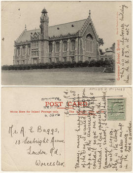
Grammar school, Bristol.
![Queen Elizabeth's [School] Sports Day 1958 & 1959](/uploads/r/null/4/1/418549/2bc4b4ca-1ddb-4490-a358-45b83809f2c6-V00234_142.jpg)
Queen Elizabeth's [School] Sports Day 1958 & 1959
![[School buidling]](/uploads/r/null/4/1/d/41d180811de4ef150e9fc20cbf7713ab4a27b51a03f02ed12164b22e4ad4b47f/8bca8e93-bc97-42e0-a7ad-fa3bccedcee8-CVA1095-08699_142.jpg)
[School buidling]
![Bayview School [group photograph]](/uploads/r/null/5/7/571b8afe7da55c7f099d52696be6bfb868e54ff58d193d8a0719fb50a21716f6/0ad008aa-ed5b-4423-8ab9-90abc2d35481-A59802_142.jpg)
Bayview School [group photograph]
![Bayview School [group photograph]](/uploads/r/null/b/9/b93ccc48c18d2949827ffb5c018527c33d15fc46a5fff67a4e5ced3f3930f1d8/1f53fe4a-2757-40ef-8e19-ab86702400d3-A59803_142.jpg)
Bayview School [group photograph]
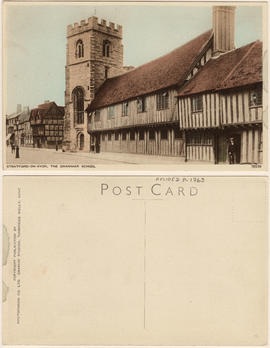
Stratford-on-Avon, The Grammar School

Open Air School at East 20th and Clark Drive with children on school grounds

First graduating class of the Vancouver School of Decorative and Applied Art
![City of Vancouver [park sites June/80]](/uploads/r/null/9/4/9484add7c4684ea3838e4d00ee8add3ecf85d78d5aa8fe2780cae273e59556a5/bd2464d8-2aa9-4501-aba6-8b3f7d130a42-MAP1032_142.jpg)
City of Vancouver [park sites June/80]

City of Vancouver, British Columbia

Sheet 9 : Clark Drive to Slocan Street and Triumph Street to Charles Street

Sheet 11 : Carrall Street to Clark Drive and waterfront to Keefer Street

Sheet 15 : Oak Street to Main Street and False Creek to Sixteenth Avenue

Sheet 21 : Burrard Street to False Creek and waterfront to Robson Street

Sheet E : University Endowment Lands to Wallace Street and Sixteenth Avenue to Twenty-seventh Avenue

Sheet K : Wallace Street to Trafalgar Street and Twenty-seventh Avenue to Thirty-eighth Avenue

Sheet Q : Churchill Street to Cambie Street and Thirty-eighth Street to Forty-ninth Avenue

Sheet 6 : Craddock Street to Boundary Road and Twenty-ninth Avenue to Fortieth Avenue

Sheet 16 : Maple Street to Oak Street and False Creek to Sixteenth Avenue

Sheet 7 : Clark Drive to Slocan Street and Seventh Avenue to Eighteenth Avenue

Sheet S.V. 14 : Duchess Street to Boundary Road and Twenty-ninth Avenue to Fortieth Avenue

Sheet 13 : Ontario Street to Clark Drive and First Avenue to Sixteenth Avenue

Sheet 15 : Oak Street to Main Street and False Creek to Sixteenth Avenue

Sheet 17 : Trutch Street to Maple Street and Fourth Avenue to Sixteenth Avenue

Sheet 23 : Stanley Park to Granville Street and Robson Street to False Creek

Sheet C : University Endowment Lands to Discovery Street and Fourth Avenue to Sixteenth Avenue

Sheet D : Discovery Street to Trutch Street and Fourth Avenue to Sixteenth Avenue

Sheet G : Trafalgar Street to Granville Street and Sixteenth Avenue to Nanton Avenue