![[View of] Downtown from Cambie Bridge](/uploads/r/null/9/5/9569782086f72e1216c2b4c9677babe70ef361e9008444790951403f3fbd32d3/af222087-669e-456f-980d-947447a9da81-A58781_142.jpg)
[View of] Downtown from Cambie Bridge
![[Night view of the West End and] downtown from Broadway at Stephens](/uploads/r/null/1/7/1780d2870a5034926f4da263ba69643bb411bcdb2050ce6a0dedad07de1bbb6d/8e84be38-3ea9-4e8b-ac8a-054c51742272-A58783_142.jpg)
[Night view of the West End and] downtown from Broadway at Stephens
![[View of buildings from] Hastings St[reet] at Granville [Street]](/uploads/r/null/c/2/c27a7826be7b3190205fc70c42e70a63dc7135c8703a763b83348842015f18bc/5d3a5c8f-e032-4b03-ba6d-129b36323885-A58826_142.jpg)
[View of buildings from] Hastings St[reet] at Granville [Street]
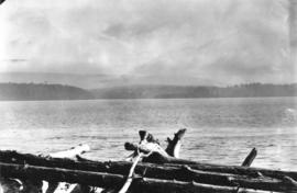
![[View of the entrance to Princess Louisa Inlet]](/uploads/r/null/1/4/14010d532ba587a29e79e7b835278f8ed0e3ed0d82b1f50147a97d7c012b034a/a643a0d7-57f0-48d5-9cec-0da01541a9fe-A33232_142.jpg)
[View of the entrance to Princess Louisa Inlet]
![[View of the lake bed prior to the opening of the Cleveland Dam]](/uploads/r/null/8/1/819128c707f9d8acf3c9abf8b4c28f4aada0d6b269cc7260d86ce4cbceac6043/e6b9fb65-b580-4308-a4d9-dc9d9d26a1c3-A33595_142.jpg)
[View of the lake bed prior to the opening of the Cleveland Dam]
![[View of the old McCleery home]](/uploads/r/null/e/5/e5b77ab9bd2b643b4c7a50791519d8d4be1d28dd82a08d3697cbad2b0954080e/de98e634-cdaf-4b70-a913-430c41217678-A34097_142.jpg)
[View of the old McCleery home]
![[View of the Union Steamship Company's S.S. "Chilco" docking at Selma Park]](/uploads/r/null/b/0/b0fec0dcabecfba92d5a75aae8ae60f5e73ea5bf70cac4a9515152b24f76608b/600ec7c8-593a-4006-8068-3093b8f0b0c7-A34056_142.jpg)
[View of the Union Steamship Company's S.S. "Chilco" docking at Selma Park]
![[View of Tofino]](/uploads/r/null/d/4/d4441e652dc32b3de52dd590d1d1c6a3d48f295010bcfa4d00b210aaadfd450e/c7a24a17-f772-4188-ae9b-800fab5e3360-A33867_142.jpg)
[View of Tofino]
![[View of tree stumps from the corner of 12th Avenue and Crown Street]](/uploads/r/null/b/4/b46306b5ca9bd13516353852a316fa079419824de41937d89065c29c0992a1ea/4c0f1f5c-1305-477e-84e5-b06450f49f67-A37077_142.jpg)
[View of tree stumps from the corner of 12th Avenue and Crown Street]
![[View of Vancouver from Brockton Point]](/uploads/r/null/f/a/faccb7ffd8899c4575efbc7fe8526b052ad52e140d1082bc00fa5a5d1597f7ea/be2271a1-9a6b-42f5-b151-9b6fa29ce75f-A43379_142.jpg)
[View of Vancouver from Brockton Point]
![[View of Vancouver from Deadman's Island]](/uploads/r/null/a/0/a0850ee76e9744cd984cc88ad876a42f4e3b3b6130acd98c12f10174e1808a99/bb8f847f-b5b8-42f4-a859-d2fe95c65441-A43305_142.jpg)
[View of Vancouver from Deadman's Island]
![[View of Vancouver from Queen Elizabeth Park]](/uploads/r/null/3/c/3cfa35e93d85743dd1ad48a86ce5f0b71bf08e45929ae6991b6d8813a2f44495/3e6e8c12-9a55-4194-8e18-db2a1af348a9-A43278_142.jpg)
[View of Vancouver from Queen Elizabeth Park]
![[View of Vancouver from Queen Elizabeth Park]](/uploads/r/null/6/4/64860f27993ee170af0c59a78956705df453012e6ddceee2c220602e88a6b204/46c722f6-1a90-415c-a497-c66971f613f1-A43279_142.jpg)
[View of Vancouver from Queen Elizabeth Park]
![[View of Vermillion River in Kootenay National Park]](/uploads/r/null/c/8/c8c364673e8a2c868a3312f032dd999c535c7afcb0dbe8035ae094b950e597c1/5a6c5f94-1058-4309-8353-804ffaa118f1-A34133_142.jpg)
[View of Vermillion River in Kootenay National Park]
![[View of Yale from across the river]](/uploads/r/null/d/8/d88bb63c674fa01155005f050b7f8d2ee6d5c424265116251dcf4dda08e4b73c/32c5ed3b-5b71-4c9d-8738-671a1fb58eef-A33844_142.jpg)
[View of Yale from across the river]
![[View of Yale]](/uploads/r/null/6/0/603bebe837d022132c503aab0838f5e41e9c988db14cb48fd1dba805ce645fdf/9c1de1e9-1953-4684-ac38-636c801816ae-A33944_142.jpg)
[View of Yale]
![[View of] Grenfell Town, N.W. T.](/uploads/r/null/b/e/bee0c721c311b997e7f43e14a83ada5316b67ce89962df27fbdb78d74f6f5e00/235512ad-119c-4ee6-90e8-27ec6603f05e-A08109_142.jpg)
[View of] Grenfell Town, N.W. T.
![[View overlooking Port Essington]](/uploads/r/null/a/0/a08ebb8be28e288cb44d6484102440b22aca7f987beb4046fc8ecb78606b8778/acf263c1-b159-4366-9b8b-37516d881418-A33120_142.jpg)
[View overlooking Port Essington]
![[Western view of Fairview from the tower of King Edward High School on 12th Avenue and Oak Street]](/uploads/r/null/5/7/57f78634c36cdc44896b928e95b888dc11481e391bcf511d52692a2ee6953e09/d4c21e48-ce87-44ed-8181-22199bd4fa93-A43281_142.jpg)
[Western view of Fairview from the tower of King Edward High School on 12th Avenue and Oak Street]
Banfield from Wizard Rocks

Barkerville, B.C.

Brockton Point Lighthouse, Stanley Park, Vancouver, B.C.

C.P.R. Hotel - Banff
![[View across Bedwell Bay towards Belvedere]](/uploads/r/null/9/9/9935ee617b9ed669654a537dd5d1913fde846fefbc9a4fd5d6e5cae1a674e01e/96c10272-ba9b-41a3-b618-d60c8aa1dbbb-A43387_142.jpg)
[View across Bedwell Bay towards Belvedere]
![[View across Burrard Inlet toward English Bay from the foot of Trafalgar Street]](/uploads/r/null/6/3/63dcc142e99746062de179b6facfab6fccd8a86241823bbab31d3191a9b5b7c3/c30444a3-8e5d-41dd-b170-5eb3a69913df-A23675_142.jpg)
[View across Burrard Inlet toward English Bay from the foot of Trafalgar Street]
![[View across the water of B.C. Pulp and Paper Company Limited's wood fibre plant]](/uploads/r/null/0/5/05837c82f8a519f1a126986c57f6fa48178886a16de88362db559556a46c33fa/c6aa009e-2ad2-4238-bfad-52e707d52bcd-A33197_142.jpg)
[View across the water of B.C. Pulp and Paper Company Limited's wood fibre plant]
![[View looking northwest from the Hotel Vancouver]](/uploads/r/null/b/d/bdcd8bdfd65db0aec0be20ca80cd505d4e9abaea4b65e0e32bceee2e94a3053d/a2dd39f2-eb73-48e8-adb2-527495ce047e-A43229_142.jpg)
[View looking northwest from the Hotel Vancouver]
![[View looking west across Burrard Inlet from Prospect Point]](/uploads/r/null/9/4/9466f7028c9e35c004cb74395044c2b524f80f22f80421b1414f7df1dcb411ce/fe974e47-33ec-4d54-bd74-29b5a4080162-A43378_142.jpg)
[View looking west across Burrard Inlet from Prospect Point]
![[View near Apodaca Cove on the East Coast of Bowen Island]](/uploads/r/null/b/d/bdf82d53412f5c572a5fa16eb42cd581c93d69e89bc96675e9b6eac29d6aca38/8522393d-2075-4821-9b53-ad5d531e6ac6-A33443_142.jpg)
[View near Apodaca Cove on the East Coast of Bowen Island]
![[View of a country village in Quebec]](/uploads/r/null/a/4/a4418d2b7d228b2e82c430f2fd4c88d64942b73bbe05bff15885b02a036ea1fe/7a94c279-af5a-4046-972d-521da414268a-A33157_142.jpg)
[View of a country village in Quebec]
![[View of a tallship in Burrard Inlet]](/uploads/r/null/9/2/92d00298fa2f6f6aaceff11fadb35afcecef231612bb1c633e506d729822cca9/9c26a667-3e50-450d-9658-b074c28e6052-A43313_142.jpg)
[View of a tallship in Burrard Inlet]
![[View of Brockton Point from Coal Harbour]](/uploads/r/null/b/7/b72d0a91686983254a010ebe842ea27b32eadba8c953cb2acd8e3a52c2e70d97/e56e3de6-bcf1-4351-a837-fba28bb4e755-A43327_142.jpg)
[View of Brockton Point from Coal Harbour]
![[View of Cape Scott Islands from Cape Scott]](/uploads/r/null/c/1/c1da592da9d4118e3adad565dc087f62970331ca631f8d3c1ef61f1550a996b1/8cce9039-3954-4190-9be6-14bca133a745-A33653_142.jpg)
[View of Cape Scott Islands from Cape Scott]
![[View of Cayoosh and Seton Creeks and Ample Mountain near Lillooet]](/uploads/r/null/5/7/57181e6ec6ec75550f5d52bf724b69c60ab23fb3e184c18707445f8ec0d83316/e07e6929-4ef7-44e8-8cd8-1259f4fc8030-A33603_142.jpg)
[View of Cayoosh and Seton Creeks and Ample Mountain near Lillooet]
![[View of Deadman's Island after being clear-cut of trees]](/uploads/r/null/0/d/0d52bc123aeaf44551a219dde291611efbf6a9f8b49e80e436cdbf33322e2eec/184b970b-6838-4854-bb67-7cd007564196-A43283_142.jpg)
[View of Deadman's Island after being clear-cut of trees]
![[View of Downtown from City Hall]](/uploads/r/null/6/b/6b60b736823fa512f4b8a1edde2ba364e9c95d1270efe8fdfb102298a81de48a/9c8443d5-d9bb-4803-bf6a-9e6ade54a4d6-A43277_142.jpg)
[View of Downtown from City Hall]
![[View of Fairview looking north from approximately 15th Avenue and Wolfe Avenue]](/uploads/r/null/e/a/eaab56faf0a7b092c1ac2f048adeb38e5f96c84432579614999510acdc002f6b/67ead65e-0e9b-403c-a1c7-ba225e406161-A37252_142.jpg)
[View of Fairview looking north from approximately 15th Avenue and Wolfe Avenue]
![[View of Fairview looking west from City Hall]](/uploads/r/null/d/8/d87892f743f488ae9a2f5003bc53c8a5f283417a8d4193ff9f894feec2d06564/ee474602-8f4a-4cf4-9f70-7a60fb4e7bad-A43291_142.jpg)
[View of Fairview looking west from City Hall]
![[View of Howe Sound from West Vancouver showing Hood Point, Bowyer Island and Whytecliffe]](/uploads/r/null/6/7/67562932d73e81a1eb4649431864ce783f7c20df7f3d066a345c0d5240f3f4ea/c298f1e1-fb66-4e56-8bcb-11686ae38da7-A09918_142.jpg)
[View of Howe Sound from West Vancouver showing Hood Point, Bowyer Island and Whytecliffe]
![[View of Howe Sound from West Vancouver]](/uploads/r/null/4/e/4e434b4da0159b0f9ddcc19828bf72e262bf6d490874b5b2ff13bc89ca870a41/241ac1d5-a75f-44bb-87e5-0a9a8802d021-A09920_142.jpg)
[View of Howe Sound from West Vancouver]
![[View of Kamloops]](/uploads/r/null/4/3/43435086d538d0ff283cf875220be110b869573cc8d36826664a3e9d175b25be/5bcb8e06-8535-4dab-a254-0b4165cc73bb-A34104_142.jpg)
[View of Kamloops]
![[View of Lillooet]](/uploads/r/null/5/0/50f146e9e439fcd3bf14d29759d31dd388474f6b6499911ed7cf6bf60240d3fc/0597e9d1-1aaf-4e27-85a7-e55da6328188-A33598_142.jpg)
[View of Lillooet]
![[View of Lord Roberts School from the corner of Davie Street and Cardero Street]](/uploads/r/null/d/c/dcb35a1971ab94bb28b39ad66936cd399d259b48f014b86732fff2bd8ccbc631/f04d98d2-2cce-400f-a91e-12f6aeac1f08-A36984_142.jpg)
[View of Lord Roberts School from the corner of Davie Street and Cardero Street]
![[View of Lytton, B.C.]](/uploads/r/null/4/5/45ea4d639a38dea8ce201bd93323fcd005cec0b67bcffd1ea6fe9e1807f6b7c3/56f7e832-fc76-41b1-b5c2-9c7226b5f0ae-A26918_142.jpg)
[View of Lytton, B.C.]
![[View of Mount Pleasant looking northeast from City Hall]](/uploads/r/null/0/0/00f3be8cb9dc06c9f844f78cf67bf5b62a3d09109caccd699ac683b4f47a90e4/a8fc3c83-fbc0-4050-8f98-ae95939608f6-A43292_142.jpg)
[View of Mount Pleasant looking northeast from City Hall]
![[View of Nelson]](/uploads/r/null/7/f/7f26f0064c8f037c8556e8409c7883c80d3f7a24cb54853273f3361b277bf771/ba00825f-26b7-4e30-8768-1b2b22751a04-A33558_142.jpg)
[View of Nelson]
![[View of New Westminster from across the river]](/uploads/r/null/8/f/8f82aebb4c849e2bb1f74b79994fab8be690ff186aaa671c5ae8a966dbdf8a2f/2ca5abb4-a6d5-443d-85bc-25dcc6f7e5bd-A33970_142.jpg)
[View of New Westminster from across the river]
![[View of North Vancouver from across Burrard Inlet]](/uploads/r/null/f/3/f3f3752f66509bf91857f1790e0ef7e59de6f1125cf77326c5529552883a1768/d3c54dd1-21f8-4c66-9168-2d130918fd9b-A32575_142.jpg)
[View of North Vancouver from across Burrard Inlet]
![[View of Parramatta]](/uploads/r/null/d/7/d7c81e17e3e441db22856c5444acc376ee1293019d778857780abc523aa6c148/094af9a5-9ba4-4efe-9dc8-df1bf65543ad-A33909_142.jpg)
[View of Parramatta]
![[View of Sea Otter Cove from Captain Peterson's residence]](/uploads/r/null/f/9/f9f2366c1aec33080b5f6cf621a8aeb3f8bedd459020f3686ad482800a4fd17a/c0c82b4d-0bd5-409b-915c-1a1968f8cf7b-A34041_142.jpg)
[View of Sea Otter Cove from Captain Peterson's residence]