
City of Vancouver, British Columbia : co-ordinate street index map 12
![City of Vancouver [park sites June/80]](/uploads/r/null/9/4/9484add7c4684ea3838e4d00ee8add3ecf85d78d5aa8fe2780cae273e59556a5/bd2464d8-2aa9-4501-aba6-8b3f7d130a42-MAP1032_142.jpg)
City of Vancouver [park sites June/80]

City of Vancouver

City of Vancouver

Vancouver, B.C. 1890 : built-on area

Railroad map of Greater Vancouver, British Columbia
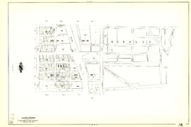
![[Sheet 7 : Burrard Street to Main Street and Georgia Viaduct to Burrard Inlet]](/uploads/r/null/c/d/cd235086cbaf81487b8784fb32b6ef913f4fe27305678cd1961adf506324c250/8f72f6bd-1013-48ad-a56c-e6269cb6f5a8-MAP339_142.jpg)
[Sheet 7 : Burrard Street to Main Street and Georgia Viaduct to Burrard Inlet]
![[Sheet 9 : Main Street to Clark Drive and Prior Street to Burrard Inlet]](/uploads/r/null/c/a/ca4b4713bea0118fec812e6258afe5c1efa039db74073214703001a47b00f122/5e0d243a-99ae-42aa-8bb3-4a1abe9e1209-MAP339_142.jpg)
[Sheet 9 : Main Street to Clark Drive and Prior Street to Burrard Inlet]
![[Sheet 21 : Homer Street to Main Street and Fourth Avenue to Georgia Viaduct]](/uploads/r/null/8/c/8c7ce2ae32274b3000b670b2a47c1114fd3c3faf20caeaef1a64c8137aab4f37/d256dda0-fa87-4985-97d6-ed6431e5a608-MAP339_142.jpg)
[Sheet 21 : Homer Street to Main Street and Fourth Avenue to Georgia Viaduct]
![[Sheet 29 : Balaclava Street to Maple Street and Fourteenth Avenue to Third Avenue]](/uploads/r/null/d/6/d672783fbbcdf46b6e25dc13c2f50caa22e19935f01490a9053af4afffc83c80/9a39458e-9f4b-43a8-a595-082419eecd5b-MAP339_142.jpg)
[Sheet 29 : Balaclava Street to Maple Street and Fourteenth Avenue to Third Avenue]
![[Sheet 35 : Rupert Street to Ardley Avenue and Grandview Highway to Fifth Avenue]](/uploads/r/null/b/9/b99ee96b798b34d2651dd213f0a858725b96bd6d586dd8d3701744c75c085139/a2e07931-8625-4adb-a51a-547f78416127-MAP339_142.jpg)
[Sheet 35 : Rupert Street to Ardley Avenue and Grandview Highway to Fifth Avenue]
![[Sheet 40 : Inverness Street to Nanaimo Street and Twenty-second Avenue to Thirteenth Avenue]](/uploads/r/null/9/3/9367a0c50f6fa513d717a1972b1bac72acde6d41b002fefcf48ddbd8c8122e8a/c7bfac0b-bf44-441b-b059-fd7bbc0bd4a0-MAP339_142.jpg)
[Sheet 40 : Inverness Street to Nanaimo Street and Twenty-second Avenue to Thirteenth Avenue]

[Sheet 55 : Cecil Street and McHardy Street to Patterson Avenue and Kingsway to Monmouth Avenue and Price Street]
![[Sheet 56 : Doman Street and Joyce Street to Boundary Road and Forty-ninth Avenue to Kingsway]](/uploads/r/null/5/e/5ee0f6b78ce9f3b0e0e39795d6220cd37d587872bad7b41b67f4d29c7cb49d4c/f8a321d6-ea4f-4e1f-85da-6d12e149ea85-MAP339_142.jpg)
[Sheet 56 : Doman Street and Joyce Street to Boundary Road and Forty-ninth Avenue to Kingsway]
![[Sheet 78 : Kerr Street to Ivy Avenue and North Arm of Fraser River to Southeast Marine Drive]](/uploads/r/null/9/0/90c6186a1aa17588ec162078d412440a826f55dc10a9d49f8e74df97a4d3ff6e/0a3e4f49-3d6d-4dec-95f1-08aa42e666d8-MAP339_142.jpg)
[Sheet 78 : Kerr Street to Ivy Avenue and North Arm of Fraser River to Southeast Marine Drive]

[Sheet 82 : Main Street to Tipping Road and Crompton Street and Twigg Island to Southeast Marine Drive]

City of Vancouver, British Columbia
![[Sheet 6 : Nicola Street to Beatty Street and English Bay Beach to Georgia Street]](/uploads/r/null/f/2/f2effc97084427c0bd73bae3566d3ad910caaa6e7fb3e5ed9f3ece81bd2ac0a1/f2cc48a6-1195-4dd8-8227-71d36d1791bb-MAP339_142.jpg)
[Sheet 6 : Nicola Street to Beatty Street and English Bay Beach to Georgia Street]
![[Sheet 12 : Nanaimo Street to Cassiar Street and Pender Street to McGill Street]](/uploads/r/null/6/0/603c1cdc3adb1f0dec963bbd885c378ce1e23c71767cb0b461ef6ccc54807a5a/49483dc1-d90f-4a82-86cd-3c7a09f2ddae-MAP339_142.jpg)
[Sheet 12 : Nanaimo Street to Cassiar Street and Pender Street to McGill Street]
![[Sheet 16 : Rupert Street to Gilmore Avenue and Fifth Avenue to Kitchener Street]](/uploads/r/null/6/2/6247d4ce631b144e891bbf078d02b8397e56f53625f45e0c464d4bc0e213b752/d68185e8-9db3-488c-a115-03184f2e1941-MAP339_142.jpg)
[Sheet 16 : Rupert Street to Gilmore Avenue and Fifth Avenue to Kitchener Street]
![[Sheet 33 : Clark Drive to Nanaimo Street and Thirteenth Avenue to Second Avenue]](/uploads/r/null/5/e/5ef811f96e8c284708c2b73dafde35219a65ddca967ebd7473adfc3e76a171d6/a1b4e29f-54ea-431a-8eff-df608d7e60ff-MAP339_142.jpg)
[Sheet 33 : Clark Drive to Nanaimo Street and Thirteenth Avenue to Second Avenue]
![[Sheet 39 : Kingsway and Nanaimo Street to Rupert Street and Ward Street to Twenty-second Avenue]](/uploads/r/null/0/4/0409c276b1c046750a9680e1310ce46ec18fce0f1dfc928aab80fbe273730918/665972e9-723b-462b-b30f-95f1484b2c51-MAP339_142.jpg)
[Sheet 39 : Kingsway and Nanaimo Street to Rupert Street and Ward Street to Twenty-second Avenue]
![[Sheet 79 : Gladstone Street to Kerr Street and North Arm of Fraser River to Bobolink Avenue]](/uploads/r/null/7/9/79214408afd85e4ab6ccc7eec43ecc85caf5ce5dedb9cfeb219866aa0091a733/7696de5a-3bba-4c2d-bc6c-83bf14bcf845-MAP339_142.jpg)
[Sheet 79 : Gladstone Street to Kerr Street and North Arm of Fraser River to Bobolink Avenue]
![[Sheet 8 : Main Street to Clark Drive and Alexander Street to Burrard Inlet]](/uploads/r/null/a/1/a10fe461f7836acc659d886d1888eef9d17bfc99d33e474c29ae025ed531b50c/e81d36a6-a6c1-40a5-852b-ef52bfbdb8dd-MAP339_142.jpg)
[Sheet 8 : Main Street to Clark Drive and Alexander Street to Burrard Inlet]
![[Sheet 11 : Wall Street to Rupert Street and McGill Street to Burrard Inlet]](/uploads/r/null/e/b/eb84fb8de9ca2e1644a2e39bcbaad5253c563e8716cf25114e675fb7d40365ea/0935fb81-4662-411a-bdfd-c9823c7fb82b-MAP339_142.jpg)
[Sheet 11 : Wall Street to Rupert Street and McGill Street to Burrard Inlet]
![[Sheet 30 : Maple Street to Oak Street and Fourteenth Avenue to Third Avenue and False Creek]](/uploads/r/null/2/f/2f9cbcb3930282909d8a62f01384c5c21cf803594c41529ced8de9bed70e9575/e94bfa39-bc0b-46aa-9bdd-b2c0b97f5eba-MAP339_142.jpg)
[Sheet 30 : Maple Street to Oak Street and Fourteenth Avenue to Third Avenue and False Creek]
![[Sheet 32 : Main Street to Clark Drive and Sixteenth Avenue to Great Northern Way]](/uploads/r/null/1/2/1275197193b0488ed8a599413ce061f9bd30140e8bcc64728b9f05c994d8909a/718a0877-7ea9-4090-a67c-7e61c28e238e-MAP339_142.jpg)
[Sheet 32 : Main Street to Clark Drive and Sixteenth Avenue to Great Northern Way]
![[Sheet 44 : Blenheim Street to Arbutus Street and King Edward Avenue to Fourteenth Avenue]](/uploads/r/null/2/f/2fdf5060ec6fdc47756dc75416312dd42047abea2beed2d99f086c73bd0c8726/2fe0f45d-ad6c-46e6-9a9f-50c795523f5f-MAP339_142.jpg)
[Sheet 44 : Blenheim Street to Arbutus Street and King Edward Avenue to Fourteenth Avenue]

City of Vancouver, British Columbia
![[Sheet 13 : Rupert Street to Gilmore Avenue and Eton Street to Burrard Inlet]](/uploads/r/null/f/0/f03aaa2671556fb722cf612a9736c0a6b919aff4af5a9dbe048dd93863af5773/30eb2a4c-b404-4552-81da-7461e4aacfaa-MAP339_142.jpg)
[Sheet 13 : Rupert Street to Gilmore Avenue and Eton Street to Burrard Inlet]
![[Sheet 22 : Maple Street to Drake Street and Fourth Avenue to Thurlow Street]](/uploads/r/null/4/2/42281b3ab55033f1c62b4ea532ffecc218f82690d1735cd3bb58cfbb1c9a5424/cb682ac6-121a-4bac-99a4-5470e73d38f4-MAP339_142.jpg)
[Sheet 22 : Maple Street to Drake Street and Fourth Avenue to Thurlow Street]
![[Sheet 34 : Nanaimo Street to Rupert Street and Fifth Avenue to Grandview Highway]](/uploads/r/null/4/d/4dec0865cb529d2b3586764b85cb4fe3474714725cb43f9b355eec779ad8162d/6493e9ac-b956-4a83-88fc-b8d6c13efcdf-MAP339_142.jpg)
[Sheet 34 : Nanaimo Street to Rupert Street and Fifth Avenue to Grandview Highway]
![[Sheet 70 : Macdonald Street to Cypress Street and Fifty-seventh Avenue to Forty-ninth Avenue]](/uploads/r/null/f/9/f92d773f16070e3762b2b8519c7993087e55cec394d3c593367dd2f160a3e9ad/b01f6a8d-18a1-4872-b084-475fd79e81da-MAP339_142.jpg)
[Sheet 70 : Macdonald Street to Cypress Street and Fifty-seventh Avenue to Forty-ninth Avenue]

Sheet 12 : Nanaimo Street to Cassiar Street and Pender Street to McGill Street

Sheet 20 : Main Street to Clark Drive and Great Northern Way to Prior Street

Sheet 29 : Balaclava Street to Maple Street and Fourteenth Avenue to Third Avenue

Sheet 31 : Oak Street to Main Street and Sixteenth Avenue to Fourth Avenue and False Creek

Sheet 35 : Rupert Street to Ardley Avenue and Grandview Highway to Fifth Avenue

Sheet 49 : Arbutus Street to Oak Street and Thirty-third Avenue to Laurier Avenue

Sheet 79 : Gladstone Street to Kerr Street and North Arm of Fraser River to Bobolink Avenue

Sheet 33 : Clark Drive to Nanaimo Street and Thirteenth Avenue to Second Avenue

Sheet 11 : Wall Street to Rupert Street and McGill Street to Burrard Inlet

Sheet 13 : Rupert Street to Boundary Road and Eton Street to Burrard Inlet
Sheet 16 : Rupert Street to Boundary Road and Fifth Avenue to Kitchener Street

Sheet 34 : Nanaimo Street to Rupert Street and Grandview Highway to Fifth Avenue

Sheet 39 : Kingsway and Nanaimo Street to Rupert Street and Ward Street to Twenty-second Avenue

Sheet 55 : Cecil Street and McHardy Street to Patterson Avenue and Kingsway to Monmouth Avenue and Price Street

Sheet 78 : Kerr Street to Ivy Avenue and North Arm of Fraser River to Southeast Marine Drive

Sheet 84 : Laurel Street to Main Street and North Arm of Fraser River to Southwest Marine Drive

Sheet 32 : Main Street to Clark Drive and Sixteenth Avenue to Great Northern Way