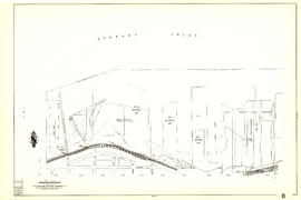
[Sheet 70 : Macdonald Street to Cypress Street and Fifty-seventh Avenue to Forty-ninth Avenue]
Vancouver, B.C. 1890 : built-on area
City of Vancouver [park sites June/80]
City of Vancouver, British Columbia
Map showing route Vancouver to Mission
Sheet 9 : Clark Drive to Slocan Street and Triumph Street to Charles Street
Sheet 11 : Carrall Street to Clark Drive and waterfront to Keefer Street
Sheet 14 : Ash Street to St. George Street and Marine Drive to Fraser River
Sheet 15 : Ash Street to St. George Street and Fifty-eighth Avenue to Marine Drive
Sheet 6 : Craddock Street to Boundary Road and Twenty-ninth Avenue to Fortieth Avenue
Sheet 16 : Maple Street to Oak Street and False Creek to Sixteenth Avenue
Sheet 7 : Clark Drive to Slocan Street and Seventh Avenue to Eighteenth Avenue
Sheet 13 : Ontario Street to Clark Drive and First Avenue to Sixteenth Avenue
Sheet 23 : Stanley Park to Granville Street and Robson Street to False Creek
Sheet G : Trafalgar Street to Granville Street and Sixteenth Avenue to Nanton Avenue
Sheet S.V. 5 : Ash Street to St. George Street and Sixty-third Avenue to Fraser River
Sheet 6 : Nicola Street to Beatty Street and English Bay Beach to Georgia Street
Sheet 8 : Main Street to Clark Drive and Alexander Street to Burrard Inlet
Sheet 30 : Maple Street to Oak Street and Fourteenth Avenue to Third Avenue and False Creek
[Sheet 13 : Rupert Street to Gilmore Avenue and Eton Street to Burrard Inlet]
[Sheet 22 : Maple Street to Drake Street and Fourth Avenue to Thurlow Street]
[Sheet 34 : Nanaimo Street to Rupert Street and Fifth Avenue to Grandview Highway]
Plan of the City of Vancouver, B.C.
City of Vancouver, British Columbia : co-ordinate street index map 12
Sheet 1: Slocan Street to Boundary Road and Triumph Street to Burrard Inlet
Sheet 10 : Clark Drive to Slocan Street and waterfront to Triumph Street
Sheet 19 : Maple Street to Richards Street and Drake Street to Third Avenue
Sheet 16 : St. George Street to Argyle Street and Fifty-eighth Avenue to Fraser River
Sheet G : Trafalgar Street to Granville Street and Sixteenth Avenue to Nanton Avenue
Sheet 6 : Knight Street to Slocan Street and Eighteenth Avenue to Twenty-ninth Avenue
Sheet 9 : Clark Drive to Slocan Street and Triumph Street to Charles Street
Sheet 4 : Slocan Street to Boundary Road and Broadway to Seventeenth Avenue
Sheet V and Z : Milton Street to Heather Street and Seventy-second Avenue to Fraser River ; Angus Drive to Granville Street and South West Marine Drive to Fraser River
Sheet S.V. 9 : St. George Street to Argyle Street and Fifty-eighth Avenue to Fraser River
Sheet S.V. 10 : Dumfries Street to Fairmont Street and Twenty-seventh Avenue to Thirty-seventh Avenue
Sheet 32 : Main Street to Clark Drive and Sixteenth Avenue to Great Northern Way
Sheet 7 : Burrard Street to Main Street and Georgia Viaduct to Burrard Inlet
Sheet 9 : Main Street to Clark Drive and Prior Street to Burrard Inlet
Sheet 21 : Homer Street to Main Street and Fourth Avenue to Georgia Viaduct
Sheet 22 : Maple Street to Drake Street and Fourth Avenue to Thurlow Street
Sheet 40 : Inverness Street to Nanaimo Street and Twenty-second Avenue to Thirteenth Avenue
Sheet 44 : Blenheim Street to Arbutus Street and King Edward Avenue to Fourteenth Avenue
Sheet 56 : Doman Street and Joyce Street to Boundary Road and Forty-ninth Avenue to Kingsway
Sheet 70 : Macdonald Street to Cypress Street and Fifty-seventh Avenue to Forty-ninth Avenue
Sheet 82 : Main Street to Tipping Road and Crompton Street and Twigg Island to Southeast Marine Drive
[Sheet 8 : Main Street to Clark Drive and Alexander Street to Burrard Inlet]
[Sheet 11 : Wall Street to Rupert Street and McGill Street to Burrard Inlet]
[Sheet 30 : Maple Street to Oak Street and Fourteenth Avenue to Third Avenue and False Creek]
[Sheet 32 : Main Street to Clark Drive and Sixteenth Avenue to Great Northern Way]
[Sheet 44 : Blenheim Street to Arbutus Street and King Edward Avenue to Fourteenth Avenue]
![[Sheet 70 : Macdonald Street to Cypress Street and Fifty-seventh Avenue to Forty-ninth Avenue]](/uploads/r/null/f/9/f92d773f16070e3762b2b8519c7993087e55cec394d3c593367dd2f160a3e9ad/b01f6a8d-18a1-4872-b084-475fd79e81da-MAP339_142.jpg)

![City of Vancouver [park sites June/80]](/uploads/r/null/9/4/9484add7c4684ea3838e4d00ee8add3ecf85d78d5aa8fe2780cae273e59556a5/bd2464d8-2aa9-4501-aba6-8b3f7d130a42-MAP1032_142.jpg)


![[Sheet 13 : Rupert Street to Gilmore Avenue and Eton Street to Burrard Inlet]](/uploads/r/null/f/0/f03aaa2671556fb722cf612a9736c0a6b919aff4af5a9dbe048dd93863af5773/30eb2a4c-b404-4552-81da-7461e4aacfaa-MAP339_142.jpg)
![[Sheet 22 : Maple Street to Drake Street and Fourth Avenue to Thurlow Street]](/uploads/r/null/4/2/42281b3ab55033f1c62b4ea532ffecc218f82690d1735cd3bb58cfbb1c9a5424/cb682ac6-121a-4bac-99a4-5470e73d38f4-MAP339_142.jpg)
![[Sheet 34 : Nanaimo Street to Rupert Street and Fifth Avenue to Grandview Highway]](/uploads/r/null/4/d/4dec0865cb529d2b3586764b85cb4fe3474714725cb43f9b355eec779ad8162d/6493e9ac-b956-4a83-88fc-b8d6c13efcdf-MAP339_142.jpg)


![[Sheet 8 : Main Street to Clark Drive and Alexander Street to Burrard Inlet]](/uploads/r/null/a/1/a10fe461f7836acc659d886d1888eef9d17bfc99d33e474c29ae025ed531b50c/e81d36a6-a6c1-40a5-852b-ef52bfbdb8dd-MAP339_142.jpg)
![[Sheet 11 : Wall Street to Rupert Street and McGill Street to Burrard Inlet]](/uploads/r/null/e/b/eb84fb8de9ca2e1644a2e39bcbaad5253c563e8716cf25114e675fb7d40365ea/0935fb81-4662-411a-bdfd-c9823c7fb82b-MAP339_142.jpg)
![[Sheet 30 : Maple Street to Oak Street and Fourteenth Avenue to Third Avenue and False Creek]](/uploads/r/null/2/f/2f9cbcb3930282909d8a62f01384c5c21cf803594c41529ced8de9bed70e9575/e94bfa39-bc0b-46aa-9bdd-b2c0b97f5eba-MAP339_142.jpg)
![[Sheet 32 : Main Street to Clark Drive and Sixteenth Avenue to Great Northern Way]](/uploads/r/null/1/2/1275197193b0488ed8a599413ce061f9bd30140e8bcc64728b9f05c994d8909a/718a0877-7ea9-4090-a67c-7e61c28e238e-MAP339_142.jpg)
![[Sheet 44 : Blenheim Street to Arbutus Street and King Edward Avenue to Fourteenth Avenue]](/uploads/r/null/2/f/2fdf5060ec6fdc47756dc75416312dd42047abea2beed2d99f086c73bd0c8726/2fe0f45d-ad6c-46e6-9a9f-50c795523f5f-MAP339_142.jpg)