[View of intersection at 16th Avenue and Arbutus, looking west]
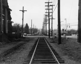
16th Avenue at Arbutus Street - Tracks looking south from north of 16th Avenue
False Creek - Railway Embankment [3 of 3]
False Creek - Railway Embankment [2 of 3]
False Creek - Railway Embankment [1 of 3]
Miscellaneous [68 of 130]
Miscellaneous [55 of 130]
Miscellaneous [54 of 130]
Miscellaneous [53 of 130]
Miscellaneous [37 of 130]
Miscellaneous [36 of 130]
Miscellaneous [35 of 130]
Miscellaneous [34 of 130]
[Underground railway tracks]
[Coal Harbour?]
[Northeast view of False Creek]
Trading scrap yard [at] Cordova St[reet]
[Houses in Kitsilano]
[View of a railroad] looking East at Kerr [Street] and Kent [Avenue]
Wartime housing cottages
Terminal railway location from Fraser River Bridge, New Westminster, to Spanish Bank, Point Grey, showing terminal layout [Burrard Peninsula topographical plan]
Profile Mile 27 to Mile 58 Port Mann Subdivision
Profile Mile 0 to Mile 27 Port Mann Subdivision
Hydro electric survey City of Vancouver : Cheakamus River system from Squamish River to Green River
Hydro electric surveys. Plan showing location of water powers investigated by City of Vancouver
Hydro electric surveys. Plan showing location of water powers investigated by City of Vancouver
Sheet 16 : St. George Street to Argyle Street and Fifty-eighth Avenue to Fraser River
Sheet 15 : Ash Street to St. George Street and Fifty-eighth Avenue to Marine Drive
Sheet 14 : Ash Street to St. George Street and Marine Drive to Fraser River
Sheet 6 : Craddock Street to Boundary Road and Twenty-ninth Avenue to Fortieth Avenue
Sheet Z : Milton Street to Heather Street and Seventy-second Avenue to Fraser River and sheet v: Angus Drive to Granville Street and South West Marine Drive to Fraser River
Sheet G : Trafalgar Street to Granville Street and Sixteenth Avenue to Nanton Avenue
Sheet 23 : Stanley Park to Granville Street and Robson Street to False Creek
Sheet 19 : Maple Street to Richards Street and Drake Street to Third Avenue
Sheet 16 : Maple Street to Oak Street and False Creek to Sixteenth Avenue
Sheet 13 : Ontario Street to Clark Drive and First Avenue to Sixteenth Avenue
Sheet 12 : Ontario Street to Clark Drive and Keefer Street to Second Avenue
Sheet 11 : Carrall Street to Clark Drive and waterfront to Keefer Street
Sheet 10 : Clark Drive to Slocan Street and Burrard Inlet to Triumph Street
Sheet 9 : Clark Drive to Slocan Street and Triumph Street to Charles Street
Sheet 8 : McLean Drive to Slocan Street and William Street to Seventh Avenue
Sheet 7 : Clark Drive to Slocan Street and Seventh Avenue to Eighteenth Avenue
Sheet 6 : Knight Street to Slocan Street and Eighteenth Avenue to Twenty-ninth Avenue
Sheet 5 : Slocan Street to Boundary Road and Seventeenth Avenue to Twenty-ninth Avenue
Sheet 4 : Slocan Street to Boundary Road and Seventh Avenue to Seventeenth Avenue
Sheet 1 : Slocan Street to Boundary Road and Triumph Street to Burrard Inlet
![[View of 16th Avenue at Arbutus, looking east]](/uploads/r/null/5/a/9/5a970098dc3f7ec5ddb6a1eba0fedaed0bfff67cd6c7c167b1d90f204c8343a1/f190af08-2543-40e5-bd78-23f0a5951b30-CVA480-335_142.jpg)
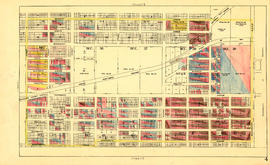
![[View of intersection at 16th Avenue and Arbutus, looking west]](/uploads/r/null/7/2/e/72e1c1bcedc284d5a15cfcd4c780d96e74414174786caef96680d2bc81e6c17d/b883f78c-c99f-4822-8e1d-4dadbd84724e-CVA480-334_142.jpg)
![False Creek - Railway Embankment [3 of 3]](/uploads/r/null/c/7/c7113c95840569285da601cb075a796bfa281f1166b0f53a60887606f3ddd44f/849520db-bb0a-4be5-b3f9-ac3cf88bbdbb-A66398_142.jpg)
![False Creek - Railway Embankment [2 of 3]](/uploads/r/null/3/9/394dbf9c49676d4b4d8d4de6aa031e38e52f0b30bfa0b14b797ced9c14cc73e4/0293a4f3-c34d-487b-818c-8bbe00c1de2a-A66397_142.jpg)
![False Creek - Railway Embankment [1 of 3]](/uploads/r/null/d/9/d9a643481f6b33c2eff84aa7ea14a4fe633557ea38157f408e11a13f4cc42f9f/3e6aa5b8-7483-4b5b-b543-79f82d7c5f1a-A66396_142.jpg)
![Miscellaneous [68 of 130]](/uploads/r/null/7/1/71eb447ac97b8dd12a30ce2749b94af2887bb2c044536d599f677a9a487ace45/d11ca122-b806-4991-a03a-73938512db71-A64419_142.jpg)
![Miscellaneous [55 of 130]](/uploads/r/null/6/b/6b76a7bc9c11958ea03236273a346a2fdd7fcba56659419f85403323e3d40a45/4f238cee-3c9d-4aeb-b129-ea759db87fbb-A64386_142.jpg)
![Miscellaneous [54 of 130]](/uploads/r/null/9/0/903f6156f1812c4545deba0949b4c2b9ab99979ad25193013f5f329055368ba0/94bfc5e6-6b69-43d9-95c0-02654abd321e-A64385_142.jpg)
![Miscellaneous [53 of 130]](/uploads/r/null/0/6/06eae5eb055240bc3f25c814df29fc4e98ed13f96a078ed53b3aa631cbbbb5be/01da875c-4a64-476b-b225-1e6b6c125eb5-A64384_142.jpg)
![Miscellaneous [37 of 130]](/uploads/r/null/6/b/6b12f4534c38c24d4567db9adde3a59d2c84bea9a68facada78c66e2cea42bff/41931f04-548e-4b7c-9c69-214709d7a058-A64363_142.jpg)
![Miscellaneous [36 of 130]](/uploads/r/null/b/d/bd9d0b5a56996acdb17c3a4f17f5de6e7a4aaf9673aac419c294f3819d4094c9/8acbf1ad-e3c4-4d5c-b0c7-f4691d422009-A64359_142.jpg)
![Miscellaneous [35 of 130]](/uploads/r/null/7/5/7541e0eef4c4bc4969897b15b2e2cdd88df3138413d4d0176878b20dcec56b3e/db7a9559-37f0-4245-b666-0a0718df1f67-A64358_142.jpg)
![Miscellaneous [34 of 130]](/uploads/r/null/0/4/042ccff47bff4aaa681d0691dc975eef20f315514a52472a82f55384da0e8c9f/2033fddd-6b30-4278-8796-071a072f6dd8-A64357_142.jpg)
![[Underground railway tracks]](/uploads/r/null/5/4/5439f29b6743d86426dae5d15d29e545a67efad81cb117979d0ff71b78e34414/8e09c282-a1ec-4bd9-b8af-03ac32da8944-A16570_142.jpg)
![[Coal Harbour?]](/uploads/r/null/f/b/fb269570031b2a3828f329c97b9db78a5236f47cf4286fb78bf3c2058c53b0de/626b353c-ab4a-4c40-bcaf-41aaec70fe04-A16630_142.jpg)
![[Northeast view of False Creek]](/uploads/r/null/c/b/cb30fde9722b8b64fd3b7e25f7487dfe9b743e7495319068d8ee15205635a8d1/982986e0-014c-4224-a34c-78e2d1d69b3f-A59369_142.jpg)
![Trading scrap yard [at] Cordova St[reet]](/uploads/r/null/3/4/34810e915ef42c2f76a16f6333500154eb58648255e2ffd83f90faa653e9e221/bdb0a8be-b05c-4b27-88b3-b99382c73afd-A59202_142.jpg)
![[Houses in Kitsilano]](/uploads/r/null/6/8/68f06ce6dde97dc34d6de508380ae6b1aa75c28f43f3ea4b0f58e46e584a4ef3/f61f1fae-b54c-4ae2-8b7f-18e22557f2be-A58936_142.jpg)
![[View of a railroad] looking East at Kerr [Street] and Kent [Avenue]](/uploads/r/null/4/d/4d9124902e1a1fa0e80bd739334b786f435286c4c008f415fe8492e8141b07aa/d70a3ab6-f5ff-4cd8-ad75-e6d320bb38ab-A58924_142.jpg)