British Columbia Electric Railway Company systems : Vancouver Island, Lower Mainland, Vancouver and New Westminster; Alouette-Stave development, present and projected
Add to clipboard
British Columbia Electric Railway Company systems : Vancouver Island, Lower Mainland, Vancouver and New Westminster; Alouette-Stave development, present and projected
Canadian National Railways mountain region : Vancouver, B.C.
Add to clipboard
Canadian National Railways mountain region : Vancouver, B.C.
Add to clipboard
City of Vancouver
Add to clipboard
City of Vancouver
Add to clipboard
City of Vancouver [park sites June/80]
Add to clipboard
City of Vancouver, British Columbia
Add to clipboard
City of Vancouver, British Columbia
Add to clipboard
City of Vancouver, British Columbia : co-ordinate street index map 12
Corporation of Point Grey : topographical plan of ABCDE D.L. 317 and HIJK D.L. 318 : Marine Drive & Vancouver & Lulu Railway to Fraser River between Angus St. [Drive] & Milton St
Add to clipboard
Corporation of Point Grey : topographical plan of ABCDE D.L. 317 and HIJK D.L. 318 : Marine Drive & Vancouver & Lulu Railway to Fraser River between Angus St. [Drive] & Milton St
Add to clipboard
Map of the city of Vancouver, British Columbia
Map of Vancouver Unemployment and Relief [BC]
Add to clipboard
Map of Vancouver Unemployment and Relief [BC]
Add to clipboard
Map of Vancouver, New Westminster, Steveston and the Lower Mainland District
Add to clipboard
Map showing route Vancouver to Mission
Add to clipboard
Plan of the City of Vancouver. Western Terminus of the Canadian Pacific Railway
Add to clipboard
Plan of the City of Vancouver, B.C.
Add to clipboard
Proposed Raymur Ave. [Avenue] Trunk Sewer diverting sewage from False Creek reclaimed area
Add to clipboard
Proposed Raymur Ave. [Avenue] Trunk Sewer diverting sewage from False Creek reclaimed area
Add to clipboard
Proposed Raymur Ave. [Avenue] Trunk Sewer diverting sewage from False Creek reclaimed area
Add to clipboard
Sheet 1 : Slocan Street to Boundary Road and Triumph Street to Burrard Inlet
Add to clipboard
Sheet 1: Slocan Street to Boundary Road and Triumph Street to Burrard Inlet
Add to clipboard
Sheet 10 : Clark Drive to Slocan Street and waterfront to Triumph Street
Add to clipboard
Sheet 10 : Clark Drive to Slocan Street and waterfront to Triumph Street
Add to clipboard
Sheet 11 : Carrall Street to Clark Drive and waterfront to Keefer Street
Add to clipboard
Sheet 11 : Carrall Street to Clark Drive and waterfront to Keefer Street
Add to clipboard
Sheet 11 : Wall Street to Rupert Street and McGill Street to Burrard Inlet
Add to clipboard
[Sheet 11 : Wall Street to Rupert Street and McGill Street to Burrard Inlet]
Add to clipboard
Sheet 12 : Nanaimo Street to Cassiar Street and Pender Street to McGill Street
Add to clipboard
[Sheet 12 : Nanaimo Street to Cassiar Street and Pender Street to McGill Street]
Add to clipboard
Sheet 12 : Ontario Street to Clark Drive and Keefer Street to Second Avenue
Add to clipboard
Sheet 12 : Ontario Street to Clark Drive and Keefer Street to Second Avenue
Add to clipboard
Sheet 13 : Ontario Street to Clark Drive and First Avenue to Sixteenth Avenue
Add to clipboard
Sheet 13 : Ontario Street to Clark Drive and First Avenue to Sixteenth Avenue
Add to clipboard
Sheet 13 : Rupert Street to Boundary Road and Eton Street to Burrard Inlet
Add to clipboard
[Sheet 13 : Rupert Street to Gilmore Avenue and Eton Street to Burrard Inlet]
Add to clipboard
Sheet 14 : Ash Street to St. George Street and Marine Drive to Fraser River
Add to clipboard
Sheet 15 : Ash Street to St. George Street and Fifty-eighth Avenue to Marine Drive
Add to clipboard
Sheet 16 : Maple Street to Oak Street and False Creek to Sixteenth Avenue
Add to clipboard
Sheet 16 : Maple Street to Oak Street and False Creek to Sixteenth Avenue
Add to clipboard
Sheet 16 : Rupert Street to Boundary Road and Fifth Avenue to Kitchener Street
Add to clipboard
[Sheet 16 : Rupert Street to Gilmore Avenue and Fifth Avenue to Kitchener Street]
Add to clipboard
Sheet 16 : St. George Street to Argyle Street and Fifty-eighth Avenue to Fraser River
Add to clipboard
Sheet 18 : Vivian Street to Boundary Road and Sixty-fifth Avenue to Fraser River
Add to clipboard
Sheet 19 : Maple Street to Richards Street and Drake Street to Third Avenue
Add to clipboard
Sheet 19 : Maple Street to Richards Street and Drake Street to Third Avenue
Add to clipboard
Sheet 20 : Main Street to Clark Drive and Great Northern Way to Prior Street
[Sheet 20 : Main Street to Clark Drive and Great Northern Way to Prior Street]
Add to clipboard
[Sheet 20 : Main Street to Clark Drive and Great Northern Way to Prior Street]
Add to clipboard
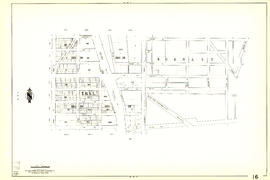
[Sheet 21 : Homer Street to Main Street and Fourth Avenue to Georgia Viaduct]
Add to clipboard
Sheet 21 : Homer Street to Main Street and Fourth Avenue to Georgia Viaduct
Add to clipboard
Sheet 22 : Maple Street to Drake Street and Fourth Avenue to Thurlow Street
Add to clipboard
[Sheet 22 : Maple Street to Drake Street and Fourth Avenue to Thurlow Street]


![City of Vancouver [park sites June/80]](/uploads/r/null/9/4/9484add7c4684ea3838e4d00ee8add3ecf85d78d5aa8fe2780cae273e59556a5/bd2464d8-2aa9-4501-aba6-8b3f7d130a42-MAP1032_142.jpg)


![Proposed Raymur Ave. [Avenue] Trunk Sewer diverting sewage from False Creek reclaimed area](/uploads/r/null/c/d/cddf61ac60b97b6fc54309ecbf8d1aea8e9aac3c672576fbd9953a05b82d42fc/14951fa4-0fd0-480c-a1f3-b7c2ef158398-MAP761_142.jpg)
![Proposed Raymur Ave. [Avenue] Trunk Sewer diverting sewage from False Creek reclaimed area](/uploads/r/null/5/2/5260099e92441f23442086ea3a8b5f7512bb5b4b4b5cbf554c9f13450bf4d37f/b5165f5d-bd82-46b5-9beb-0f969f7755ef-MAP761_142.jpg)
![Proposed Raymur Ave. [Avenue] Trunk Sewer diverting sewage from False Creek reclaimed area](/uploads/r/null/a/8/a8edd70876832fb32ffa8add8b5e261fe78b0e6efcb26d07a6fe1c74bf545b57/ac62eada-955d-4eee-8508-6bf4b71a21e5-MAP761_142.jpg)


![[Sheet 11 : Wall Street to Rupert Street and McGill Street to Burrard Inlet]](/uploads/r/null/e/b/eb84fb8de9ca2e1644a2e39bcbaad5253c563e8716cf25114e675fb7d40365ea/0935fb81-4662-411a-bdfd-c9823c7fb82b-MAP339_142.jpg)

![[Sheet 12 : Nanaimo Street to Cassiar Street and Pender Street to McGill Street]](/uploads/r/null/6/0/603c1cdc3adb1f0dec963bbd885c378ce1e23c71767cb0b461ef6ccc54807a5a/49483dc1-d90f-4a82-86cd-3c7a09f2ddae-MAP339_142.jpg)


![[Sheet 13 : Rupert Street to Gilmore Avenue and Eton Street to Burrard Inlet]](/uploads/r/null/f/0/f03aaa2671556fb722cf612a9736c0a6b919aff4af5a9dbe048dd93863af5773/30eb2a4c-b404-4552-81da-7461e4aacfaa-MAP339_142.jpg)


![[Sheet 16 : Rupert Street to Gilmore Avenue and Fifth Avenue to Kitchener Street]](/uploads/r/null/6/2/6247d4ce631b144e891bbf078d02b8397e56f53625f45e0c464d4bc0e213b752/d68185e8-9db3-488c-a115-03184f2e1941-MAP339_142.jpg)


![[Sheet 21 : Homer Street to Main Street and Fourth Avenue to Georgia Viaduct]](/uploads/r/null/8/c/8c7ce2ae32274b3000b670b2a47c1114fd3c3faf20caeaef1a64c8137aab4f37/d256dda0-fa87-4985-97d6-ed6431e5a608-MAP339_142.jpg)


![[Sheet 22 : Maple Street to Drake Street and Fourth Avenue to Thurlow Street]](/uploads/r/null/4/2/42281b3ab55033f1c62b4ea532ffecc218f82690d1735cd3bb58cfbb1c9a5424/cb682ac6-121a-4bac-99a4-5470e73d38f4-MAP339_142.jpg)