Add to clipboard
Sheet G : Trafalgar Street to Granville Street and Sixteenth Avenue to Nanton Avenue
Add to clipboard
Sheet 84 : Laurel Street to Main Street and North Arm of Fraser River to Southwest Marine Drive
Add to clipboard
Sheet 82 : Main Street to Tipping Road and Crompton Street and Twigg Island to Southeast Marine Drive
Add to clipboard
Sheet 79 : Gladstone Street to Kerr Street and North Arm of Fraser River to Bobolink Avenue
Add to clipboard
Sheet 78 : Kerr Street to Ivy Avenue and North Arm of Fraser River to Southeast Marine Drive
Add to clipboard
Sheet 70 : Macdonald Street to Cypress Street and Fifty-seventh Avenue to Forty-ninth Avenue
Add to clipboard
Sheet 56 : Doman Street and Joyce Street to Boundary Road and Forty-ninth Avenue to Kingsway
Add to clipboard
Sheet 55 : Cecil Street and McHardy Street to Patterson Avenue and Kingsway to Monmouth Avenue and Price Street
Add to clipboard
Sheet 49 : Arbutus Street to Oak Street and Thirty-third Avenue to Laurier Avenue
Add to clipboard
Sheet 32 : Main Street to Clark Drive and Sixteenth Avenue to Great Northern Way
Add to clipboard
Sheet 33 : Clark Drive to Nanaimo Street and Thirteenth Avenue to Second Avenue
Add to clipboard
Sheet 6 : Nicola Street to Beatty Street and English Bay Beach to Georgia Street
Add to clipboard
Sheet 7 : Burrard Street to Main Street and Georgia Viaduct to Burrard Inlet
Add to clipboard
Sheet 8 : Main Street to Clark Drive and Alexander Street to Burrard Inlet
Add to clipboard
Sheet 9 : Main Street to Clark Drive and Prior Street to Burrard Inlet
Add to clipboard
Sheet 11 : Wall Street to Rupert Street and McGill Street to Burrard Inlet
Add to clipboard
Sheet 12 : Nanaimo Street to Cassiar Street and Pender Street to McGill Street
Add to clipboard
Sheet 13 : Rupert Street to Boundary Road and Eton Street to Burrard Inlet
Add to clipboard
Sheet 16 : Rupert Street to Boundary Road and Fifth Avenue to Kitchener Street
Add to clipboard
Sheet 20 : Main Street to Clark Drive and Great Northern Way to Prior Street
Add to clipboard
Sheet 21 : Homer Street to Main Street and Fourth Avenue to Georgia Viaduct
Add to clipboard
Sheet 22 : Maple Street to Drake Street and Fourth Avenue to Thurlow Street
Add to clipboard
Sheet 29 : Balaclava Street to Maple Street and Fourteenth Avenue to Third Avenue
Add to clipboard
Sheet 30 : Maple Street to Oak Street and Fourteenth Avenue to Third Avenue and False Creek
Add to clipboard
Sheet 34 : Nanaimo Street to Rupert Street and Grandview Highway to Fifth Avenue
Add to clipboard
Sheet 35 : Rupert Street to Ardley Avenue and Grandview Highway to Fifth Avenue
Add to clipboard
Sheet 39 : Kingsway and Nanaimo Street to Rupert Street and Ward Street to Twenty-second Avenue
Add to clipboard
Sheet 40 : Inverness Street to Nanaimo Street and Twenty-second Avenue to Thirteenth Avenue
Add to clipboard
Sheet 44 : Blenheim Street to Arbutus Street and King Edward Avenue to Fourteenth Avenue
Plan of the City of Vancouver [BC] Western Terminus of the Canadian Pacific Railway
Add to clipboard
Plan of the City of Vancouver [BC] Western Terminus of the Canadian Pacific Railway
Scarborough's New Map of British Columbia
Add to clipboard
Scarborough's New Map of British Columbia
Commercial Map of Greater Vancouver and District [BC]
Add to clipboard
Commercial Map of Greater Vancouver and District [BC]
Add to clipboard
Stuart's pocket map of Vancouver, B.C.
Map of Vancouver Unemployment and Relief [BC]
Add to clipboard
Map of Vancouver Unemployment and Relief [BC]
Railroads of the Lower Mainland of British Columbia, 1882-1992
Add to clipboard
Railroads of the Lower Mainland of British Columbia, 1882-1992
Railroads of the Lower Mainland of British Columbia
Add to clipboard
Railroads of the Lower Mainland of British Columbia
Add to clipboard
City of Vancouver
Add to clipboard
City of Vancouver, British Columbia
Add to clipboard
City of Vancouver, British Columbia
Add to clipboard
City of Vancouver
Add to clipboard
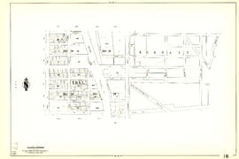
City of Vancouver [park sites June/80]
Add to clipboard
City of Vancouver, British Columbia : co-ordinate street index map 12
Add to clipboard
Vancouver and Northern Railway, 1908
Add to clipboard
Vancouver, B.C. 1890 : built-on area
Corporation of Point Grey : topographical plan of ABCDE D.L. 317 and HIJK D.L. 318 : Marine Drive & Vancouver & Lulu Railway to Fraser River between Angus St. [Drive] & Milton St
Add to clipboard
Corporation of Point Grey : topographical plan of ABCDE D.L. 317 and HIJK D.L. 318 : Marine Drive & Vancouver & Lulu Railway to Fraser River between Angus St. [Drive] & Milton St
Add to clipboard
Map of Vancouver, New Westminster, Steveston and the Lower Mainland District
Add to clipboard
Plan showing vicinity of Fisher Case, Nov 9th, 1949
Add to clipboard
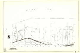
Proposed Raymur Ave. [Avenue] Trunk Sewer diverting sewage from False Creek reclaimed area
Add to clipboard
Proposed Raymur Ave. [Avenue] Trunk Sewer diverting sewage from False Creek reclaimed area
Add to clipboard
Proposed Raymur Ave. [Avenue] Trunk Sewer diverting sewage from False Creek reclaimed area


![City of Vancouver [park sites June/80]](/uploads/r/null/9/4/9484add7c4684ea3838e4d00ee8add3ecf85d78d5aa8fe2780cae273e59556a5/bd2464d8-2aa9-4501-aba6-8b3f7d130a42-MAP1032_142.jpg)


![Proposed Raymur Ave. [Avenue] Trunk Sewer diverting sewage from False Creek reclaimed area](/uploads/r/null/a/8/a8edd70876832fb32ffa8add8b5e261fe78b0e6efcb26d07a6fe1c74bf545b57/ac62eada-955d-4eee-8508-6bf4b71a21e5-MAP761_142.jpg)
![Proposed Raymur Ave. [Avenue] Trunk Sewer diverting sewage from False Creek reclaimed area](/uploads/r/null/5/2/5260099e92441f23442086ea3a8b5f7512bb5b4b4b5cbf554c9f13450bf4d37f/b5165f5d-bd82-46b5-9beb-0f969f7755ef-MAP761_142.jpg)
![Proposed Raymur Ave. [Avenue] Trunk Sewer diverting sewage from False Creek reclaimed area](/uploads/r/null/c/d/cddf61ac60b97b6fc54309ecbf8d1aea8e9aac3c672576fbd9953a05b82d42fc/14951fa4-0fd0-480c-a1f3-b7c2ef158398-MAP761_142.jpg)