Print preview Close
Showing 32 results
Archival description32 results with digital objects Show results with digital objects

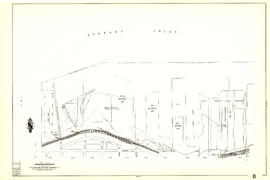
Plan showing vicinity of Fisher Case, Nov 9th, 1949

Sheet 84 : Laurel Street to Main Street and North Arm of Fraser River to Southwest Marine Drive

Sheet 82 : Main Street to Tipping Road and Crompton Street and Twigg Island to Southeast Marine Drive

Sheet 79 : Gladstone Street to Kerr Street and North Arm of Fraser River to Bobolink Avenue

Sheet 78 : Kerr Street to Ivy Avenue and North Arm of Fraser River to Southeast Marine Drive

Sheet 70 : Macdonald Street to Cypress Street and Fifty-seventh Avenue to Forty-ninth Avenue

Sheet 56 : Doman Street and Joyce Street to Boundary Road and Forty-ninth Avenue to Kingsway

Sheet 55 : Cecil Street and McHardy Street to Patterson Avenue and Kingsway to Monmouth Avenue and Price Street

Sheet 49 : Arbutus Street to Oak Street and Thirty-third Avenue to Laurier Avenue

Sheet 44 : Blenheim Street to Arbutus Street and King Edward Avenue to Fourteenth Avenue

Sheet 40 : Inverness Street to Nanaimo Street and Twenty-second Avenue to Thirteenth Avenue

Sheet 39 : Kingsway and Nanaimo Street to Rupert Street and Ward Street to Twenty-second Avenue

Sheet 35 : Rupert Street to Ardley Avenue and Grandview Highway to Fifth Avenue

Sheet 34 : Nanaimo Street to Rupert Street and Grandview Highway to Fifth Avenue

Sheet 33 : Clark Drive to Nanaimo Street and Thirteenth Avenue to Second Avenue

Sheet 32 : Main Street to Clark Drive and Sixteenth Avenue to Great Northern Way

Sheet 31 : Oak Street to Main Street and Sixteenth Avenue to Fourth Avenue and False Creek

Sheet 30 : Maple Street to Oak Street and Fourteenth Avenue to Third Avenue and False Creek

Sheet 29 : Balaclava Street to Maple Street and Fourteenth Avenue to Third Avenue

Sheet 22 : Maple Street to Drake Street and Fourth Avenue to Thurlow Street

Sheet 21 : Homer Street to Main Street and Fourth Avenue to Georgia Viaduct

Sheet 20 : Main Street to Clark Drive and Great Northern Way to Prior Street
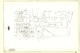
Sheet 16 : Rupert Street to Boundary Road and Fifth Avenue to Kitchener Street

Sheet 13 : Rupert Street to Boundary Road and Eton Street to Burrard Inlet

Sheet 12 : Nanaimo Street to Cassiar Street and Pender Street to McGill Street

Sheet 11 : Wall Street to Rupert Street and McGill Street to Burrard Inlet

Sheet 9 : Main Street to Clark Drive and Prior Street to Burrard Inlet
Sheet 8 : Main Street to Clark Drive and Alexander Street to Burrard Inlet

Sheet 7 : Burrard Street to Main Street and Georgia Viaduct to Burrard Inlet

Sheet 6 : Nicola Street to Beatty Street and English Bay Beach to Georgia Street

City of Vancouver, British Columbia

City of Vancouver, British Columbia