Sheet 4 : Slocan Street to Boundary Road and Seventh Avenue to Seventeenth Avenue
Sheet 5 : Slocan Street to Boundary Road and Seventeenth Avenue to Twenty-ninth Avenue
Sheet 7 : Clark Drive to Slocan Street and Seventh Avenue to Eighteenth Avenue
Sheet 13 : Ontario Street to Clark Drive and First Avenue to Sixteenth Avenue
Sheet Z : Milton Street to Heather Street and Seventy-second Avenue to Fraser River ; Angus Drive to Granville Street and South West Marine Drive to Fraser River
Sheet 18 : Vivian Street to Boundary Road and Sixty-fifth Avenue to Fraser River
Sheet 1 : Slocan Street to Boundary Road and Triumph Street to Burrard Inlet
Sheet 11 : Carrall Street to Clark Drive and waterfront to Keefer Street
Sheet 12 : Ontario Street to Clark Drive and Keefer Street to Second Avenue
Sheet 12 : Nanaimo Street to Cassiar Street and Pender Street to McGill Street
Sheet 20 : Main Street to Clark Drive and Great Northern Way to Prior Street
Sheet 29 : Balaclava Street to Maple Street and Fourteenth Avenue to Third Avenue
Sheet 31 : Oak Street to Main Street and Sixteenth Avenue to Fourth Avenue and False Creek
Sheet 35 : Rupert Street to Ardley Avenue and Grandview Highway to Fifth Avenue
Sheet 49 : Arbutus Street to Oak Street and Thirty-third Avenue to Laurier Avenue
Sheet 79 : Gladstone Street to Kerr Street and North Arm of Fraser River to Bobolink Avenue
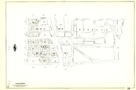
[Sheet 7 : Burrard Street to Main Street and Georgia Viaduct to Burrard Inlet]
[Sheet 9 : Main Street to Clark Drive and Prior Street to Burrard Inlet]
[Sheet 21 : Homer Street to Main Street and Fourth Avenue to Georgia Viaduct]
[Sheet 29 : Balaclava Street to Maple Street and Fourteenth Avenue to Third Avenue]
[Sheet 35 : Rupert Street to Ardley Avenue and Grandview Highway to Fifth Avenue]
[Sheet 40 : Inverness Street to Nanaimo Street and Twenty-second Avenue to Thirteenth Avenue]
[Sheet 55 : Cecil Street and McHardy Street to Patterson Avenue and Kingsway to Monmouth Avenue and Price Street]
[Sheet 56 : Doman Street and Joyce Street to Boundary Road and Forty-ninth Avenue to Kingsway]
Great Northern Railway. Map of the United States
Stuart's pocket map of Vancouver, B.C.
Greater Vancouver and Fraser Valley
[Sheet 78 : Kerr Street to Ivy Avenue and North Arm of Fraser River to Southeast Marine Drive]
[Sheet 82 : Main Street to Tipping Road and Crompton Street and Twigg Island to Southeast Marine Drive]
City of Vancouver, British Columbia
Proposed Raymur Ave. [Avenue] Trunk Sewer diverting sewage from False Creek reclaimed area
Proposed Raymur Ave. [Avenue] Trunk Sewer diverting sewage from False Creek reclaimed area
Proposed Raymur Ave. [Avenue] Trunk Sewer diverting sewage from False Creek reclaimed area
Sheet 6 : Knight Street to Slocan Street and Eighteenth Avenue to Twenty-ninth Avenue
Sheet 8 : McLean Drive to Slocan Street and William Street to Seventh Avenue
Sheet 12 : Ontario Street to Clark Drive and Keefer Street to Second Avenue
Sheet 23 : Stanley Park to Granville Street and Robson Street to False Creek
Sheet 5 : Slocan Street to Boundary Road and Seventeenth Avenue to Twenty-ninth Avenue
Sheet 8 : McLean Drive to Slocan Street and William Street to Seventh Avenue
Sheet 10 : Clark Drive to Slocan Street and waterfront to Triumph Street
Sheet 16 : Maple Street to Oak Street and False Creek to Sixteenth Avenue
Sheet 19 : Maple Street to Richards Street and Drake Street to Third Avenue
Sheet 33 : Clark Drive to Nanaimo Street and Thirteenth Avenue to Second Avenue
Sheet 11 : Wall Street to Rupert Street and McGill Street to Burrard Inlet
Sheet 13 : Rupert Street to Boundary Road and Eton Street to Burrard Inlet
Sheet 16 : Rupert Street to Boundary Road and Fifth Avenue to Kitchener Street
Sheet 34 : Nanaimo Street to Rupert Street and Grandview Highway to Fifth Avenue
Sheet 39 : Kingsway and Nanaimo Street to Rupert Street and Ward Street to Twenty-second Avenue


![[Sheet 7 : Burrard Street to Main Street and Georgia Viaduct to Burrard Inlet]](/uploads/r/null/c/d/cd235086cbaf81487b8784fb32b6ef913f4fe27305678cd1961adf506324c250/8f72f6bd-1013-48ad-a56c-e6269cb6f5a8-MAP339_142.jpg)
![[Sheet 9 : Main Street to Clark Drive and Prior Street to Burrard Inlet]](/uploads/r/null/c/a/ca4b4713bea0118fec812e6258afe5c1efa039db74073214703001a47b00f122/5e0d243a-99ae-42aa-8bb3-4a1abe9e1209-MAP339_142.jpg)
![[Sheet 21 : Homer Street to Main Street and Fourth Avenue to Georgia Viaduct]](/uploads/r/null/8/c/8c7ce2ae32274b3000b670b2a47c1114fd3c3faf20caeaef1a64c8137aab4f37/d256dda0-fa87-4985-97d6-ed6431e5a608-MAP339_142.jpg)
![[Sheet 29 : Balaclava Street to Maple Street and Fourteenth Avenue to Third Avenue]](/uploads/r/null/d/6/d672783fbbcdf46b6e25dc13c2f50caa22e19935f01490a9053af4afffc83c80/9a39458e-9f4b-43a8-a595-082419eecd5b-MAP339_142.jpg)
![[Sheet 35 : Rupert Street to Ardley Avenue and Grandview Highway to Fifth Avenue]](/uploads/r/null/b/9/b99ee96b798b34d2651dd213f0a858725b96bd6d586dd8d3701744c75c085139/a2e07931-8625-4adb-a51a-547f78416127-MAP339_142.jpg)
![[Sheet 40 : Inverness Street to Nanaimo Street and Twenty-second Avenue to Thirteenth Avenue]](/uploads/r/null/9/3/9367a0c50f6fa513d717a1972b1bac72acde6d41b002fefcf48ddbd8c8122e8a/c7bfac0b-bf44-441b-b059-fd7bbc0bd4a0-MAP339_142.jpg)

![[Sheet 56 : Doman Street and Joyce Street to Boundary Road and Forty-ninth Avenue to Kingsway]](/uploads/r/null/5/e/5ee0f6b78ce9f3b0e0e39795d6220cd37d587872bad7b41b67f4d29c7cb49d4c/f8a321d6-ea4f-4e1f-85da-6d12e149ea85-MAP339_142.jpg)


![[Sheet 78 : Kerr Street to Ivy Avenue and North Arm of Fraser River to Southeast Marine Drive]](/uploads/r/null/9/0/90c6186a1aa17588ec162078d412440a826f55dc10a9d49f8e74df97a4d3ff6e/0a3e4f49-3d6d-4dec-95f1-08aa42e666d8-MAP339_142.jpg)


![Proposed Raymur Ave. [Avenue] Trunk Sewer diverting sewage from False Creek reclaimed area](/uploads/r/null/c/d/cddf61ac60b97b6fc54309ecbf8d1aea8e9aac3c672576fbd9953a05b82d42fc/14951fa4-0fd0-480c-a1f3-b7c2ef158398-MAP761_142.jpg)
![Proposed Raymur Ave. [Avenue] Trunk Sewer diverting sewage from False Creek reclaimed area](/uploads/r/null/5/2/5260099e92441f23442086ea3a8b5f7512bb5b4b4b5cbf554c9f13450bf4d37f/b5165f5d-bd82-46b5-9beb-0f969f7755ef-MAP761_142.jpg)
![Proposed Raymur Ave. [Avenue] Trunk Sewer diverting sewage from False Creek reclaimed area](/uploads/r/null/a/8/a8edd70876832fb32ffa8add8b5e261fe78b0e6efcb26d07a6fe1c74bf545b57/ac62eada-955d-4eee-8508-6bf4b71a21e5-MAP761_142.jpg)